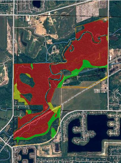
Suitability for Haul Roads (MI) Macomb County, Michigan, and Oakland County, Michigan (River Bends Park, West Side, Shelby Twp.)
|
|
|
- Britney Russell
- 5 years ago
- Views:
Transcription
1
2 Suitability for Haul Roads (MI) Macomb, and Oakland () MAP LEGEND Area of Interest () Soils Soil Ratings Area of Interest () Soil Map Units Poorly suited Moderately suited Well suited Political Features not rated or not available Cities Water Features Transportation PLSS Township and Range PLSS Section Oceans Streams and Canals Rails Interstate Highways US Routes Major Roads Local Roads MAP INFORMATION Map Scale: 1:13,300 if printed on A size (8.5" 11") sheet. The soil surveys that comprise your were mapped at scales ranging from 1:15,840 to 1:20,000. Please rely on the bar scale on each map sheet for accurate map measurements. Source of Map: URL: Coordinate System: UTM Zone 17N NAD83 This product is generated from the USDA-NRCS certified data as of the version date(s) listed below. Soil Survey Area: Macomb Survey Area Data: Version 5, Dec 14, 2006 Soil Survey Area: Oakland Survey Area Data: Version 7, Dec 14, 2009 Your area of interest () includes more than one soil survey area. These survey areas may have been mapped at different scales, with a different land use in mind, at different times, or at different levels of detail. This may result in map unit symbols, soil properties, and interpretations that do not completely agree across soil survey area boundaries. Date(s) aerial images were photographed: 7/30/2005 The orthophoto or other base map on which the soil lines were compiled and digitized probably differs from the background imagery displayed on these maps. As a result, some minor shifting of map unit boundaries may be evident. Page 2 of 6
3 Suitability for Haul Roads (MI) Macomb, and Oakland Suitability for Haul Roads (MI) Map unit symbol BrA BrB BsA BsB BsC BsE Cf Cm Suitability for Haul Roads (MI) Summary by Map Unit Macomb Map unit name Rating Component name (percent) Boyer loamy sand, 0 to 2 percent slopes Boyer loamy sand, 2 to 6 percent slopes Boyer sandy loam, 0 to 2 percent slopes Boyer sandy loam, 2 to 6 percent slopes Boyer sandy loam, 6 to 12 percent slopes Boyer sandy loam, 18 to 25 percent slopes Ceresco fine sandy loam Cohoctah fine sandy loam Rating reasons (numeric values) Acres in Percent of Well suited Boyer (93%) % Well suited Boyer (93%) % Well suited Boyer (93%) % Well suited Boyer (93%) % Well suited Boyer (93%) % Moderately suited Boyer (93%) Slope (0.50) % Poorly suited Ceresco (93%) % Wetness (0.50) Cohoctah (7%) Wetness (1.00) Poorly suited Cohoctah (93%) Wetness (1.00) % Ceresco (7%) Wetness (0.50) Gd Gilford sandy loam Poorly suited Gilford (90%) Wetness (1.00) % Md Made land Moderately suited Made land (100%) % Pb Pits, borrow Not Rated Pits, borrow (100%) % Pg Pits, gravel Not Rated Pits, gravel (100%) % Sa Sanitary land fill Not Rated Sanitary land fill (100%) % Ta Tawas muck Poorly suited Tawas (93%) Wetness (1.00) % Lupton (7%) Wetness (1.00) Page 3 of 6
4 Suitability for Haul Roads (MI) Macomb, and Oakland Map unit symbol Suitability for Haul Roads (MI) Summary by Map Unit Macomb Map unit name Rating Component name (percent) Rating reasons (numeric values) Acres in Percent of Ur Urban land Not Rated Urban land (100%) % W Water Not Rated Water (100%) % WtA Wasepi sandy loam, 0 to 2 percent slopes Moderately suited Wasepi (90%) Wetness (0.50) % Subtotals for Soil Survey Area % Totals for Area of Interest % Map unit symbol 17A Suitability for Haul Roads (MI) Summary by Map Unit Oakland Map unit name Rating Component name (percent) Wasepi sandy loam, 0 to 3 percent slopes 27 Houghton and Adrian mucks Rating reasons (numeric values) Acres in Percent of Moderately suited Wasepi (94%) Wetness (0.50) % Matherton (2%) Wetness (0.50) Poorly suited Houghton (55%) Wetness (1.00) % Adrian (35%) Wetness (1.00) Granby (5%) Wetness (1.00) Brookston (5%) Wetness (1.00) Low strength (0.50) 42 Pits Not Rated Pits (100%) % 49 Cohoctah fine sandy loam 68 Cohoctah-Fox association Poorly suited Cohoctah (100%) Wetness (1.00) % Poorly suited Cohoctah (58%) Wetness (1.00) % Subtotals for Soil Survey Area % Totals for Area of Interest % Suitability for Haul Roads (MI) Summary by Rating Value Rating Acres in Percent of Poorly suited % Not Rated % Well suited % Moderately suited % Null or Not Rated % Totals for Area of Interest % Page 4 of 6
5 Suitability for Haul Roads (MI) Macomb, and Oakland Description This interpretation evaluates soil properties and qualities that affect earth-moving activities, excavating, or removal and shaping of native soil materials for the development of haul roads for forest harvesting and other management activities. Also considered are cutting and filling less than 3 meters in depth; the use of bladed crawler tractors, excavators, graders, and other construction equipment; a yearround water table; and year-round ponding. It is assumed that construction activities occur during customary periods of such work for the local area and that roads are up to 1.6km in length and have a running surface up to 6 meters wide. The ratings do not consider frozen or snow-covered soil. The primary soil characteristics that affect the suitability of the map unit for construction of haul roads are slope, surface rock fragments, soil stickiness, sandiness, strength, depth to a restrictive feature, frequency of ponding and flooding, and depth to a water table. The ratings are both verbal and numerical. A rating of "well suited" (rating index = 0) indicates that few or no restrictions affect construction activities. A rating of "moderately suited" (rating index > 0 and < 1.0) indicates that one or more restrictions may cause some difficulty in construction of haul roads. A rating of "poorly suited" (rating index = 1.0) indicates that one or more limitations make the construction of haul roads very difficult or costly. The map unit components listed for each map unit in the accompanying Summary by Map Unit table in or the Aggregation Report in Soil Data Viewer are determined by the aggregation method chosen, which is displayed on the report. An aggregated rating class is shown for each map unit. The components listed for each map unit are only those that have the same rating class as listed for the map unit. The percent composition of each component in a particular map unit is presented to help the user better understand the percentage of each map unit that has the rating presented. Other components with different ratings may be present in each map unit. The ratings for all components, regardless of the map unit aggregated rating, can be viewed by generating the Selected Soil Interpretations report with this interpretation included from the Soil Reports tab in or from the Soil Data Mart site. Onsite investigation may be needed to validate these interpretations and to confirm the identity of the soil on a given site. The Michigan version of this interpretation differs from the national version in that strength limitations also are considered. Also, frozen or snow-covered soils are not considered in the ratings. Rating Options Aggregation Method: Dominant Condition Page 5 of 6
6 Suitability for Haul Roads (MI) Macomb, and Oakland Aggregation is the process by which a set of component attribute values is reduced to a single value that represents the map unit as a whole. A map unit is typically composed of one or more "components". A component is either some type of soil or some nonsoil entity, e.g., rock outcrop. For the attribute being aggregated, the first step of the aggregation process is to derive one attribute value for each of a map unit's components. From this set of component attributes, the next step of the aggregation process derives a single value that represents the map unit as a whole. Once a single value for each map unit is derived, a thematic map for soil map units can be rendered. Aggregation must be done because, on any soil map, map units are delineated but components are not. For each of a map unit's components, a corresponding percent composition is recorded. A percent composition of 60 indicates that the corresponding component typically makes up approximately 60% of the map unit. Percent composition is a critical factor in some, but not all, aggregation methods. The aggregation method "Dominant Condition" first groups like attribute values for the components in a map unit. For each group, percent composition is set to the sum of the percent composition of all components participating in that group. These groups now represent "conditions" rather than components. The attribute value associated with the group with the highest cumulative percent composition is returned. If more than one group shares the highest cumulative percent composition, the corresponding "tie-break" rule determines which value should be returned. The "tie-break" rule indicates whether the lower or higher group value should be returned in the case of a percent composition tie. The result returned by this aggregation method represents the dominant condition throughout the map unit only when no tie has occurred. Component Percent Cutoff: None Specified Components whose percent composition is below the cutoff value will not be considered. If no cutoff value is specified, all components in the database will be considered. The data for some contrasting soils of minor extent may not be in the database, and therefore are not considered. Tie-break Rule: Higher The tie-break rule indicates which value should be selected from a set of multiple candidate values, or which value should be selected in the event of a percent composition tie. Page 6 of 6
Depth to Water Table Macomb County, Michigan, and Oakland County, Michigan (River Bends Park, West Side, Shelby Twp.)
") () MAP LEGEND Area of Interest (AOI) Soils Soil Ratings Area of Interest (AOI) Soil Map Units 0-25 25-50 50-100 100-150 150-200 > 200 Political Features Cities Water Features Transportation PLSS Township
() MAP LEGEND Area of Interest (AOI) Soils Soil Ratings Area of Interest (AOI) Soil Map Units 0-25 25-50 50-100 100-150 150-200 > 200 Political Features Cities Water Features Transportation PLSS Township
Erosion Hazard (Road, Trail) Angelina County, Texas (Upland Island Erosion Hazard (Road, Trail)) Web Soil Survey National Cooperative Soil Survey
 Angelina County, Texas (Upland Island Erosion Hazard (Road, Trail)) Web Soil Survey National Cooperative Soil Survey") Cypress Creek Erosion Hazard (Road, Trail) Angelina County, Texas () 31 7' 50'' 31 4' 50'' 3439500 3440400 3441300 3442200 3443100 3444000 3444900 94 24' 48'' 94 24' 51'' 365700 Graham Creek 365700 366600
Cypress Creek Erosion Hazard (Road, Trail) Angelina County, Texas () 31 7' 50'' 31 4' 50'' 3439500 3440400 3441300 3442200 3443100 3444000 3444900 94 24' 48'' 94 24' 51'' 365700 Graham Creek 365700 366600
Erosion Hazard (Off-Road, Off-Trail) Angelina County, Texas (Upland Island Erosion Hazard (Off-Road, Off-Trail))
 Angelina County, Texas (Upland Island Erosion Hazard (Off-Road, Off-Trail))") Cypress Creek Erosion Hazard (Off-Road, Off-Trail) Angelina County, Texas () 31 7' 50'' 31 4' 50'' 3439500 3440400 3441300 3442200 3443100 3444000 3444900 94 24' 48'' 94 24' 51'' 365700 Graham Creek 365700
Cypress Creek Erosion Hazard (Off-Road, Off-Trail) Angelina County, Texas () 31 7' 50'' 31 4' 50'' 3439500 3440400 3441300 3442200 3443100 3444000 3444900 94 24' 48'' 94 24' 51'' 365700 Graham Creek 365700
APPENDIX C - NRCS PRIME FARMLAND REPORT
 APPENDIX C - NRCS PRIME FARMLAND REPORT June 2007 Page 51 Parks, Trails, and Open Space Plan Page 52 Payson City- East Side Comprehensive Plan FARMLAND CLASSIFICATION RATING FOR UTAH COUNTY, UTAH - CENTRAL
L I N D E M A N N. Young Almonds Excellent Production Potential Madera County Acres P R O P E R T I E S I N C.
 L I N D E M A N N Young Almonds Excellent Production Potential Madera County 19.11+- Acres P R O P E R T I E S I N C. 3734 W. Spruce Ave Fresno, CA 93711 TEL-559-479-1658 FAX-559-827-4077 Young Almonds
Custom Soil Resource Report for Ramsey County, North Dakota
 United States Department of Agriculture Natural Resources Conservation Service A product of the National Cooperative Soil Survey, a joint effort of the United States Department of Agriculture and other
 72C 155F 350B 350C 542A SOILS IN AREA OF INTEREST Doughty Loam; 4 to 8 percent slopes Anceney Cobbly Loam; 15 to 60 percent slopes Blackmore Silt Loam; 0 to 4 percent slopes Blackmore Silt Loam; 4 to 8
I-20 at Hwy-277 Northeast Richland County, SC
 Springtree Apartments Greenbriar Apartments 277 For Sale ±21.07 Acres I-20 at Hwy-277 Northeast Richland County, SC Property Features ±21.07 acres available Unincorporated Richland County Excellent visibility
NZ GEOGRAPHICAL INDICATION (GI)
") NZ GEOGRAPHICAL INDICATION (GI) EXAMINATION CHECKSHEET Application information (reg 7) and formalities Box Reference Number 1 GI Number: 1015 GI Name: WAIHEKE ISLAND 2 New Zealand GI correctly selected
NZ GEOGRAPHICAL INDICATION (GI) EXAMINATION CHECKSHEET Application information (reg 7) and formalities Box Reference Number 1 GI Number: 1015 GI Name: WAIHEKE ISLAND 2 New Zealand GI correctly selected
Applying GIS to Determine Suitability for Viticulture in Washington State. 1. Introduction Data Collection... 8
 Gockowski 1 Mark Gockowski Dr. David Maidment CE394K.3 GIS in Water Resources 12/2/2016 Applying GIS to Determine Suitability for Viticulture in Washington State Contents 1. Introduction... 4 1.1 Background...
NZ GEOGRAPHICAL INDICATION (GI)
") NZ GEOGRAPHICAL INDICATION (GI) EXAMINATION CHECKSHEET Application information (reg 7) and formalities Box Reference Number 1 GI Number: 1021 GI Name: MATAKANA 2 New Zealand GI correctly selected (cf foreign)
NZ GEOGRAPHICAL INDICATION (GI) EXAMINATION CHECKSHEET Application information (reg 7) and formalities Box Reference Number 1 GI Number: 1021 GI Name: MATAKANA 2 New Zealand GI correctly selected (cf foreign)
Custom Soil Resource Report for Wright County, Minnesota
 United States Department of Agriculture Natural Resources Conservation Service A product of the National Cooperative Soil Survey, a joint effort of the United States Department of Agriculture and other
Dreher Shoals Irmo, South Carolina
 For Sale ±1346 Acres Dreher Shoals Irmo, South Carolina Dutch Fork Road Property Features Exxon Subway/ Burger King Wildlife Solutions Walgreens Our Hands Together Dutch Fork Baptist Church Dreher Shoals
PROPERTY DESCRIPTION PROPOSED CONSTRUCTION
 September 30, 2010 Project No. 10797 11A Ms. Ginger Hitzke Hitzke Development Corporation 251 Autumn Drive, Suite 100 San Marcos, CA 92069 Subject: Interpretive Report for Infiltration System Design, Proposed
Custom Soil Resource Report for Dawes County, Nebraska
 United States Department of Agriculture Natural Resources Conservation Service A product of the National Cooperative Soil Survey, a joint effort of the United States Department of Agriculture and other
Custom Soil Resource Report for Warren County, Kentucky
 United States Department of Agriculture Natural Resources Conservation Service A product of the National Cooperative Soil Survey, a joint effort of the United States Department of Agriculture and other
Cactus Moth Detection & Monitoring Network
 Cactus Moth Detection & Monitoring Network Pricklypear Data Form Variable Definitions Pricklypear Data Form Pricklypear in the context of this form refers to pad-forming Opuntia spp. belonging to the subgenus
SPATIAL ANALYSIS OF WINERY CONTAMINATION
 SPATIAL ANALYSIS OF WINERY CONTAMINATION The Spatial Analysis of Winery Contamination project used a previously created MS Access database to create a personal geodatabase within ArcGIS in order to perform
GLOSSARY Last Updated: 10/17/ KL. Terms and Definitions
 GLOSSARY Last Updated: 10/17/2017 - KL Terms and Definitions Spacing 4ETa Zone(s) Background Drill Elevation Climate Soil Ecoregion 4 Recommended base spacing between containerized, cutting, plug or sprig
SPLENDID SOIL (1 Hour) Addresses NGSS Level of Difficulty: 2 Grade Range: K-2
 Addresses NGSS Level of Difficulty: 2 Grade Range: K-2") (1 Hour) Addresses NGSS Level of Difficulty: 2 Grade Range: K-2 OVERVIEW In this activity, students will examine the physical characteristics of materials that make up soil. Then, they will observe the
(1 Hour) Addresses NGSS Level of Difficulty: 2 Grade Range: K-2 OVERVIEW In this activity, students will examine the physical characteristics of materials that make up soil. Then, they will observe the
Custom Soil Resource Report for Lamoille County, Vermont
 United States Department of Agriculture Natural Resources Conservation Service A product of the National Cooperative Soil Survey, a joint effort of the United States Department of Agriculture and other
Custom Soil Resource Report for Polk and San Jacinto Counties, Texas
 United States Department of Agriculture Natural Resources Conservation Service A product of the National Cooperative Soil Survey, a joint effort of the United States Department of Agriculture and other
#611 ON-SITE TESTING AND EVALUATION
 OBJECTIVES: After completing this chapter, you will be able to... Discuss the purpose of a percolation test. List the regulatory requirements for conducting a percolation test. Revised 01-02-2013 MEETING
FOR SALE VINEYARD AND OPEN LAND ACRES WALLACE ROAD KERN COUNTY CA
 VINEYARD AND OPEN LAND FOR SALE WALLACE ROAD KERN COUNTY CA PROPERTY HIGHLIGHTS Southern San Joaquin Municpal Utility District Deep well Existing table grape and wine grape vineyard Additional open land
Research - Strawberry Nutrition
 Research - Strawberry Nutrition The Effect of Increased Nitrogen and Potassium Levels within the Sap of Strawberry Leaf Petioles on Overall Yield and Quality of Strawberry Fruit as Affected by Justification:
Vineyard Site Evaluation For: Beringer
 For: Location: 32720 SW Bell Rd, Sherwood OR 97140 T3S R2W Sec 11 Total Property Acreage: TL200 (39.7 acres), TL300 (19.84 acres), TL301 (59.99 acres) Gross Plantable Vineyard Acres (approximate): 90.0
2012 Estimated Acres Producers Estimated Production Units Estimated Farm Value Farm Crawfish 182,167 1,251 90,973,725 Lbs.
 www.lsuagcenter.com 2012 Estimated Acres Producers Estimated Production Units Estimated Farm Value Farm Crawfish 182,167 1,251 90,973,725 Lbs. $152,835,858 Crawfish Biology Life Cycles evolved in nature,
$49,000,000. TULARE 22 Pistachios. 1,509.21± acres. Exclusively Presented by: Tulare County, CA. ($32,468 per acre)
") TULARE 22 $49,000,000 ($32,468 per acre) Exclusively Presented by: CA BRE# 00020875 www.pearsonrealty.com TULARE 22 Location The property is located East of Highway approximately 5 miles northwest of the
TULARE 22 $49,000,000 ($32,468 per acre) Exclusively Presented by: CA BRE# 00020875 www.pearsonrealty.com TULARE 22 Location The property is located East of Highway approximately 5 miles northwest of the
THE ECONOMIC IMPACT OF BEER TOURISM IN KENT COUNTY, MICHIGAN
 THE ECONOMIC IMPACT OF BEER TOURISM IN KENT COUNTY, MICHIGAN Dan Giedeman, Ph.D., Paul Isely, Ph.D., and Gerry Simons, Ph.D. 10/8/2015 THE ECONOMIC IMPACT OF BEER TOURISM IN KENT COUNTY, MICHIGAN EXECUTIVE
Geographic Information Systemystem
 Agenda Time 9:00:-9:20 9-20 9:50 9:50 10:00 Topic Intro to GIS/Mapping and GPS Applications for GIS in Vineyards Break Presenter Kelly Bobbitt, Mike Bobbitt and Associates Kelly Bobbitt, Mike Bobbitt and
PROPERTY INFORMATION SUMMARY. 599 Testalinden Place, 4.5 miles South of Oliver BC. Legal Description Size Property Description
 PROPERTY INFORMATION SUMMARY 599 Testalinden Place, 4.5 miles South of Oliver BC Legal Description Size Property Description Lot A, District Lot 2450s, Similkameen Division Yale District, Plan EPP25799
$44,000,000. TULARE 22 Pistachios. 1,506.25± acres. E xclus iv ely Pr esen t e d by : ($29,212 per acre) CA BRE#
 CA BRE#") TULARE 22 E xclus iv ely Pr esen t e d by : Tu l a r e C o u n t y, C A $44,000,000 ($29,212 per acre) CA BRE# 00020875 www.pearsonrealty.com TULARE 22 Tu l a r e C o u n t y, C A Lo c at i on The property
TULARE 22 E xclus iv ely Pr esen t e d by : Tu l a r e C o u n t y, C A $44,000,000 ($29,212 per acre) CA BRE# 00020875 www.pearsonrealty.com TULARE 22 Tu l a r e C o u n t y, C A Lo c at i on The property
Goodban Ecological Consulting Inc.
 Goodban Ecological Consulting Inc. 879 Cabot Trail, Milton, Ontario L9T 3W4 Phone: (905) 693-9064 e-mail: anthony.goodban@sympatico.ca January 30, 2013 Ms. Melinda Thompson-Black: Species at Risk Biologist
Healthy Soils for a Sustainable Viticulture John Reganold
 Healthy Soils for a Sustainable Viticulture John Reganold Department of Crop & Soil Sciences Pullman, W Sustainable Viticulture Economically viable Environmentally sound Socially responsible QuickTime
A C E. Answers Investigation 1. Review Day: 1/5 pg. 22 #10, 11, 36, 37, 38
 A C E Answers Investigation 1 Review Day: 1/5 pg. 22 #10, 11, 3, 37, 38 10. a. Mix Y is the most appley given it has the highest concentrate- to- juice ratio. The ratios of concentrate to juice are the
Washington State Wine 101
 Washington State Wine 101 Washington 2 nd Largest Producer in US Washington State produces: Premium wines of superior quality Range of varieties Distinctive character Unique balance of Old World and New
Joseph A. Fiola, Ph.D. Specialist in Viticulture and Small Fruit Western MD Research & Education Center Keedysville Road Keedysville, MD
 Joseph A. Fiola, Ph.D. Specialist in Viticulture and Small Fruit Western MD Research & Education Center 18330 Keedysville Road Keedysville, MD 21756-1104 301-432-2767 ext. 344; Fax 301-432-4089 jfiola@umd.edu
Guidelines for measuring the area of vineyard parcels in the context of Regulations (EC) No 479/2008 and 555/2008
 No 479/2008 and 555/2008") EUROPEAN COMMISSION JOINT RESEARCH CENTRE Institute for the Protection and Security of the Citizen Agriculture Unit JRC IPSC/G03/P/KGA/kga D(2008)(9675) / file://s:\fmparchive\p\9675.doc Working Document
EUROPEAN COMMISSION JOINT RESEARCH CENTRE Institute for the Protection and Security of the Citizen Agriculture Unit JRC IPSC/G03/P/KGA/kga D(2008)(9675) / file://s:\fmparchive\p\9675.doc Working Document
SA Winegrape Crush Survey Regional Summary Report 2017 South Australia - other
 SA Winegrape Crush Survey Regional Summary Report 2017 South Australia - other Vintage overview South Australia (other) includes the GI region of Southern Flinders Ranges, the Peninsulas zone, and the
Road Construction on Sabkha Soils
 Road Construction on Sabkha Soils Mohamed Mehemmed Shahin Department of Civil Engineering, 7 th October University, Misurata,, Libya mohamed_zubi@yahoo.com ABSTRACT. Sabkha is an Arabic expression to describe
An application of cumulative prospect theory to travel time variability
 Katrine Hjorth (DTU) Stefan Flügel, Farideh Ramjerdi (TØI) An application of cumulative prospect theory to travel time variability Sixth workshop on discrete choice models at EPFL August 19-21, 2010 Page
Help in Addressing the Challenges to Entering the Vineyard and Winery Industry
 Help in Addressing the Challenges to Entering the Vineyard and Winery Industry Part 3 Iowa State University United States Department of Agriculture Risk Management Agency Dr. Paul Domoto Department of
Adelaide Plains Wine Region
 SA Winegrape Crush Survey Regional Summary Report 2017 Adelaide Plains Wine Region Adelaide Plains Vintage overview OVERVIEW OF VINTAGE STATISTICS A total of 3,496 tonnes of Adelaide Plains winegrapes
Starbucks Geography Summary
 Lesson Plans Starbucks Geography Starbucks Geography Summary Overview There are five lessons designed to teach basic geographic concepts. Each lesson uses Starbucks Coffee to help illustrate the main concepts.
#611-7 Workbook REVIEW OF PERCOLATION TESTING PROCEDURES. After completing this chapter, you will be able to...
 REVIEW OF PERCOLATION 7 TESTING PROCEDURES CHAPTER OBJECTIVES: After completing this chapter, you will be able to... Discuss the purpose of a percolation test. List the regulatory requirements for conducting
The multicolored Asian lady beetle, Harmonia axyridis: A nuisance pest in Ohio
 The multicolored Asian lady beetle, Harmonia axyridis: A nuisance pest in Ohio Margaret Frericks Huelsman, Jim Jasinski, Curtis Young, and Joe Kovach IPM Program, OARDC, The Ohio State University, Wooster,
Reliable Profiling for Chocolate and Cacao
 Reliable Profiling for Chocolate and Cacao Models of Flavour, Quality Scoring and Cultural Profiling Dr. Alexander Rast University of Southampton Martin Christy Seventy% Dr. Maricel Presilla Gran Cacao
Fleurieu zone (other)
") Fleurieu zone (other) Incorporating Southern Fleurieu and Kangaroo Island wine regions, as well as the remainder of the Fleurieu zone outside all GI regions Regional summary report 2006 South Australian
Fleurieu zone (other) Incorporating Southern Fleurieu and Kangaroo Island wine regions, as well as the remainder of the Fleurieu zone outside all GI regions Regional summary report 2006 South Australian
DRAFT SECTION 4(F) EVALUATION FAIRVIEW CEMETERY
 EVALUATION FAIRVIEW CEMETERY") DRAFT SECTION 4(F) EVALUATION I. DESCRIPTION OF SECTION 4(F) RESOURCE The Section 4(f) resource that could be affected by the proposed action is Fairview Cemetery. The proposed action would require the
DRAFT SECTION 4(F) EVALUATION I. DESCRIPTION OF SECTION 4(F) RESOURCE The Section 4(f) resource that could be affected by the proposed action is Fairview Cemetery. The proposed action would require the
Lab: Groundwater. Prediction: Which sample (4mm, 7mm, 12mm) will have the greatest porosity?
 will have the greatest porosity?") Name: Date: Lab: Groundwater PART 1: POROSITY Purpose: To explain the relationship between particle size and porosity. Background: The porosity of a material is a measurement of how much of its volume
Name: Date: Lab: Groundwater PART 1: POROSITY Purpose: To explain the relationship between particle size and porosity. Background: The porosity of a material is a measurement of how much of its volume
Bt Corn IRM Compliance in Canada
 Bt Corn IRM Compliance in Canada Canadian Corn Pest Coalition Report Author: Greg Dunlop (BSc. Agr, MBA, CMRP), ifusion Research Ltd. 15 CONTENTS CONTENTS... 2 EXECUTIVE SUMMARY... 4 BT CORN MARKET OVERVIEW...
Soybean Yield Loss Due to Hail Damage*
 1 of 6 6/11/2009 9:22 AM G85-762-A Soybean Yield Loss Due to Hail Damage* This NebGuide discusses the methods used by the hail insurance industry to assess yield loss due to hail damage in soybeans. C.
Farmland Auction Wednesday, November 14, 10 AM Marion Columbus Club 5650 Kacena Ave, Marion, Iowa
 Linn County, IA 122 Acres M/L Sold for $1,793,400 $14,700/Acre Farmland Auction Wednesday, November 14, 10 AM Marion Columbus Club 5650 Kacena Ave, Marion, Iowa 13 County Home Road County Home Road 13
Joseph G. Alfieri 1, William P. Kustas 1, John H. Prueger 2, Lynn G. McKee 1, Feng Gao 1 Lawrence E. Hipps 3, Sebastian Los 3
 Joseph G. Alfieri 1, William P. Kustas 1, John H. Prueger 2, Lynn G. McKee 1, Feng Gao 1 Lawrence E. Hipps 3, Sebastian Los 3 1 USDA, ARS, Hydrology & Remote Sensing Lab, Beltsville MD 2 USDA,ARS, National
Unit Test: Nature of Science
 Unit Test: Nature of Science Some questions (c) 2015 by TEKS Resource System. Some questions (c) 2015 by Region 10 Educational Service enter. Page 2 1 Students who participated in a frog dissection investigation
20 th edition of Mattoni Grand Drink
 20 th edition of Mattoni Grand Drink 7 th World Championship in mixing non-alcoholic cocktails, under the auspices of IBA RULES 2017 PREAMBLE The 20 th annual Mattoni Grand Drink 2017 Contest (further
Project Justification: Objectives: Accomplishments:
 Spruce decline in Michigan: Disease Incidence, causal organism and epidemiology MDRD Hort Fund (791N6) Final report Team leader ndrew M Jarosz Team members: Dennis Fulbright, ert Cregg, and Jill O Donnell
The Roles of Social Media and Expert Reviews in the Market for High-End Goods: An Example Using Bordeaux and California Wines
 The Roles of Social Media and Expert Reviews in the Market for High-End Goods: An Example Using Bordeaux and California Wines Alex Albright, Stanford/Harvard University Peter Pedroni, Williams College
Heat stress increases long-term human migration in rural Pakistan
 Supplementary Methods: SUPPLEMENTARY INFORMATION DOI: 10.1038/NCLIMATE2103 Heat stress increases long-term human migration in rural Pakistan Our sample includes the households surveyed by the International
Route List Configuration
 CHAPTER 32 Use the following topics to add or delete route lists or to add, remove, or change the order of route groups in a route list: Settings, page 32-1 Adding Route Groups to a Route List, page 32-3
EFFECT OF TOMATO GENETIC VARIATION ON LYE PEELING EFFICACY TOMATO SOLUTIONS JIM AND ADAM DICK SUMMARY
 EFFECT OF TOMATO GENETIC VARIATION ON LYE PEELING EFFICACY TOMATO SOLUTIONS JIM AND ADAM DICK 2013 SUMMARY Several breeding lines and hybrids were peeled in an 18% lye solution using an exposure time of
EFFECTS OF HIGH TEMPERATURE AND CONTROLLED FRUITING ON COTTON YIELD
 Chapter 6 57 EFFECTS OF HIGH TEMPERATURE AND CONTROLLED FRUITING ON COTTON YIELD Carl F. Ehlig USDA-ARS Brawley, California INTRODUCTION The fruit load is the primary cause for mid-season decreases in
Memorandum for Tree Survey at the Marywood Residential Development Site in Orange, CA.
 Memorandum Date: January 22, 2015 To: From: Subject: The New Home Company Brianna Bernard, VCS Environmental Memorandum for Tree Survey at the Marywood Residential Development Site in Orange, CA. 1. Introduction
UPC / SCC CODES MANITOBA LIQUOR & LOTTERIES ITEM NUMBER
 UPC / SCC CODES All products require a Universal Product Code (UPC) to be printed on them. For European products, this might be known as the European Article Number (EAN). UPC and EAN are also known as
Activity 7.3 Comparing the density of different liquids
 Activity 7.3 Comparing the density of different liquids How do the densities of vegetable oil, water, and corn syrup help them to form layers in a cup? Students will carefully pour vegetable oil, water,
Our Project file: TPI-2017P Highway 27, Vaughan, Proposed Restaurant, Parking Justification Study Letter Response to Study Peer Review
 13 February 22, 2018 c/o Ms. Nicole Sampogna Associate Planner Evans Planning Inc. 8481 Keele Street, Unit 12 Vaughan, Ontario, L4K1Z7 Our Project file: TPI-2017P004 Re: 9732 Highway 27, Vaughan, Proposed
Langhorne Creek Wine Region
 SA Winegrape Crush Survey Regional Summary Report 2017 Langhorne Creek Wine Region Vintage overview VINTAGE REPORT The Langhorne Creek wine region experienced a long, slow vintage in 2017, beginning with
Notes on the Philadelphia Fed s Real-Time Data Set for Macroeconomists (RTDSM) Indexes of Aggregate Weekly Hours. Last Updated: December 22, 2016
 Indexes of Aggregate Weekly Hours. Last Updated: December 22, 2016") 1 Notes on the Philadelphia Fed s Real-Time Data Set for Macroeconomists (RTDSM) Indexes of Aggregate Weekly Hours Last Updated: December 22, 2016 I. General Comments This file provides documentation for
1 Notes on the Philadelphia Fed s Real-Time Data Set for Macroeconomists (RTDSM) Indexes of Aggregate Weekly Hours Last Updated: December 22, 2016 I. General Comments This file provides documentation for
Kielty Arborist Services LLC P.O. Box 6187 San Mateo, CA
 Kielty Arborist Services LLC P.O. Box 6187 San Mateo, CA 94403 January 15, 2016 California Water Service Attn: Ms. Selma Vukolic 1278 Redcliff Drive San Jose, CA 95118 Site: California Water Corporation
Brief information about the species status of Utricularia cornigera Studnička.
 Brief information about the species status of Utricularia cornigera Studnička. MILOSLAV STUDNIČKA Liberec Botanic Gardens, Purkyňova 630/1, CZ-460 01 Liberec, botangarden@volny.cz Abstract: The carnivorous
G Soybean Yield Loss Due to Hail Damage
 Extension Historical Materials from University of Nebraska-Lincoln Extension University of Nebraska Lincoln Year 1985 G85-762 Soybean Yield Loss Due to Hail Damage Charles A. Shapiro T.A. Peterson A.D.
CODEX STANDARD FOR CANNED FRUIT COCKTAIL 1 CODEX STAN
 CODEX STAN 78 Page 1 de 9 1. DESCRIPTION 1.1 Product Definition Canned Fruit Cocktail is the product: CODEX STANDARD FOR CANNED FRUIT COCKTAIL 1 CODEX STAN 78-1981 prepared from a mixture of small fruits
FOR PERSONAL USE. Capacity BROWARD COUNTY ELEMENTARY SCIENCE BENCHMARK PLAN ACTIVITY ASSESSMENT OPPORTUNITIES. Grade 3 Quarter 1 Activity 2
 activity 2 Capacity BROWARD COUNTY ELEMENTARY SCIENCE BENCHMARK PLAN Grade 3 Quarter 1 Activity 2 SC.A.1.2.1 The student determines that the properties of materials (e.g., density and volume) can be compared
Assignment 03 Portfolio
 Assignment 03 Portfolio The portfolio will be the examination opportunity for Module GGH2603. Plagiarism will not be tolerated. If it is found that you copied from another source, website, article, textbook,
Napa County Planning Commission Board Agenda Letter
 Agenda Date: 3/4/2015 Agenda Placement: 10A Napa County Planning Commission Board Agenda Letter TO: FROM: Napa County Planning Commission David Morrison - Director Planning, Building and Environmental
IT 403 Project Beer Advocate Analysis
 1. Exploratory Data Analysis (EDA) IT 403 Project Beer Advocate Analysis Beer Advocate is a membership-based reviews website where members rank different beers based on a wide number of categories. The
An Investigation of Tree Growth and Colonization on a 19 Year-Old Forestry Reclamation Site. Wesley Dement 4/10/17
 An Investigation of Tree Growth and Colonization on a 19 Year-Old Forestry Reclamation Site Wesley Dement 4/10/17 Introduction/Goals Provide a brief overview of the forestry reclamation approach. Discuss
Multiple Choice: Which product on this map is found in the location that is farthest from Delaware? vanilla sugar walnuts chocolate
 Lesson Title: International Pie a Taste of the World Lesson Author: Mary Matthes (mmatthes@cape.k12.de.us), Cape Henlopen School District Lesson Description: Based on reading the book How to Make an Apple
Non-GMO Project Trademark Use Guide
 Non-GMO Project Trademark Use Guide Table of Contents Introduction.... 3 General Use Guidelines.... 5 Design Specifications.... 6 Non-GMO Project Verified Mark (English).... 7 Non-GMO Project Bilingual
! " Alternatives to Ash: Native Trees for Southern Wisconsin" Compiled by the UW Madison Arboretum! January, 2014!
 " Alternatives to Ash: Native Trees for Southern Wisconsin" Compiled by the UW Madison Arboretum January, 2014 The UW Madison Arboretum recommends planting native tree species to replace ash trees (Fraxinus
[Billing Code: P] [Docket No. TTB ; T.D. TTB 148; Re: Notice No. 162] AGENCY: Alcohol and Tobacco Tax and Trade Bureau, Treasury.
![[Billing Code: P] [Docket No. TTB ; T.D. TTB 148; Re: Notice No. 162] AGENCY: Alcohol and Tobacco Tax and Trade Bureau, Treasury.](/thumbs/81/83414830.jpg "[Billing Code: P] [Docket No. TTB ; T.D. TTB 148; Re: Notice No. 162] AGENCY: Alcohol and Tobacco Tax and Trade Bureau, Treasury.") This document is scheduled to be published in the Federal Register on 12/07/2017 and available online at https://federalregister.gov/d/2017-26414, and on FDsys.gov [Billing Code: 4810 31 P] DEPARTMENT
This document is scheduled to be published in the Federal Register on 12/07/2017 and available online at https://federalregister.gov/d/2017-26414, and on FDsys.gov [Billing Code: 4810 31 P] DEPARTMENT
Dietary Diversity in Urban and Rural China: An Endogenous Variety Approach
 Dietary Diversity in Urban and Rural China: An Endogenous Variety Approach Jing Liu September 6, 2011 Road Map What is endogenous variety? Why is it? A structural framework illustrating this idea An application
Certified Home Brewer Program. Minimum Certification Requirements
 Certified Home Brewer Program Minimum Certification Requirements SCA's Minimum Certification Requirements for Coffee Brewers 1. Coffee Volume: The volume of the brew basket must be sized in proportion
MULTIVAC BETTER PACKAGING. Multivac Southern Africa
 MULTIVAC BETTER PACKAGING Multivac Southern Africa Where do we come from? MULTIVAC Wolfertschwenden, South of Munich, current size approx. 30 000 square meters and expanding, and employing some 1500 people.
Fair Trade Certified TM Seal & Language Use Guide
 Overview This document provides guidelines for use of the Fair Trade Certified seal artwork and language by authorized licensees in connection with Fair Trade Certified products. The Fair Trade Certified
TABLE OF CONTENTS. Page. Page
 TABLE OF CONTENTS Chapter 1 INTRODUCTION... 1-1 Background... 1-1 Planning Benefits... 1-1 Comprehensive Planning Law... 1-4 County Partnership... 1-5 Advisory Committee and Staff Structure... 1-5 Plan
PROCEDURE million pounds of pecans annually with an average
 SOUTHERN JOURNAL OF AGRICULTURAL ECONOMICS JULY, 1972 THE CONSUMER MARKET FOR PECANS AND COMPETING NUTS F. W. Williams, M. G. LaPlante, and E. K. Heaton Pecans contribute significantly to agricultural
Supplement of Physical and chemical properties of deposited airborne particulates over the Arabian Red Sea coastal plain
 Supplement of Atmos. Chem. Phys., 17, 11467 11490, 2017 https://doi.org/10.5194/acp-17-11467-2017-supplement Author(s) 2017. This work is distributed under the Creative Commons Attribution 3.0 License.
Activity 2.3 Solubility test
 Activity 2.3 Solubility test Can you identify the unknown crystal by the amount that dissolves in water? In Demonstration 2a, students saw that more salt is left behind than sugar when both crystals are
Advancing Agriculture Grape Industry Development Program
 2017-2018 Advancing Agriculture Grape Industry Development Program 1) Objectives: To provide assistance for the establishment of new or more productive vineyards. To assist with the adoption of new technologies
Summary Report Survey on Community Perceptions of Wine Businesses
 Summary Report Survey on Community Perceptions of Wine Businesses Updated August 10, 2018 Conducted by Professors David McCuan and Richard Hertz for the Wine Business Institute School of Business and Economics
Comparison of Two Commercial Modified Atmosphere Box-liners for Sweet Cherries.
 Comparison of Two Commercial Modified Atmosphere Box-liners for Sweet Cherries. Peter M.A. Toivonen, Frank Kappel, Brenda Lannard and Darrel-Lee MacKenzie. Agriculture and Agri-Food Canada, Pacific Agri-Food
CODEX STANDARD FOR CANNED PLUMS 1 CODEX STAN
 CODEX STAN 59 Page 1 of 9 1. DESCRIPTION 1.1 Product Definition CODEX STANDARD FOR CANNED PLUMS 1 CODEX STAN 59-1981 Canned plums is the product (a) prepared from clean, substantially sound, whole or halved
Field water balance of final landfill covers: The USEPA s Alternative Cover Assessment Program (ACAP)
") Field water balance of final landfill covers: The USEPA s Alternative Cover Assessment Program (ACAP) William H. Albright Desert Research Institute, University of Nevada and Craig H. Benson University
Field water balance of final landfill covers: The USEPA s Alternative Cover Assessment Program (ACAP) William H. Albright Desert Research Institute, University of Nevada and Craig H. Benson University
CODEX STANDARD FOR CANNED APRICOTS CODEX STAN
 CODEX STAN 129 Page 1 of 9 CODEX STANDARD FOR CANNED APRICOTS CODEX STAN 129-1981 1. DESCRIPTION 1.1 Product Definition Canned apricots is the product (a) prepared from stemmed, fresh or frozen or previously
Break down K cups. Faculty collection
 DATA: Data Table 1 Daily Activity Log A summary of student activities completed each school day for the composting program over a period of 26 days. items were activities that were not repeated. The number
QUALITY DESCRIPTOR / REPRESENTATIONS GUIDELINES FOR THE
 QUALITY DESCRIPTOR / REPRESENTATIONS GUIDELINES FOR THE AUSTRALIAN FRUIT JUICE INDUSTRY Adopted 30 September 2005 Reviewed 12 January 2007 CODE OF PRACTICE QUALITY DESCRIPTOR/REPRESENTATIONS GUIDELINES
Adelaide Hills Wine Region
 SA Winegrape Crush Survey Regional Summary Report 2017 Adelaide Hills Wine Region Adelaide Hills Vintage overview VINTAGE REPORT The annual rainfall in 2016 (1240mm at Lenswood) was the highest in the
Flavour Legislation Past Present and Future or From the Stone Age to the Internet Age and Beyond. Joy Hardinge
 Flavour Legislation Past Present and Future or From the Stone Age to the Internet Age and Beyond Joy Hardinge PAST Pre 1988 No EU legislation Each Member State had the possibility have their own legislation.
Plant root activity is limited to the soil bulbs Does not require technical expertise to. wetted by the water bottle emitter implement
 Case Study Bottle Drip Irrigation Case Study Background Data Tool Category: Adaptation on the farm Variety: Robusta Climatic Hazard: Prolonged dry spells and high temperatures Expected Outcome: Improved