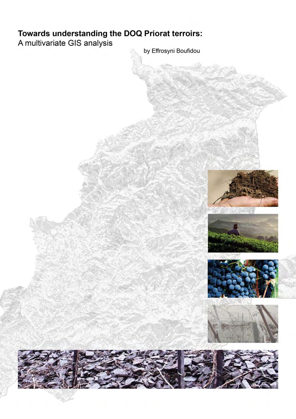
Cover page designed by Menelaos Kokkinos
|
|
|
- Dinah Hudson
- 5 years ago
- Views:
Transcription
1
2 Cover page designed by Menelaos Kokkinos Cover page pictures taken from (top-bottom): tour priorat.html clima.php En/TE von 100.htm Copyright c2011, by E. Boufidou, Faculty of Civil Engineering and Geosciences, Delft University of Technology, Delft, The Netherlands. All rights reserved. No part of this publication may be reproduced, stored in a retrieval system or transmitted in any form or by any means, electronic, mechanical, photocopying, recording or otherwise, without the prior written permission of the author E. Boufidou, Faculty of Civil Engineering and Geosciences, Delft University of Technology, P.O. Box 5048, 2628 CN, Delft, The Netherlands. Typesetting system: L A TEX. Printed in Greece by International, Konstantinou Melenikou 5, 54635, Thessaloniki
3 i Towards understanding the DOQ Priorat terroirs: A multivariate GIS analysis Thesis, submitted in partial fulfilment of the requirements for the degree of Master of Science in Geomatics Effrosyni Boufidou Born in Thessaloniki, Greece Delft University of Technology Faculty of Civil Engineering and Geosciences Stevinweg 1, 2628 CN Delft, Tel: +31 (0) Geological Institute of Catalonia Department of Engineering Geology and Hazards Balmes , E Barcelona, Tel: +34 (0)
4 ii
5 iii Towards understanding the DOQ Priorat terroirs: A multivariate GIS analysis Effrosyni Boufidou Student number: empoufid@gmail.com Thesis committee members: Academic supervision: Delft University of Technology Prof. Nick van de Giesen Faculty of Civil Engineering and Geosciences Department of Water Resources Management n.c.vandegiesen@tudelft.nl Dr. Sisi Zlatanova OTB Research Institute for the Built Environment Section of GIS Technology S.Zlatanova@tudelft.nl Dr. Leon van Paassen Faculty of Civil Engineering and Geosciences Department of Geotechnology L.A.vanPaassen@tudelft.nl External supervision: Ir. Aline Concha i Dimas Department of Engineering Geology and Risks Geological Institute of Catalonia aconcha@igc.cat Geological Institute of Catalonia
6 iv
7 Executive summary The notion of terroir covers the interaction between the natural, the cultural conditions and the grape vine itself relative to the character of the final wine product. It is about a dynamic chain whose factors get different weights in each wine region and this results in the typicality of the different terroir wine products. The Old World wine regions have been for many years occupied with the terroir research in order to explain the uniqueness and the specificities of their wine products. Nowadays, more and more wine regions are interested in such kind of investigations in order to highlight their distinct products, expose their originality and get a place in the wine market. DOQ Priorat is located in South Catalonia in Spain and is a wine region that has recently been nominated a label of originality for its products. Such a denomination made the region s cultivators interested to learn more about the natural conditions of the area in a try to explain the success of their products and with the prospect to preserve the quality of their wines. In these terms, Geographical Information Systems (GIS), providing the ability for spatial, statistical analysis and visualisation, have been considered important tools for the DOQ Priorat s natural conditions analysis and diverse terroir investigation. Previous research has indicated topography, the soil properties and the climate of a region to define the natural conditions of a region and therefore being the factors of interest/effect in the wine terroir. These three factors can be described by specific attributes. For instance, elevation and ground inclination for topography, PH and texture for soil, temperature and precipitation for climate. The distribution of such attributes and many others that characterize the aforementioned natural conditions, has been studied in the DOQ Priorat territory in order to examine the resemblance of the DOQ Priorat vine growing conditions to the conditions that are considered beneficial from international research. The correspondence of the DOQ Priorat conditions to the standards for vine growing has been treated by means of a multivariate GIS analysis. The DOQ Priorat topographic and soil attributes have been evaluated relative to their suitability for vine growing and different suitability classes have been defined. Moreover, the growing season temperature distribution and its capability to define conditions of viability for specific grape varieties, has been used to define two major terroir units in DOQ Priorat. The suitability of the DOQ Priorat land for cultivation of specific varieties has been assessed through the topographic-soil composite suitability in relation to the teroir units defined. DOQ Priorat s greatest extend has been classified in intermediate and intermediate to high vine growing suitability classes relative to its topography and soil conditions. The shallow and dry soils as well as the steep slopes visited in the area seem to contradict to what is considered beneficial for vine growing. In terms of climate however, the whole area presents ideal conditions for a wide variety of grape cultivations whereas most of these varieties proposed to fit the area are already cultivated today. Even though the current vineyard cultivations still present conditions of intermediate and intermediate-high suitability relative to what is v
8 vi considered beneficial from international vine growing research, the quality of the wines produced in DOQ Priorat is indisputable; there are therefore some unique features in the DOQ Priorat terroirs. The DOQ Priorat vines are cultivated in higher elevations and in soils shallower and less fine textured than what is considered to fit for vine growing internationally. That is what gives the DOQ Priorat wines their unique character and these are finally the conditions that are considered ideal for Priorat wines. Such a conclusion, leads to the confirmation of the dynamic nature of terroir, whose factors and attributes cannot be strictly defined and quantified for every wine region. New vine growing standards could be defined for several wine regions relative to their specificities whereas it is mostly the try, the result and the experience that define good and bad terroirs. The DOQ Priorat case has been a very nice example of a region going against the vine cultivation pattern whereas obtaining high quality and recognised wine products.
9 Acknowledgements This report constitutes the graduation project of the Master of Science in Geomatics from the Technical University of Delft. The study has been carried out with the help of the Technical University of Delft and the Geological Institute of Catalonia. I would like to thank therefore both organizations for giving me the opportunity to work in this project whereas also for providing me with the tools and the knowledge to perform this study. Many people have been involved in my project and in these lines I would like to express my appreciation to them as well as to thank them for their support. Special thanks and the greatest appreciation go to my primary supervisor, Dr. Sisi Zlatanova, who always appeared and helped me at the right moment and without her help, this thesis would not be finished. Furthermore, I would like to thank Dr. Dominique Ngan-Tillard and Dr. Bob Hoogendoorn, being the people who introduced me and helped me at the first steps of this project whereas also my Professor Nick van de Giesen, my external supervisor Dr. Aline Concha Dimas and my second supervisor Dr. Leon van Paassen for their assistance during the project implementation. Professor Massimo Menenti, Dr. Emmanuel Tsiros, Mr. Pavlos Argyropoulos and Miss Fanny Argyropoulos deserve many thanks and my appreciation since their experience and familiarity with the wine terroir and data analysis as well as their practical experience with vine cultivations and the wine products offered me great assistance during this thesis implementation. My family and friends have always been with me during my studies diminishing the distance to my home country. I would like to thank my family, Costas, Lilian and Maria who made it possible for me to follow and complete the Geomatics MSc, providing me with continuous emotional and material support as well as my friends Dimitris, Alexandros, Menelaos, Efi, Zoi and many others who were always close to me. Last but not least I would like to thank much my boyfriend, Panos, for his support and his ability to always make me feel calm. vii
10 viii
11 Contents 1 Introduction Background Terroir and viticultural zoning research The research motivation and objectives Software and data Limitations The DOQ Priorat wine region The DOQ Priorat wine region DOQ Priorat municipalities and demographics DOQ Priorat landuse DOQ Priorat vineyards The wine BTU in DOQ Priorat Topographic features Soil features Climatic features The multivariate analysis of the DOQ Priorat BTU factors Analysis variables and methods Topographic classification and ranking Soil classification and ranking Climatic classification and vine varieties matching The DOQ Priorat terroirs and current vineyards The BTU attributes contribution to the wine terroir Topographic and soil suitability assessment The DOQ Priorat terroir units Terroirs and current vineyards Conclusions and Discussion 47 A The terroir concept 55 B Available data before processing 57 C Correlations between soil properties, topography and geology 59 D Texture 61 E Maps 63 E.1 DOQ Priorat municipalities ix
12 x CONTENTS E.2 Landuse distribution E.3 Vineyard distribution E.4 Topography E.4.1 Elevation E.4.2 Slope inclination E.4.3 Slope orientation E.5 Geology E.6 Soil E.6.1 Texture: sand content E.6.2 Depth E.6.3 Water holding capacity E.6.4 PH E.7 Climate E.7.1 Annual conditions: temperature E.7.2 Annual conditions: precipitation E.7.3 Annual conditions: received global radiation E.7.4 Growing season conditions: temperature E.7.5 Growing season conditions: precipitation E.7.6 Growing season conditions: received global radiation E.7.7 Growing season conditions: Growing Degree Days E.7.8 Growing season conditions: Growing Degree Days regions E.7.9 Growing season conditions: Grapevine Climate Maturity Grouping F Vineyard cultivations and ideal vine growing conditions 85
13 List of Figures 1.1 The wine terroir: a complex system, a chain of factors, after Morlat [2001] The Grapevine Climate-Maturity Grouping indicating suitable climates (based on temperature) for specific varieties, after Jones [2003] Priorat wine regions. DO Montsant almost completely surrounds DOQ Priorat, after Solavino [2011] Land terracing in Priorat DOQ Priorat population growth between , after IDESCAT [2011] Generalised landuse categories from Table Annual grape production (in Kg) of white and red varieties. Information provided by the Consell Regulador de la DOQ Priorat [2011] DOQ Priorat vines growing on terraced slopes DOQ Priorat trenches location XEMA station network in and around Priorat Growing season temperature-precipitation relationship in DOQ Priorat. Precipitation and temperature values represent mean monthly values Relative importance weights assigned to the attributes and factors used for the SAW application. Different colors indicate the different iteration stages. Firstly, the topographic suitability index has been assessed from the relevant attributes in blue, next the soil suitability has been assessed from its attributes in purple and then, the topographic and soil suitability indices (green) have been used to assess the topographic-soil suitability in red Suitability for vine-growing in DOQ Priorat relative to topography Suitability for vine-growing in DOQ Priorat relative to soil properties Composite topographic-soil suitability for vine-growing in DOQ Priorat Terroir zones defined in the DOQ Priorat region along with their suitability for growing of certain (warm or hot) vine varieties Vines classified in climate maturity groups and their participation in DOQ Priorat sub-region D.1 USDA fine-grained material classification system for texture definition. The shadowed area indicates the textural classes that are mostly visited in DOQ Priorat.. 61 E.1 DOQ Priorat municipalities: DOQ Priorat includes: la Morera de Montsant and the aggregate Scala Dei, la Vilella Alta, la Vilella Baixa, El Lloar, Gratallops, Bellmunt del Priorat, Porrera, Poboleda, Torroja del Priorat, the north part of Falset and the east part of El Molar E.2 DOQ Priorat generalized landuse. The landuse categories from Table 2.2 have been reclassified in general landuse categories xi
14 xii LIST OF FIGURES E.3 DOQ Priorat vineyards distribution in each municipality E.4 Spatial distribution of DOQ Priorat elevations (in meters) E.5 Spatial distribution of DOQ Priorat slope inclinations (in degrees) E.6 Spatial distribution of DOQ Priorat slope orientations (in degrees) E.7 DOQ Priorat geology E.8 Spatial distribution of % soil sand content, in DOQ Priorat E.9 Spatial distribution of soil depth in centimeters, in DOQ Priorat E.10 Spatial distribution of water holding capacity in mm H 2 O/mm soil, in DOQ Priorat 73 E.11 Spatial distribution of soil acidity in PH units, in DOQ Priorat E.12 Spatial distribution of mean annual temperature in o C, in DOQ Priorat E.13 Spatial distribution of mean annual precipitation in mm, in DOQ Priorat E.14 Spatial distribution of mean annual global radiation in W/m 2, in DOQ Priorat. 77 E.15 Spatial distribution of mean growing season temperature in o C, in DOQ Priorat 78 E.16 Spatial distribution of mean growing season precipitation in mm, in DOQ Priorat 79 E.17 Spatial distribution of mean growing season radiation in W/m 2, in DOQ Priorat 80 E.18 Spatial distribution of Growing Degree Days in o C, in DOQ Priorat E.19 Growing Degree Day regions in DOQ Priorat E.20 Climate-Maturity groups in DOQ Priorat F.1 Correlation between the intermediate ( /1 suitability), intermediate-high ( /1) suitability classes and several wine BTU attributes in vineyard locations. The correlation has been performed in order to define those attributes whose effect mainly leads the DOQ Priorat terroirs. The attributes of main effect appear to be elevation, soil depth and soil sand content. These attributes present a correlation in the range whereas the rest of the attributes present very low correlation.the correlation coefficient calculation has been performed in Matlab and the correlation value appears at the top of the figures... 86
15 List of Tables 1.1 BTU factors and attributes Critical values for several climatic characterization methods, in terms of Vitis Vinifera growing DOQ Priorat municipalities. Information has been gathered through the Catalonian statistics bureau [IDESCAT, 2011] and has been analysed with ArcGISs Spatial Analyst tools Landuse distribution in DOQ Priorat. Digital land use data have been available from the ICC and have been processed with ArcGIS tools Number of vine growers and vineyards area per municipality along with the respective municipality coverage. Information about the vine growers in each municipality has been gathered through the Consell Regulador de la DOQ Priorat [2011], whereas the vineyard s area has been obtained through GIS processing of the ICC landuse data Hectares of vines devoted to red wine production Hectares of vines devoted to white wine production Topographic features along with their characteristic statistics in DOQ Priorat and its vineyards Soil properties registered and their measurement units Correlation coefficients between soil properties and topography and soil properties and geological units in DOQ Priorat Soil features along with their characteristic statistics in DOQ Priorat and its vineyards Automatic meteorological stations in and around the DOQ Priorat territory Climate attributes registered and their measurement units Climatic features along with their characteristic statistics in DOQ Priorat and its vineyards The wine terroir BTU attributes, the classification proposed by several researchers and the most suitable values and value ranges for V.Vinifera growing. The parenthesis value in the attribute column, indicates in which BTU factor, topography (T), soil (S), climate (C), each attribute belongs. This table forms the international research guidelines for vine growing and have been used to evaluate the DOQ Priorat region Classes defined for each BTU attribute Topographic classification of DOQ Priorat in suitability classes for vine-growing Soil classification of DOQ Priorat in suitability classes for vine-growing Qualitative suitability definition and the respective value ranges standardised in the range xiii
16 xiv LIST OF TABLES 5.2 Topographic suitability results, derived from the composite suitability of elevation, slope inclination and slope orientation attributes ranges. The suitability classes refer to the classification in Table Soil suitability results, derived from the composite suitability of soil texture, depth, WHC and PH attributes values. The suitability classes refer to the classification defined in Table Composite topography-soil suitability results. Topographic and soil attributes participate in the suitability definition whereas the suitability classes refer to the classification defined in Table DOQ Priorat soils present different suitability ranges for each of the warm and hot GCMGs. Grouping relative to the average growing season temperature as well as the composite topography-soil suitability results participate in the definition of terroir suitability zones. The suitability classes refer to the suitability reclassification defined in Table Suitability for growing specific grape varieties (warm or hot GCMG) in the current vineyard cultivated locations. The suitability classes refer to the suitability reclassification defined in Table B.1 Available data

17 Chapter 1 Introduction 1.1 Background Wine making is a major contributor in several countries economy around the world with Mediterranean countries like Italy, Spain and France holding the reins in wine production and export. The New World wines coming from Australia, South Africa and South America however, have attracted much interest and created a new market the last decades. The art of wine making is all about chemistry and matching the correct vine variety to the beneficial natural and cultural conditions for it. However, given the vast variety of climates and micro-climates around the world, it is nearly impossible to name and limit the optimum conditions for vine growing and wine production. Every wine product will have its own signature and that is finally what makes this industry so interesting, with so many fans around the world. Oenologists and agriculturists refer to the term terroir to describe the chain of factors that contribute to the wine s character. It is about an holistic concept that relates both to environmental, i.e. Base Terroir Unit (BTU) factors being the regional topography, soil properties and climate, and cultural factors, i.e. human treatment and the plant itself, that interact and influence the grape growing to the wine production continuum [Jones et al., 2004] (see Figure 1.1). A more detailed description of the wine terroir chain is given in Appendix A. Figure 1.1: The wine terroir: a complex system, a chain of factors, after Morlat [2001] Researchers around the world have tried to evaluate the significance of each of the terroir factors in the chain, however, their perspectives are often controversial. For different areas, different factors seem to be of major influence creating diverse terroirs and viticultural zones. This dynamic chain is therefore what gives uniqueness to the wine. 1
18 2 CHAPTER 1. INTRODUCTION One could say however, that every agricultural product is encircled by a terroir. What makes the wine such a famous product and creates such a market around it? Why other agricultural products do not capture such interest? The answer is straightforward and has to do with the final products surplus value. Contrary to other agricultural products that still need optimum growing conditions to give a valuable yield, the wine is a product that gets value with time, and usually great value. Especially in the traditional wine production countries, wine is considered valuable after some years in the bottle. Then, the wine is considered ready to show its character and reveal the small notes that the terroir offered it. Therefore, the older the wine, the more complete the fermentation, the more evident the terroir notion and as a result, the more expensive the bottle. This story around wines seems to be well bounded and people answer to the call for evaluation of terroir wines. Given the economical significance of the wine industry and the continuously growing interest of people on wine, nowadays, even small traditional wine production areas, want to show their experience on wine making, highlight their unique terroirs and participate in the industry. An investigation of the natural and cultural conditions of a region and a viticultural zonification study would be a great step towards the enhancement of any wine producing region. 1.2 Terroir and viticultural zoning research Research about viticultural zoning and terroir identification has been conducted around the world for a long time. It is about a topic that attracted people s attention even from the 19th century in Europe, in the Old World countries 1, whereas nowadays more and more countries are taking an active role in such a kind of research [Vaudour and Shaw, 2005] in order to recognise and highlight the specificities of their terroirs as well as to boost their production. Viticultural zoning has originally been introduced solely to regulate the wine industry and especially to protect winemaker livelihood in already established wine regions [Shanmuganathan, 2010]. Even though these regulatory rules, have initially been visited in the Old World wine regions, the zonification schemas and terroirs, are not related to geographic regions. It is all about the interaction of the terroir chain factors (recall the terroir chain in Figure 1.1) and how their unique combination results in the typicality of certain wine products [Deloire et al., 2008]. As already discussed in Section 1.1, the terroir chain is a dynamic one. However, even though in every wine terroir all the chain factors (natural and cultural conditions) participate, there is not an exact combination between them that leads to the optimum conditions for vine growing whereas the effect of each factor in the chain is still fuzzy. Several models have been proposed, from many institutions around the world, indicating different factors to be of the major effect in vine growing. Rotaru et al. [2010] indicate the vineyard management as the most influential factor whereas soil, micro-climate, human factor genetics, environmental and technological factors are considered additional contributors to the wine terroir. Courjault-Radé et al. [2007] propose geology and the soil properties as being the most influential factors whereas Morlat and Bodin [2006] highlight the climate and soil as the major constituents of terroir. In these terms, the climate and its change over the years seem to employ climatologists, oenologists and relevant researchers [Savé et al., 2009, Jones et al., Jones, 2003], more than any other factor, due to its notable influence to the wine character. As the reader can note, the perspectives are often controversial, however none of them appears to be more appreciable than the other. Each study and proposed model holds some truth whereas usually, the models are representative under certain conditions and for certain study fields. 1 refers to the traditional European wine producing countries like France, Spain and Italy

19 1.2. TERROIR AND VITICULTURAL ZONING RESEARCH 3 The main volume of research has been conducted around the investigation and interaction of the wine Base Terroir Unit (BTU) factors and specific vine varieties, e.g. Merlot, Cabernet Chauvignon, Tempranillo. The wine BTU factors explain the natural conditions of the region that are of importance for vine growing. Such factors are the regional topography, the soil properties and the climatic features of the region that is examined. In a second level (called here, a parent-child hierarchy), the wine BTU factors are made up of smaller entities, the wine BTU attributes. These entities, the attributes, are the ones whose interaction forms and gives a specific character to the wine BTU factors. For instance, the soil is a wine BTU factor that among others, includes and is regulated by attributes like the soil depth, the soil texture and the soil water holding capacity. In the same way, one topographic attribute is the elevation and one climatic attribute, the temperature. The ability to control the BTU factors and attributes of a region, the ability for spatial distribution and analysis as well as the ability given to the cultivator to choose them, makes the BTU factors and their attributes more receptive to research, relative to the other terroir factors (cultural conditions and annual climate). As far as the annual conditions are concerned, they are an extension of the regional climate and can have great variability with time whereas the human intervention part is rather tricky and is usually regulated by the cultivator s experience rather than by rules. Table 1.1: BTU factors and attributes Among the great variety of attributes that each BTU factor contains, previous research conducted by Jones et al. [2004], Rotaru et al. [2010], Morlat [2001], Sarmento et al. [2006], van Leeuwen et al. [2004], van Leeuwen and Seguin [2006], Courjault-Radé et al. [2007], Jones [2003], Fiola [2002], Watkins et al. [1997], Kurtural [2007], Jackson [2008], Sàenz [2000], Wolf and Boyer [2003] has already identified the ones that are of actual effect on vine growing. At this point, researchers seem to agree. The BTU factors along with their attributes that are of importance in the wine terroir research are presented in Table 1.1 whereas they are further analysed in the following paragraphs. BTU factors and attributes Factor Attribute Topography Elevation Slope inclination Slope orientation Soil Texture Structure Depth Internal water drainage Water holding capacity PH Organic material content Cation exchange capacity Salinity Climate Temperature Precipitation Received global radiation Topography The focus is given on the elevation, the slope inclination and the slope orientation attributes of topography. Vineyards are cultivated in moderate elevations to be protected from the early autumn and spring frosts taking place at high elevations as well as from the temperature inversions taking place at low elevations. Usually, vineyards are found at meters above sea level. Ground inclination and orientation are also important. Vine parcels should acquire good water drainage, enough aeration, as well as they need to be in a beneficial location relative to the sun, so as to obtain the most radiation possible for a long time during the day. For the ease of mechanized harvesting, that is commonly used nowadays, and for the above mentioned reasons,

20 4 CHAPTER 1. INTRODUCTION moderate to low inclinations, i.e. 5-15%, are preferable. In terms of orientation of the slopes, the beneficial locations depend on the hemisphere and are the ones that are exposed for a longer time to the morning sun. Soil Soil controls the vine-plant s health and its supply in food and water. The soil properties are actually those that are responsible for the well-being of the plant during seasonal droughts due to their ability to save water. That is why usually, the vines are more resistant to droughts than frosts. The soil s texture, structure and depth to parent rock, are considered responsible for water supplying of the plant and water storage. Usually, a fine grained soil material with loose structure is considered beneficial since it allows the water, from precipitation or irrigation, to be partially infiltrated to the lower horizons and saved and partially used for the plant s actual needs. On the other hand, when the soil becomes coarse and the structures are strongly connected, then the water stays at a certain level that can potentially lead to water-logging of the plant, reduction of the sugars on the grape and in the worst case root rot. In general, the plant should be able to get the water it needs when it needs it and that is why a soil that is able to control excessive precipitation or very limited water amounts is considered beneficial. The soil s internal water drainage (IWD) is the soil property that combines the effect of the aforementioned properties, i.e. texture, structure, depth, as well as the effect of topography. Soil drainage gives a measure of the ability of the soil to allow water to pass from it. Dense soils present lower drainage than loose ones, where the water has the ability to pass quicker. The soil s drainage conditions is a very important indicator of the ability of a soil to host certain plant species. Closely related to the IWD of a soil, is the soil s water holding capacity (WHC). It is a also a property controlled by the texture, the structure and the depth to the parent rock and actually defines the amount of water that can be stored by the soil. Both the IWD and the WHC are related to the water logging and water deficiency conditions, mentioned in the previous paragraph, whereas their preferable ranges are also connected to the climatic conditions in a region and the vine plants needs. Usually, well drained soils with the ability to retain enough water to cover the seasonal needs of the plants are considered beneficial. The plant s food supply is regulated by the soil s chemistry and organic material content. Fertile and nutrient-rich soils are preferable. Soil PH values define the acidity of a soil. For vine growing, low to neutral PH is preferable since then the soil is considered more fertile. The organic material content (OMC) of a soil on the other hand, gives the plants the capacity for growth. It refers to the decayed organic material actually, often called humus, that is able to withhold water and nutrients. It is moreover the nitrogen supplier for the plant. Even though there must be enough organic material in the soil to guarantee the plant s food supply,
 of the soil.")
21 1.2. TERROIR AND VITICULTURAL ZONING RESEARCH 5 its total proportion should not be more than 5% since then there may be excessive vegetative growth that is undesirable. The ability of a soil to interact with the plant however, through organic material or PH, is controlled by the cation exchange capacity (CEC) of the soil. The more intense the CEC, the more active the reaction of the plant with the soil and then the more nutrients coming from the soil to the plant. Finally, salinity is another factor of interest in terms of soil fertility, that actually indicates the levels of different salts in the soil solution and constrains the plant growth when it gets high values. Climate The climate is considered to have the most profound effect on the ability of a region or site to produce quality grapes [Jones, 2003]. The spatial and temporal distribution of the temperature, the precipitation and the received global radiation climatic attributes is of great importance when performing wine terroir analysis. Such attributes values are usually treated in a yearly and in a growing season basis whereas in order to capture the combined effect of all the climatic attributes in the vine growing continuum, researchers have come up with specific climatic indices, e.g. Growing Degree Days, Latitude-Temperature Index, Multicriteria Climatic Classification, Grapevine Climate-Maturity Index. For Vitis Vinifera 2 species, that actually represent the majority of vines planted around the world, a normal climate throughout the year, without many extremes is considered beneficial. The winter extremes and frosts are those that appear to harm the vines, rather than the summer droughts, and that is because extreme winter conditions restrict the plants from completing their annual growth cycle. The plant s seasonal cycle is specific and includes several stages, i.e. budding-growing, flowering-fertilization, berry growth, veraison 3, maturation, [Pérez, 2008], each of which has different needs in water and heat. When the seasonal cycle is disturbed, and the weather phenomena are opposite to the ones expected, then there is a direct effect on the grape s quality, its health, its vigour and the final wine product. That is why, in viticultural research and especially in viticultural zoning, the water, temperature and radiation levels are the ones examined. Several methods have been proposed throughout the years for measuring the suitability of a climate for vine growing, however it appears that planting is the most precise measure. Climate suitability for vine growing is a rather tricky subject, since it incorporates topography and geomorphology along with the climatic attributes and therefore there are not absolute values that can represent the heat and water needs for the plant as well as, suitable and unsuitable locations. That was moreover, the reason why much research has been conducted towards defining climatic indices that would incorporate topographic along with climatic conditions. In every climatic index defined, temperature, due to its relation to the photosynthetic processes of the vine plant, is the leading climatic attribute. 2 refers to the common grape vines, native to the Mediterranean region, central Europe, and south-western Asia, from Morocco and Portugal north to southern Germany and east to northern Iran 3 is a viticultural (grape-growing) term meaning the onset of ripening. It is originally French, but has been adopted into English use. The official definition of veraison is change of color of the grape berries. Veraison represents the transition from berry growth to berry ripening.
22 6 CHAPTER 1. INTRODUCTION For the majority of the researchers, climate is treated in terms of growing season length and Growing Degree Days (GDD), when it comes to viticultural zoning. When normally the growing season for V. Vinifera species, is the period between April and October that the aforementioned seasonal cycle of the plant is completed, the are several deviations from this rule depending mostly on the geographical location of a region. As a result, researchers have defined the vines growing season as the frost free period throughout a year or a period starting when the average daily temperatures begin to surpass 10 o C and ending with the first frost in autumn-winter. A growing season of at least 180 days is considered to be a limiting factor for vine growing. GDD on the other hand, is actually a measure of heat summation for the days of the growing season and there is where the correlation of the climate to vine-growing comes. The more the heat obtained during the growing season the better for the plant. The GDD formula (see Equation 1.1) uses the days of the month for which the average temperature surpasses 10 o C and then, the number of these days is multiplied with their average daily temperature minus 10 that is the base temperature in Celsius ( o C) for vine growing [Jackson, 2008, Boulton et al., 1996, Szymanowski et al., 2007]. The base temperature of 10 o C is chosen in the case of vines, because when the average air temperature is higher than 10 o C, the soil is considered ready to start the vine growing cycle (T min + T max) [ ] (1.1) where, T min is the minimum and T max the maximum temperature for those days from April to October, for which the temperature is >10 o C. The GDD index, results in the definition of climatic classes as illustrated in Table 1.2. Several researchers [Jones, 2003, Fiola, 2002, Watkins et al., 1997] use Fahreneit ( o F) units to obtain the GDD measure; in this case, the base temperature is 50 o F and then special attention has to be paid on the units conversion and the final classes intervals. For a conversion from o C to o F, the C units values have to be multiplied with 1.8 in the final classes. Since the GDD formula takes into account only temperature variations, other researchers [Jackson, 2008, Szymanowski et al., 2007], added supplementary weather parameters, such as humidity and water stress as a modification to the degree days formula, considering the result more complete. One of this modifications is the Latitude-Temperature Index (LTI) proposed by Jackson and Cherry [1988]. This model, uses the product of the average temperature of the warmest month of the year in o C, multiplied with, 60 minus the area s latitude and incorporates therefore the geographic location to the temperature (see Equation 1.2). LT I = T mean w (60 L) (1.2) where, T mean w is the average temperature of the warmest month of the year and L the latitude of the region under investigation. Finally, Tonietto and Carbonneau [2004] presented the Multicriteria Climatic Classification system (MCC) that incorporates the heliothermal index (HI) (see Equation 1.3), the cool night index (CI) (see Equation 1.4) and the dryness index (DI) (see Equation 1.5) that are actually measures of temperature, ground humidity and precipitation. The MCC system has been designed specifically for vine growing purposes. The equations that describe the aforementioned indices are the following:
23 1.2. TERROIR AND VITICULTURAL ZONING RESEARCH 7 Table 1.2: Critical values for several climatic characterization methods, in terms of Vitis Vinifera growing. Climatic classification Climatic Classification Index Value range Climatic type Growing Degree Days (GDD) ( o C) Region I: < Cool Region II: Moderately cool Region III: Moderately warm Region IV: Warm Region V: > Hot Latitude-Temperature Index (LTI) The classes depend on the month accounted as the warmest The classes depend on the month accounted as the warmest Multicriteria Climatic Classification (MCC) For HI in o C: >3000 Very warm > Warm > Temperate warm > Cool > Very cool For CI in o C: 12 Very cool nights > Cool nights > Temperate nights > 18 Warm nights For DI in mm: 100 Very dry 50 > 100 Moderately dry 150 > 50 Sub-humid > 150 Humid Grapevine Climate Maturity Grouping (GCMG) (in o C) Cool varieties Intermediate varieties Warm varieties Hot varieties HI = [(T mean 10) + (T max 10)] d (1.3) 2 where, for the Northern hemisphere, T mean is the mean air temperature (in o C), T max is the average maximum air temperature (in o C), d is the day length coefficient ranging from 1.02 to 1.06 and depending on the latitude. The measurements are regarded for a period from the 1st of April to the 30th of September, corresponding to the vine s growth cycle and the temperatures are regarded as mean monthly values. CI = T min/sept (1.4) where T min/sept is the minimum air temperature in the month of September (in o C). W = Wo+ P Tv Es (1.5)
24 8 CHAPTER 1. INTRODUCTION where, W is the estimate of soil water reserve at the end of a given period, Wo the initial useful soil water reserve, which can be accessed by the roots, P the precipitation, Tv the potential transpiration in the vineyard and Es the direct evaporation from the soil. The estimate of soil water reserve (W ), like HI, is calculated over a seven-month period (April- October) whereas the Dryness Index (DI) is called the value of W at the end of this sevenmonth period. We accept an initial soil water reserve being Wo = 200mm at the 1st of April (acceptable for most of vineyard in the world) and then for the calculation of W of each month we use as water soil reserve, the W value of the previous month. The DI for a specific growing season would therefore be the W value as calculated for September. The MCC method results in the definition of three different indices that should be evaluated for every region under investigation. The critical values and the classes defined by the climatic indices presented above, are summarized in Table 1.2. However, not all the vine plants have the same needs in heat and water and the aforementioned climatic classification indices provide means to identify suitable and unsuitable locations for vine growing in general. A very interesting method to approach climatic suitability for vine growing is the one proposed by Jones [2003], namely the Grapevine Climate Maturity Grouping (GCMG). It is about a world-widely applicable method that assesses the climate suitability relative to specific vine varieties, contrary to the aforementioned methodologies that can be used to obtain a general climatic indication for the growing season of the vine plants. Using the GCMG, the climatic suitability is assessed in terms of winter minimum temperatures, growing season length, growing season potential evapotranspiration, heat summations, sunshine hours and a precipitation index, relative to the features and the needs of diverse vine varieties. The period in which these climate attributes are examined is the period April-October for the North Hemisphere and October-April for the South Hemisphere. Figure 1.2: The Grapevine Climate-Maturity Grouping indicating suitable climates (based on temperature) for specific varieties, after Jones [2003] Even though for the definition of the GCMG classes several climatic attributes have been initially taken into account (during the research stage), the suitability of a specific vine variety cultivation in a region, is assessed only using the mean temperature during the growing season. Four climate types are defined, i.e. Cool, Intermediate, Warm and Hot, and each is characterized by a specific temperature range. Each region that is investigated, is classified into one of these classes with the potential of a certain vine variety range. In such a way, the vine variety, being an integral part of the terroir chain, is introduced in the zonification study and the cultivators, not only know where to plant but also what to plant in a given terroir zone. The classification system introduced by Jones [2003], is illustrated in Figure 1.2.
25 1.3. THE RESEARCH MOTIVATION AND OBJECTIVES The research motivation and objectives Priorat is a wine region located in South Catalonia, in Spain. Even though Priorat has a long history in wine making, it has attracted much people s interest the last decade due to its assignment with a DOQ 4 label, symbolising the highest position in the Spanish wine classification system. Even though Priorat has shown much evidence of its distinct characteristics and unique terroirs, limited research has been conducted in the area and this research has only covered specific topics, e.g. land terracing, soil erosion, climate change. A global view of the Priorat wine region is still missing. Until today, the leading factor for cultivation of vineyards in DOQ Priorat has been empirical experience. Empirical experience is usually infallible, but what about new cultivators? Governments nowadays try to convince people return to farming, especially in areas with such a wealth and potential for agricultural production. An investigation around the factors that contribute to the DOQ Priorat unique terroirs and viticultural zones therefore, would value for every sector of the wine production and export chain, from the smallest Priorat producer to the level of the area s economy, as associated to wine making. Gaining knowledge on the wine BTU factors (topography, soil, climate) of DOQ Priorat, would contribute in understanding the environment where such distinct products originate from. In terms of existing vineyards, understanding the interaction between the natural conditions in DOQ Priorat would give answers on why certain fields give certain products. Correlating finally the natural conditions and the area s specificities to the wine product, would draw conclusions related to the DOQ Priorat special signature. All these would help new cultivators and new business in the area whereas there could be even more valuable for experienced farmers, in order to ameliorate the existing situation in problematic areas and go a step forward to a controlled production. In any case, for the continuation and the well-being of the existing market, any act that would explain the reasons for such a success in the wines produced in Priorat, would rapidly turn the interest in the area, would raise the product sales and would highlight the need for investment there. With the initiative therefore of promoting DOQ Priorat s unique characteristics, a study that would be able to expose and relate the wine BTU factors and attributes in Priorat with the international vine growing standards, would give the ability to new cultivators to examine the potential of the region and the existing cultivators the ability to exploit the physical aspects of the region in the greatest degree, given their experience. Due to the fuzziness of the terroir mechanisms, caused by the interaction between natural and human processes, it would be better to keep this research in the safe side, being acquainted with the wine BTU factors and observing their distribution in space and time as already most of the terroir researchers have done. Therefore, the notions of human intervention and annual conditions are considered beyond the scope of this study. Moreover, since DOQ Priorat is a commercial region, not much information regarding the know-how in vine-growing and the varieties planted are available. Guided by the international zonification studies and vine cultivation standards as defined by previous viticulturists and terroir researchers, the previous research and the available data in the Priorat territory as well as the needs of DOQ Priorat cultivators, the goal of this study is, to clarify which of the wine BTU attributes are most prominent in DOQ Priorat and what is their correlation with the internationally defined standards for vine growing. 4 Denominació d Origen Qualificada in Catalan and Qualified Denomination of Origin in English. The term is part of a regulatory classification system primarily used for Spanish wines and with similarities to the French appellations. Such a term is used for products/ wines typical of an area and is actually a signature for the product s originality, due to the special characteristics of their origin. In terms of classification, DOQ regions are in a higher rank than DO ones.
26 10 CHAPTER 1. INTRODUCTION After this study and with the results obtained, this research is expected to be able to answer questions like: What are the natural conditions in Priorat and what is their spatial distribution? How does the distribution of the DOQ Priorat natural conditions relates to previously posed international standards for vine-growing regions? Which are the terroir units that can be defined in DOQ Priorat based on the proposed international standards for vine growing? How do the current vineyard locations follow the terroirs defined in DOQ Priorat and how can the outliers be explained? Are there any unique features in DOQ Priorat accounting for the mismatch between suitable terroirs and high quality wines? Initially, an analysis of the Priorat wine history, the research conducted there and the area s landuse will give an insight in the area under investigation whereas the aforementioned objectives, will be defined in a three step process. The first step, includes the spatial and statistical analysis of the wine BTU factors and attributes in DOQ Priorat. The topographic, soil and climatic features of DOQ Priorat that are interesting for a terroir zonification study, will be recognized and their distribution in space and time will be displayed. Secondly, with the use of international standards for vine growing as discussed in Section 1.2, a multivariate suitability analysis of the wine BTU attributes will be performed and will lead to the definition of vine growing suitability classes. The third step, is devoted to the terror definition in DOQ Priorat and their correlation with the current vineyard locations. The terroir zones will be defined with the aid of the multivariate suitability analysis and the the existing vineyard cultivations will be used to assess will be used to draw conclusions about the role of empirical knowledge on the vineyard cultivation pattern in DOQ Priorat. Moreover, such a correlation would give the ability to define the importance and the uniqueness of some terroir characteristics in DOQ Priorat as well as the deviation of the DOQ Priorat vine growing condition from the international vine growing standards. 1.4 Software and data Software For the analysis of the region s unique features and terroirs, Geographical Information Systems (GIS), Remote Sensing techniques as well as Statistics are considered very powerful tools. A GIS signature on the wine products of DOQ Priorat is considered an important assistance in the region s emergence while either quantitative or qualitative parameters of interest in the area can be spatially and temporally represented and distributed. Moreover, with the use of statistics one can draw conclusions about specific trends in the terroir factors distribution. The main GIS software that has been used is ArcGIS 9.3 whereas for the needs of more demanding, than what ArcGIS can handle, image analysis, ILWIS GIS software has been considered a good alternative. Matlab statistical toolboxes have also been used for the preparation of the data, their analysis and correlations. Available data This study is held as a collaboration between the Delft University of Technology (TU Delft) and the Geological Institute of Catalonia (IGC); as a result, several information about the natural conditions in DOQ Priorat, originated from the IGC and its partners, i.e. the Cartographic Institute of Catalonia (ICC), the Department of Agriculture of Catalonia (Departament d Agricultura, Ramaderia, Pesca, Alimentació i Medi Natural).
27 1.5. LIMITATIONS 11 Digital Elevation Models (DEM) with 5x5 and 15x15 meters resolution, covering the whole DOQ Priorat territory, have been provided by the ICC and have been used for the definition of the topographic features of the area like the elevation pattern, the slope inclination and the slope orientation. Data concerning the major geological units, the faults and the geological structures of the Priorat area have also been provided by the ICC in a 1 : 50, 000 scale and have been mainly used for background information about the area s geology and the soil s properties. Extensive soil information concerning mechanical (depth, texture, whc), biological (OMC) and chemical ( PH, CEC, salinity) properties of the Priorat soils have been gathered through the soil report conducted from the University of Lleida by Mahiques et al. [2008]. The resolution of these datasets depended on the frequency of the measurements in each of the properties. The climatic features of Priorat have been assessed through internet based portals, like the one of the Meteorological Survey of Catalonia included in GENCAT portal. Monthly records from eight automatic meteorological stations have been used to obtain the temperature, precipitation and received global radiation patterns in DOQ Priorat. Finally, municipality limits information have been gathered from the IGC whereas landuse and agricultural parcels information from the Department of Agriculture of Catalonia. Both datasets have been in a 1 : 50, 000 scale. Appendix B provides a list of the data that have been used for the characterization of the natural conditions in DOQ Priorat. 1.5 Limitations Due to the youth of the area as a DOQ label one, not much research has been conducted and therefore not much data sources have been available to allow for a complete terroir analysis. For such an holistic study, the topographic, soil and climatic features, the annual climatic conditions (milléssime climate), the vine characteristics as well as the cultivation conditions should be taken into account. In Priorat, topography can be well examined through DEMs whereas the soil and climatic information available is enough for a preliminary terroir study due to the sparsity of the measurements. Seventy soil trenches have been available to assess the soil properties in Priorat whereas records from eight automatic weather stations have only been available for public use. Even though several weather stations are installed in the Priorat area, these are owned by the cultivators and are not accessible. Furthermore, the data coming from the automatic weather stations have gaps in time since the stations have not been installed at once and that is why the annual climatic conditions could not be analyzed with safety. The vine characteristics, like the age of the vines, their height and volume, their maturity cycle, etc, could be proven much valuable since they would serve as the product of the interaction between the different BTU factors. Unfortunately, such information is considered classified too whereas the resolution given by satellite images is too low to allow capture and spatial analysis of such vine characteristics. The cultivation conditions finally, should be assessed by means of interviews with the cultivators and that has been out of the scope of this study. The main limitation of this study therefore, comes from the lack of published data about the DOQ Priorat region. The terroir analysis has been therefore performed with a narrower scope, focusing on the terroir definition according to the wine BTU. The low resolution of the BTU factors data, poses one more constraint towards capturing the smallest details of the Priorat terroirs. Depending on the data available and processed, i.e. remote sensing data (satellite and aerial photography), regional data (covering a whole vineyard parcel) or point data, the results have certain scale, extend and applicability. That is why often, influenced from climatology, terroir studies and grapevine research discriminate between three
28 12 CHAPTER 1. INTRODUCTION organizational or spatial levels: (i) the macro or regional scale (from tens to hundreds of kilometers), (ii) the mesoscale for a topographical unit or a block/vineyard (tens of meters up to kilometers) and (iii) the microscale for a canopy (millimeters to meters). According to this information and considering the data sources and the data scales, this study is classified as a macro-scale terroir analysis. The information provided in this thesis could, under certain interpretation, either harm or praise the commercial products of the DOQ Priorat region. Thus, it is important to stress out that this is not the aim of this study. Here we will be confined to explore Priorat s unique characteristics with respect to the internationally recognized terroirs of this region. Therefore, the aforementioned limitations can be used as guidelines for further research.

29 Chapter 2 The DOQ Priorat wine region 2.1 The DOQ Priorat wine region History Priorat is located in Tarragona, South-West Catalonia, Spain and comprises of the DOQ Priorat and the biggest part of the DO 1 Montsant wine regions. DO Montsant almost completely surrounds DOQ Priorat (see Figure 2.1) whereas it was only in 2001 that the area became independent of the Tarragona DO. A preliminary viticultural zonification study has already been conducted for DO Montsant [Bella et al., 2008]. The study aimed at making the agriculturists and locals familiar with the natural characteristics of DO Montsant and the region s terroirs, whereas giving them a hint on the viticultural zones diversity. Figure 2.1: Priorat wine regions. DO Montsant almost completely surrounds DOQ Priorat, after Solavino [2011] In DOQ Priorat, no viticultural research has been performed or published yet; however, to those acquainted with the wine industry, DOQ Priorat is a very famous region due to its long history in wine making, its special character wines, as well as due to its re-genesis after the totally disastrous phylloxera 2 attack. Barcelona Field Studies Centre [2010] reports on the history of the area: 1 Denominació d Origen in Catalan and Denomination of Origin in English. Label of the Spanish wine classification system, lower than the DOQ one. 2 Phylloxera is a plant louse that is a pest of vines. Phylloxera attacks the roots and leaves of the grapevine, doing great damage, especially in Europe. It exists in several forms, some of which are winged, other wingless. One form produces galls on the leaves and twigs, another affects the roots, causing galls or swellings, and often killing the vine [Webster s dictionary, 2011]. 13
30 14 CHAPTER 2. THE DOQ PRIORAT WINE REGION The first recorded evidence of grape growing and wine production dates from the 12th century, when the monks from the Carthusian Monastery of Scala Dei, founded in 1163, introduced the art of viticulture in the area. The monks tended the vineyards for centuries until 1835 when they were expropriated by the state, and distributed to smallholders. At the end of the 19th century, the phylloxera pest devastated the vineyards causing economic ruin and large scale emigration of the population. In 1893, before the phylloxera struck, there were 17,000 hectares of vineyards in Priorat. Practically not one single vine was saved and Priorat proved incapable of recovering from the disaster. Emigration was a relentless phenomenon that lasted an entire century. It was not until the 1950s that replanting was undertaken. The Denomination of Origin (DO) Priorat was formally created in In 2000, due to the great recognition of the quality and singularity of the DO Priorat wines, the Regulatory Council applied for the qualified wine region distinction. The regulations of the new Qualified Denomination of Origin Priorat (DOQ Priorat) were approved on December 2000 whereas in April, 2006 the new regulations of the DOQ Priorat were approved and adapted to the Catalan Wine Laws. Such radical changes in the Priorat territory, had a strong impact on both the population and the grape production. Nowadays, DOQ Priorat faces again a great development stage; occupies an approximate area of 20,000 hectares, counts 567 vineyards and 88 wineries and produces approximately 5 tones of grapes each year [Consell Regulador de la DOQ Priorat, 2011]. Research in the Priorat region Even though there is limited to no research in terms of terroir and viticultural zonification in the Priorat region, there is already some insight in geological, morphological and climatic observations. The main volume of research in the area has been carried out by M.C. Ramos and J.A. Martinez-Casasnovas. They are actually focused on geology, soil properties and geomorphology. Among the topics they have been acquainted with, are: soil erosion, soil metal and nutrient content as well as the interaction between the soil and the climate and climate change issues. Their references covering such a wide variety of aspects have been considered a valuable source of information. The Montsant and Siurana mountain series shadow the North of DOQ Priorat which is actually located in the valleys of these mountains. A hilly landscape is visited in DOQ Priorat, with natural slopes being prominent in the area whereas also man made terraces being constructed to benefit the vine cultivations as discussed in Section 1.2. The main function of land terracing is soil conservation and drainage issues [Cots-Folch et al., 2006a], however the ease of mechanised harvesting in inaccessible slopes gives another more practical reasoning. Cots-Folch et al. [2006a], Martínez-Casasnovas et al. Figure 2.2: Land terracing in Priorat [a], Martínez-Casasnovas and Ramos [2006], Martínez- Casasnovas et al. [b], Huisman [2006] discuss several soil stability and soil erosion issues that seem to follow such land terracing operations, charging the DOQ Priorat landscape and affecting the vine cultivations. Ramos et al. [2007] and Cots-Folch et al. [2006b] accuse the cultivators for not accounting for the environmental restrictions when designing land terraces while proposing several measures for better regulations and control. The licorella soils of Priorat have been proposed by many oenologists as the unique feature of the Priorat terroirs. Such Paleozoic soils as well the other soils characteristics and distribution
31 2.2. DOQ PRIORAT MUNICIPALITIES AND DEMOGRAPHICS 15 in DOQ Priorat, are extensively presented in a study conducted by Mahiques et al. [2008] for the University of Lieida. This is probably, the most complete study available today for DOQ Priorat, in terms of available information for the areas soils and information interesting for a viticultural zonification study. The physical, mechanical and chemical properties of the soils are treated through samples gathered by means of a field study in significant and representative locations. Even though being an area with limited extend, DOQ Priorat s meso-climatic and micro-climatic features are diverse and are mainly defined by the local topography. The Montsant and Siurana mountain series, result in significant differences in weather phenomena between high and low altitudes. The area s climate is defined as temperate Mediterranean with a continental tendency [Mahiques et al., 2008, Bella et al., 2008], whereas the effect of climate change in the vines of DOQ Priorat, seems to interest researchers having already conducted studies in the area. The ongoing climate change with a predicted global temperature increase of 4 o C and precipitation decrease of 10-40% the following years, seems to worry researchers, since these changes will definitely have a direct effect on the meso-climate of the Mediterranean regions [de Herralde, 2010] and as a result on the grape production. In already dry regions, such climate disturbances would mean more demanding vine growing conditions, whereas the consequences on the final product s character are still unforeseeable. 2.2 DOQ Priorat municipalities and demographics Eleven municipalities form the DOQ Priorat territory. In the north sector, a small part of the Montsant mountains is represented by la Morera de Montsant municipality, whereas, the municipalities la Vilella Alta, la Vilella Baixa and El Llloar in the east, Torroja del Priorat and Gratallops in the center and Poboleda and Porrera in the west, form the main body of DOQ Priorat with the main concentration in vineyards. Finally, the south sector, includes parts of the municipalities of Falset, Bellmunt del Priorat and El Molar and is the sector with the highest population density. Figure E.1, Appendix E shows the distribution of the municipalities in DOQ Priorat. The DOQ Priorat municipalities, their spatial extend and their relative demographics are presented in Table 2.1. Table 2.1: DOQ Priorat municipalities. Information has been gathered through the Catalonian statistics bureau [IDESCAT, 2011] and has been analysed with ArcGISs Spatial Analyst tools Municipality Population Area (ha) Altitude (m) Longitude (UTM) Latitude (UTM) La Morera de Montsant 160 5, ,325 4,570,650 La Vilella Alta ,050 4,566,350 La Vilella Baixa ,550 4,565,875 El Lloar ,425 4,562,050 Torroja del Priorat 165 1, ,625 4,564,900 Gratallops 263 1, ,675 4,562,775 Poboleda 382 1, ,550 4,567,200 Porrera 482 2, ,300 4,562,075 Falset 2,935 1, ,175 4,557,350 Bellmunt del Priorat ,700 4,559,575 El Molar ,650 4,559,675 As shown on Table 2.1, most of the municipalities are nowadays sparsely populated but still, the population is much higher than 10 years before. That is the result of the ongoing healing of the

32 16 CHAPTER 2. THE DOQ PRIORAT WINE REGION area as a wine producing region. The recovery of the area is evident in the graph given in Figure 2.3. There is a population growth of 3.5% from 2006 that the area was officially dominated a DOQ label and a growth of 14% from 1986, that data are available and the replanting process of the 50s, started bearing fruits. Figure 2.3: DOQ Priorat population growth between , after IDESCAT [2011] 2.3 DOQ Priorat landuse DOQ Priorat occupies an area of 17,500 ha and has a perimeter of Km. The biggest part of DOQ Priorat, 57.2%, is covered by pasture and grassland, whereas the agricultural land covers an area of 3,400 hectares corresponding to 19.2% of the total area. From the crop species present and the cultivation extend, it is evident that the economy of DOQ Priorat is based on agriculture with large cultivations of grapes, olives, fruits and nuts. Forest finally, covers 19.85% of DOQ Priorat. Table 2.2 illustrates in detail the landuse categories present in DOQ Priorat as well as the general categories in which they can be classified. Figure 2.4 gives a graphic representation of the percentage of each general landuse category in DOQ Priorat whereas the spatial distribution of these categories is given in Figure E.2, Appendix E. Figure 2.4: Generalised landuse categories from Table 2.2
33 2.3. DOQ PRIORAT LANDUSE 17 Table 2.2: Landuse distribution in DOQ Priorat. Digital land use data have been available from the ICC and have been processed with ArcGIS tools Landuse in DOQ Priorat General landuse category Landuse category Area in ha % DOQ Priorat area Forest Treeless area 209,7 1,19% Forest 3270, % Water Streams and surface water 215,1 1,68% Pasture/ Grassland Wooded grassland 4228,6 24,07% Pasture 14,9 0.08% Shrub grassland 5792,8 32,96% Agriculture Vines 1806,5 10,25% Nuts 428,1 2,43% Fruits 575,9 3,28% Olives 513,4 2,92% Vines and olives 21,3 0,12% Nuts and vines 29,9 0,17% Vines and fruits 14,9 0,08% Nuts and olives 3,7 0,02% Olives and fruits 0,5 0,003% Road network Road network 242,8 1,38% Islands Islands 10,7 0,06% Built area Buildings 2,1 0,01% Gardens 5,9 0,03% Urban zone 49,1 0,28% Unproductive zone Unproductive zone 61,9 0,35% DOQ Priorat vineyards The area covered by vineyards is considered part of the agricultural land and covers approximately 11% of the DOQ Priorat territory. That corresponds to over 1,806.5 hectares of land, where 6,527 vineyard parcels 3 are located. The mean area of a vineyard parcel in DOQ Priorat is 0.28 hectares with a standard deviation of 0.45 hectares; indicating not normal distribution in the vineyards area. Table 2.3: Number of vine growers and vineyards area per municipality along with the respective municipality coverage. Information about the vine growers in each municipality has been gathered through the Consell Regulador de la DOQ Priorat [2011], whereas the vineyard s area has been obtained through GIS processing of the ICC landuse data. Municipality Vine-growers Vineyards area (ha) % vineyard municipality coverage Bellmunt del Priorat ,25 18,8% Gratallops ,9% El Lloar 28 62,75 9,5% La Morera de Montsant ,2 4,3% Poboleda ,06 10,8% Porrera ,87 13,2% Torroja del Priorat ,5 11% La Vilella Alta 31 61,62 12% La Vilella Baixa 35 59,56 10,6% Falset N.A. 162,56 9,4% El Molar N.A. 193,25 19,5% The greatest number of vineyards (in hectares of land) is present in Porrera, in the east of DOQ Priorat whereas the least number of vineyards is found in the mountainous area of la Morera 3 According to cadastral information provided by the ICC, a parcel is the smallest unit registered. Usually, the parcels are aggregated and then a vineyard may be called the aggregate of more parcels. That is why, the information provided by Consell Regulador de la DOQ Priorat [2011] give a smallest number of vineyards.

34 18 CHAPTER 2. THE DOQ PRIORAT WINE REGION de Montsant. The vineyards of la Morera de Montsant are concentrated in the southern part of the municipality that actually corresponds to the mountain feet. It seems that the weather conditions there, are such that allow vine growing even though the elevations are high. On the other hand, the municipalities in which the ratio between vineyards and municipality extend is the highest, are: el Molar, Bellmunt del Priorat and Gratallops. Table 2.3 illustrates the number of vine growers present in each municipality, the hectares devoted to vine-growing and the percentage of them over the total area of the municipality. Figure E.3, Appendix E illustrates the vineyards distribution in each municipality in DOQ Priorat. Vine age and plantation DOQ Priorat vines come from several age groups. A proportion of 40% of them are old vines, of an average age greater than 20 years old whereas 35% of the vines are 8-20 years old and the last 25% only, of an age lower than 7 years old. The way of planting and pruning differs relative to the age of the vines and their location. The younger vines are trellised 4, whereas the old vines, being already trained, are head pruned [C.R. de la Denominació d Origen Qu, 2010]. Grape yields, wine production and wine varieties in DOQ Priorat Due to the steep slopes, rocky soil and little water, the annual production per acre in DOQ Priorat is extremely low; approximately 2,600 Kg/year. This low production directly contributes to the characteristically concentrated wines of the region, which have great tannins, deep color and high alcohol content ( %). The extremely harsh growing conditions and low-yielding vines also help explain the high cost of Priorat wines, which are justifiably more expensive than those of other high-volume wine regions of Spain [C.R. de la Denominació d Origen Qu, 2010]. Figure 2.5: Annual grape production (in Kg) of white and red varieties. Information provided by the Consell Regulador de la DOQ Priorat [2011] 4 Trellising is a way of training for the grape vines. Trellises are used for the vines to learn to grow on wires or posts and therefore expose their leaves and fruits to the sun. The natural growth pattern for the vines, would mean that some leaves and even grapes have no direct access to the sunlight and are hidden behind shadows. Except for the sun needed for the photosynthetic process that has to take place in the vine leaves, additionally, the ripeness, color, and flavor characteristics of the grape berry itself are influenced by how much direct sunlight it receives. Therefore, this is the job that trellising performs.
35 2.3. DOQ PRIORAT LANDUSE 19 Given that DOQ Priorat has gained such attention the last years, the grape and wine production is continuously raising since more and more vine-growers appear in the region. Even though the yields are therefore very low, more and more DOQ Priorat products appear on the market. Figure 2.5 illustrates this continuously growing annual production being of course, significantly influenced by the annual weather conditions. DOQ Priorat produces both red and white wines, however the major production is on red wines. From the total production, 96% from the vineyards production is intended to red varieties whereas only 4% to white varieties. The most famous red varieties cultivated in DOQ Priorat, are: Red Garnache, Carignan, Merlot, Cabernet Sauvignon and Syrah, whereas the famous white varieties, are: White Garnache, Macabeo and Pedro Ximenez. According to data gathered during 2008 by the control board of DOQ Priorat [Consell Regulador de la DOQ Priorat, 2011], the extend of the different vine varieties is illustrated in Tables 2.4 and 2.5. Red Garnache (ha) Table 2.4: Hectares of vines devoted to red wine production Carignan (ha) Merlot (ha) Cabernet Sauvignon (ha) Syrah (ha) 667,52 442,61 104,1 248,92 191,59 34,04 Others (ha) Table 2.5: Hectares of vines devoted to white wine production White Garnache Macabeo (ha) Pedro Others (ha) (ha) Ximenez (ha) 39,80 20,37 8,06 10,07 Among the red varieties that are predominant in the area, the Red Garnache, Carignan and Cabernet Sauvignon lead the production whereas Merlot and Syrah reds are present in smaller proportions. Other varieties that are intended for red wine production cover only 2%. The predominant white varieties are the White Garnache and the Macabeo whereas there is a smaller proportion dedicated to Pedro Ximenez and 13% of the white production is represented by other varieties. Unfortunately, the exact locations of the aforementioned vine varieties cultivations have not been available for analysis in this study.
36
37 Chapter 3 The wine BTU in DOQ Priorat 3.1 Topographic features The elevation distribution in DOQ Priorat has been extracted from the available DEMs, whereas ArcGIS Spatial Analyst toolbox, offers a variety of tools to further analyze the topographical features of the area. The slope inclination pattern, being the first derivative of the elevation, as well as the slope orientation pattern, indicating the direction of the slopes, have been calculated as topographic indicators of the wine terroir. DOQ Priorat comprises of the valleys of Montsant and Siurana mountains which are located in the north and the north east of the region respectively. The region s elevations range between 54 and 1163 meters with a south west to north east trend whereas the main body of DOQ Priorat is located in altitudes in the range of meters. More than 50% of the whole DOQ Priorat territory is located in these altitudes which are considered generally beneficial for vine-growing. The main topographical feature of DOQ Priorat however, is the hilly morphology and the steep sloping. The region is characterized by natural slopes covering approximately the whole inclination spectrum, i.e o angle. The majority of the area (> 55%) is characterized by steep slopes in the range of o. Such steep slopes result in difficulties for vine-growing due to the excessive drainage conditions that may cause as well as due to difficulties related to the harvesting process. As a result, cultivators have turned into the construction of terraces in order to normalize the slope steepness and obtain beneficial conditions for vine cultivation, growing and harvesting (see Figure 3.1). Moreover, since this hilly morphology has been indicated as a unique characteristic of the DOQ Priorat terroir, terraces are often constructed in locations where the slopes are not enough inclined, to resemble a hilly environment and benefit from the functionality of such a structure. This terraced morphology, in either case, is one of the main characteristics of the DOQ Priorat landscape nowadays and has resulted in a great debate, as already presented in Section 2.1, due to the structural and environmental problems that causes. Unfortunately, due to the limited information provided, the actual locations of the terraces in DOQ Priorat are not identifiable. In terms of slope orientation, again, in DOQ Priorat the whole spectrum is visited, i.e o corresponding to the whole range of the compass directions. There is no prevalent slope orientation in the region, however it is expected that the majority of the vineyards is located in slope orientations in the range of o. This range, corresponds to the north east, east and south east compass orientations that are considered beneficial for cultivations in the North Hemisphere due to the sun exposure for a longer time during the day. 21

38 22 CHAPTER 3. THE WINE BTU IN DOQ PRIORAT Figure 3.1: DOQ Priorat vines growing on terraced slopes The main topographical features of DOQ Priorat along with some important statistical measures are presented in Table 3.1. Furthermore, the spatial distribution of the topographical attributes is given in Figures E.4, E.5, E.6 of Appendix E for the elevation, the slope inclination and the slope orientation respectively. Table 3.1: Topographic features along with their characteristic statistics in DOQ Priorat and its vineyards DOQ Priorat topographic features Attribute Range Highest frequency Mean Std Elevation (m) Slope inclination ( o ) Slope orientation ( o ) no Soil features Geology Even though the parent rock (geological formation) properties do not have a direct connection to the wine terroir, knowledge on the content and the distribution of the geology may be important to understand the soils properties. A description of the geological units visible today in DOQ Priorat, has been therefore considered important to obtain some background information about the region. The geological history of Priorat corresponds to the chronological succession of sediment deposits and deformations of the Catalan coastal area. The Priorat area has been affected by all the geological eras that have also affected the Mediterranean, hence, the DOQ Priorat territory has nowadays representatives from all the geological periods. In this way, several sets of soil properties are available, each one of them shaping a different character of the wine produced. During the Primary-Paleozoic era, the Priorat region was part of a big ocean basin where the river deposits were concentrated. Due to the action of plutonic magma, conditions of high pressure and temperature prevailed in Priorat and led to the metamorphism of the sedimentary blocks and the formation of shales, slates, sandstones and lidites. Carboniferous slates and sandstones cover most of the central DOQ Priorat territory, whereas in smaller amounts, still in the central part, granodiorites and granites are present. At the end of the Paleozoic era, the Hercynian orogeny led to the tectonism of the metamorphic rocks (slates, lidites, sandstones) whereas at the end of this era an intense tectonic igneous activity resulted in the big masses of granitic rocks visible today in DOQ Priorat (granitic porfirs and the granodiorites of Falset). The same activity led to the transformation of several lithologies through contact metamorphism. Metamorphic sandstones and slates as well as some Permian acid porfirs are visible in
39 3.2. SOIL FEATURES 23 the south and south-west of DOQ Priorat. During the Secondary-Mesozoic era that took place in the Triassic, siliciclastic, evaporitic and limestone sediments have been formed: lidites, Buntsandstein and Mushelkalk conglomerates, limestones from the lower or upper Mushelkalk facies and Keuper gypsum. Dolomites, limestones and clays from the Triassic are mainly visible in the south and the west of DOQ Priorat, whereas in el Molar municipality, Jurassic limestones and dolomites are present. Other Jurassic and Cretaceous material has been deposited in more distant regions of the DOQ Priorat basin and it is, therefore, not visible in the area. During the Tertiary-Cenozoic era, Eocenic and Oligocenic material has been deposited on the Triassic and Carboniferous sandstones and the conglomerates of Montsant. The Cenozoic deposits are visible today mainly in the north and, in a smaller extent, in the south of DOQ Priorat. Sandstones, conglomerates, limestones, and lutites are the main lithologies of the north DOQ Priorat. Finally, during the glacial and interglacial periods of the Quaternary which resulted in water currents, fluvial and alluvial terraces have been formulated. The glacial deposits contributed in the soil erosion and created the environment visible today. The Quaternary deposits consisting mainly of gravel, sand and clay are visible in the Molar region in the south-west and the Pobolleda region in the east of DOQ Priorat. The erosion phase that started in the Pleiocene continues until today and is one of the main characteristics of the DOQ Priorat region [Mahiques et al., 2008]. The spatial distribution of the DOQ Priorat geological formations is illustrated in Figure E.7, Appendix E. Figure 3.2: DOQ Priorat trenches location Soil The DOQ Priorat soils have been studied by Mahiques et al. [2008] in a soil report from the University of Lleida. The report treats many of the soils properties that are considered important for the wine terroir as discussed in Section 1.2 whereas it has also been accompanied by field study information and relevant laboratory results, related to these properties. This information has been used for the assessment of the DOQ Priorat soils in the current study. Measurements from seventy soil trenches (see Figure 3.2) have been used to describe the physical (texture, depth), mechanical (WHC) and chemical (PH) properties of the region s soils. For soil properties like the IWD, the OMC, the salinity and the CEC that are also considered very
40 24 CHAPTER 3. THE WINE BTU IN DOQ PRIORAT important for the wine BTU, even though the Mahiques et al. [2008] soil report provided some information, this have been with low spatial frequency and have been therefore not assessed by the current study. The soil properties that have been finally used for the DOQ Priorat soil characterisation along with their respective units, are illustrated in Table 3.2. Table 3.2: Soil properties registered and their measurement units Soil property Unit Texture (sand content) % percentage on soil column Depth centimeters (cm) WHC mm H 2O / mm soil PH PH units In order to bring each of the soil properties into the same fine grid that has been used for the topographical data and analyze their distribution in every location in DOQ Priorat, the point measurements obtained from the trenches have been interpolated. In such a way, a different dataset has been created for each of the soil properties in Table 3.2. According to Weill et al. [2010] and Ceddia et al. [2009], there is some evidence that the soil properties have some correlation with the topography and the geology of a given area; in such a case, the interpolation of the soil properties values would not be independent and a correction should be made relative to the topographical and the geological attributes before the interpolation. The relationship between the soil and topographic properties of Table 1.1 as well as the relationship between the soil properties and the geological units at the measurement locations, have been assessed by defining the correlation coefficient between the attributes. The script for the correlations has been developed in Matlab and is available in Appendix C. The results of the correlations are illustrated on Table 3.3. Table 3.3: Correlation coefficients between soil properties and topography and soil properties and geological units in DOQ Priorat Elevation Slope inclination Slope orientation Geological unit Sand content Depth WHC PH The soil properties seem to be totally uncorrelated to the geological units whereas the correlation with the topography is quite insignificant given the sampling frequency and the region s extend. The sand content of the DOQ Priorat soils shows only some evidence of correlation to the slope inclination (0.4) and the slope orientation (0.27), whereas the elevation correlates positively to the PH value (0.32) of the soils and their WHC (0.27). Contrary to the research and findings of Weill et al. [2010] and Ceddia et al. [2009] however, the soil properties datasets available for DOQ Priorat are too small and the measurement frequency too low, compared to the study area. As a result, the correlations defined have been considered negligible or even random and then the soil properties fine grid has been obtained through independent interpolation of each properties values without any correction. For the soil properties interpolation, the Natural Neighbor (NN) method has been considered the most appropriate since it gives the most smooth and natural surface result, relative to the other interpolation methods, e.g. Inverse Distance Weighted (IDW), Nearest Neighbor, Kriging, taking into account several neighbourhood values. The NN interpolation, is a method that predicts the value of an unsampled location based on the proportion of participation of each of the closest neighbors value to the unsampled location value. A Voronoi polygon is defined around each sampled location and a new Voronoi polygon is defined around the unsampled location. The value in the unsampled location is defined by the overlap of the new Voronoi polygon (around he unsampled point) with the initial ones. This overlap defines actually how much each sample point value contributes on the interpolated value [Sibson, 1981]. The Natural Neighbor interpolation tool provided by the ArcGIS extensions has been used to carry out the
41 3.2. SOIL FEATURES 25 interpolation of the soil properties. Due to the trenches distribution in the study area, after the NN interpolation the final area covered by soil properties measurements has been smaller than the DOQ Priorat territory. The new area covers 11,392 ha and includes 1,530.3 ha of vineyards. Even though this area is smaller than the original one, it is considered representative of the whole area, covering the majority of the DOQ Priorat vineyards (85%) and the majority of the geological formations that may give different soil characteristics. The DOQ Priorat soils are metamorphic, neutral to basic, and rich in slate. The most common geological formations in DOQ Priorat are the Paleozoic ones and result in soils, called licorella. Licorella consists of reddish and black carboniferous slate 1 with small particles of mica 2 and quartzite that reflect and conserve the heat. Licorella soils are much weathered due to the area s continuous geological processes that affected the area and have been discussed earlier. In-between the layers of slate, there is powdered clay, which holds water during the hot dry summers. During times of excessive rain, the steep sloping slate provides excellent drainage conditions to the vine plants. Most of the vine plants are nowadays cultivated on the Paleozoic licorella formations that seem to provide the plants and their grapes with some unique features. The soil texture in the area is generally sandy, meaning that there is high concentration of finegrained material with diameter mm (corresponding to sand), relative to other, finer material like silt ( mm) and clay (<0.0039mm). The central and western part of the study area presents the highest proportions of sand whereas in general, the sand content in DOQ Priorat s soils, varies from 10 to approximately 85%, with mean values observed at 58% sand content. The spatial distribution of sand in DOQ Priorat is illustrated in Figure E.8, Appendix E. Relative to the proportions of these fine grained materials, the Department of Agriculture of the US (USDA) [SSS, 1999], has generated a system for texture classification taking into account the respective sand, silt and clay content of the soil (see Figure D.1, Appendix D). Considering the average proportion of sand in DOQ Priorat, the soils major textures can be classified as: sandy clay, sandy clay loam, loam or sandy loam. Previous research has shown that the depth to parent rock is a very important characteristic of the wine terroir since it indicates the depth that the roots can explore to find water and therefore the water volume that a soil can absorb and store. The actual soil depth range in DOQ Priorat is cm, however the majority of the soils has a depth in the range of cm with a mean value of 55 cm for the whole region. Deep soils are very limited and only visited in small regions in the west and the southern part of the study area whereas for the greatest extend of the study area, the soil depth is considered very shallow according to the standards for vine growing and leads to the conclusion that the soils are very dry. Such an assumption for the soils, is also confirmed by the WHC observations. The soils in DOQ Priorat, have very low WHC, in the range of mm H 2 O/mm soil whereas the mean WHC value is 0.05 mm H 2 O/mm soil. Figures E.9 and E.10, Appendix E, illustrate the soil depth distribution and the WHC distribution in the study area. The soil s PH, is an indicator of the fertility of the soil and the vine s health as already discussed in Section 1.2. According to the literature, there is not really a strict rule concerning the soil PH value; vines can cope with a wide variety of soils as far as the PH is concerned. However, in the cases of too acid or too alkaline soils, some basic nutrients, e.g iron, zinc, may become 1 A fine-grained, foliated, homogeneous metamorphic rock derived from an original shale-type sedimentary rock (composed of clay or volcanic ash) through low-grade regional metamorphism [American Geological Institute and Howell, J.V., 1960] 2 The generic name given to a group of complex hydrous aluminosilicate minerals that crystallize with a sheet or plate-like structure. Micas are common rock-forming minerals found in igneous and metamorphic rocks. Some common micas are: biotite, muscovite, phlogopite [SA Government, 2010]
42 26 CHAPTER 3. THE WINE BTU IN DOQ PRIORAT inaccessible to the grapes and should be therefore added to the soil. The soils in DOQ Priorat have PH values ranging from 5 to 8.5, whereas more than 70% of them are slightly alkaline with PH values ranging from 7.5 to 8.5. The soils in the northern and the southern parts of the study area are the most alkaline ones whereas in the central part there are some regions that present neutral PH values (close to 7). The spatial distribution of PH in the DOQ Priorat soils is illustrated in Figure E.11, Appendix E. The main soil features, as presented above, as well as some important statistical measures are given in Table 3.4. Table 3.4: Soil features along with their characteristic statistics in DOQ Priorat and its vineyards DOQ Priorat soil features Attribute Range Highest frequency Mean Std Sand content (%) Depth (cm) WHC (mmh 2O/mm soil) PH units Climatic features The climatic and weather data have been obtained through internet web-portals [GENCAT] where they have been available either in digital, i.e. Excel sheets, or in report form. The measurement sources, have been automatic weather stations (XEMA), distributed in the Priorat territory. Eight of these stations, distributed in and around the DOQ Priorat territory (see Figure 3.3), have been considered representative for the climatic characterization of the area. Among these, only one, Torroja del Priorat, is located in the DOQ Priorat territory whereas the other seven are peripheral to the study area. Figure 3.3: XEMA station network in and around Priorat
43 3.3. CLIMATIC FEATURES 27 Table 3.5: Automatic meteorological stations in and around the DOQ Priorat territory Station name Station Municipality Altitude Operation period code (in m) Falset X1 el Priorat (excl ) Margalef de Montsant D1 el Priorat (excl ) Ulldemolins XD el Priorat (excl ) El Masroig WJ el Priorat (excl ) Torroja del Priorat WR el Priorat Riudoms W6 el Baix Camp (excl ) Vinebre D7 la Ribera d Ebre (excl ) Benissanet VB la Ribera d Ebre (excl ) The weather observations provided, have been on a monthly basis and cover the period , with a gap in the period for which no records have been available for any of the stations. Since not all the stations have been installed simultaneously moreover, the data-series for some of the stations have been smaller. Table 3.5 illustrates the meteorological stations that have been used, along with their altitude and operational period. The weather observations have been collected and transferred to the GIS environment. Different vector point files have been generated for each month of the year as well as for the mean annual and the growing season, i.e. April to October, conditions. Table 3.6 illustrates the climate attributes reviewed and registered in the vector files as well as their respective units. However, there is still need to get the measurements of the climatic attributes on the same fine grid used for the topographical and soil data. What is important to notice here, is that the meteorological stations altitudes, and therefore the observation altitudes, vary Table 3.6: Climate attributes registered and their measurement units Climate attribute Unit Mean temperature Celsius degrees ( o C) Maximum temperature Celsius degrees ( o C) Minimum temperature Celsius degrees ( o C) Total precipitation millimeters (mm) Mean daily global radiation Mega-Joule/meter 2 among the stations. Climate is much dependent on topography and therefore climate attributes, cannot be spatially interpolated (like soil attributes) without accounting for topography. The vertical temperature gradient causes the temperature to decrease with increasing elevation in the scale of 6,5 o C/1000 m in the troposphere whereas the received global (direct + diffuse) radiation levels depend on the slope inclination and orientation as well as the shadows created by the slopes and the atmospheric conditions, e.g. cloud cover [Goodale et al., 1998]. In order to account for the correlation between the climate attributes and the topography and since the gradients are not always identical in every geographical location, linear regression models have been used to capture the exact relation between topography and climate in DOQ Priorat. Through linear regression models, the relationship between the climate attributes and the topography attributes is defined and then the meteorological observations are corrected and transferred in a common frame. This way, all the topographic effects are included in the new corrected values. The general form of a regression model/equation is given in Equation 3.1. y = b 0 + b 1 x 1 + b 2 x b n x n + ε (3.1) where, y is the dependent variable; the one that needs to be normalized/corrected x 1...x n are the independent variables; the ones that are considered to affect the dependent
44 28 CHAPTER 3. THE WINE BTU IN DOQ PRIORAT variable b 0...b n are the regression coefficients that quantify the participation of each independent variable in the formulation of the dependent one ε is the residual error that corresponds to a proportion of the dependent variable that cannot be explained by the defined independent variables The selection of the dependent and the independent variables is therefore the first step when building a linear regression model. For the case of temperature (average, minimum or maximum), elevation has been considered the independent variable whereas temperature the dependent one. The ArcGIS Statistical Analyst extension, provides tools to analyze the dependentindependent variable relationship and exports the respective coefficients and residual error. After deriving these coefficients and residuals, other GIS tools can be used to apply such corrections on the initial data, e.g. Raster Calculator. For the regression of the global radiation, the ArcGIS tool performing the solar radiation calculation (it is part of the Spatial Analyst extension) has been used. The inputs to this tool are: a DEM, the period for which to calculate the global radiation and some time intervals that indicate the sampling time. The Solar Radiation tool takes into account slope inclinations and orientations, shadows and atmospheric parameters, to give an indication of the potential global radiation (direct + diffuse) distribution in a given location for the given time period (see Equation 3.2). where, Global tot = Dir tot + Dif tot (3.2) Dir tot is the total direct insolation for a given location, calculated as the sum of the direct insolation (Dir θ,α ) from all sunmap sectors with a centroid at zenith angle (θ) and azimuth angle (α) Dif tot is the total diffuse insolation, calculated as the sum of the diffuse insolation (Dif tot ) for all skymap sectors. For each sky sector, the diffuse radiation at its centroid (Dif) is calculated, integrated over the time interval, and corrected by the gap fraction and angle of incidence The quantities participating in the calculation of the direct and diffuse solar radiation received at a certain location are given in the Equations 3.3 and 3.4. For more information, follow ESRI [2009]. Dir tot = Dir θ,α = [SConst β m(θ) SunDur θ,α SunGap θ,α cos(angin θ,α )] (3.3) where: SConst is the solar flux outside the atmosphere at the mean earth-sun distance, known as solar constant β is transmisivity of the atmosphere (averaged over all wavelengths) for the shortest path (in the direction of the zenith) m(θ) is the relative optical path length, measured as a proportion relative to the zenith path length SunDur θ,α is the time duration represented by the sky sector
45 3.3. CLIMATIC FEATURES 29 SunGap θ,α is the gap fraction for the sunmap sector AngIn θ,α is the angle of incidence between the centroid of the sky sector and the axis normal to the surface Dif tot = Difn θ,α = [Rglb P dif Dur SkyGap θ,α W eight θ,α cos(angin θ,α )] (3.4) where: Rglb is the global normal radiation P dif is the proportion of global normal radiation flux that is diffused SkyGap θ,α is the gap fraction (proportion of visible sky) for the sky sector W eight θ,α is the proportion of diffuse radiation originating in a given sky sector relative to all sectors AngIn θ,α is the angle of incidence between the centroid of the sky sector and the intercepting surface However, the Solar Radiation tool calculates the summary of the direct and diffuse solar radiation for a certain solar constant value (SConst). This solar constant, is a conventional value defined by the World Radiation Center (WRC) and represents an average daily radiation reception independent of the geographical location. In order to keep the effect of topography and atmospheric conditions as expressed in Equations 3.3 and 3.4, but also correct for the radiation values relative to the DOQ Priorat conditions, the result of the Solar Radiation calculation has to be further processed. The resulting dataset (from the Solar Radiation calculation), has to be divided by the WRC solar constant (which participates both in the direct and diffuse radiation calculation) and multiplied with the average daily received global radiation value that has been provided by the weather stations in DOQ Priorat. The latest processing has been performed with the Raster Calculator ArcGIS tool. Even though precipitation is influenced by close-by water bodies or the elevation and the latitude, such influences are not relevant in the regional/macro-scale level that this study treats [Goodale et al., 1998, Szymanowski et al., 2007]. For the precipitation measurements, IDW interpolation has been therefore used to interpolate precipitation values in DOQ Priorat. IDW has been considered an appropriate interpolation method, given the sparsity of the weather stations and their observations [Sluiter, 2009]. DOQ Priorat s climate has been classified as temperate Mediterranean [Mahiques et al., 2008]. Dry winds coming from the NE are prevalent in the region whereas the average annual temperature is 14.6 o C and the average annual precipitation 503mm. The temperature varies from 7 o C in January (average minimum temperature) to 22.6 o C in July and August (average maximum). The lowest temperatures are recorded in la Morera de Montsant municipality, in the north and the highest in El Lloar and El Molar municipalities in the south-west of DOQ Priorat (see Figure E.12, Appendix E). The municipality of Falset appears to receive the highest precipitation throughout the year whereas the northern municipalities, la Morrera de Montsant, la Vilella Alta and la Vilella Baixa receive the lowest precipitation (see Figure E.13, Appendix E). The mean annual received global radiation is W/m 2 and the highest values are presented in the north of DOQ Priorat (see Figure E.14, Appendix E). Extreme temperature lows, are very rare, and especially in the vineyard cultivated locations; therefore the vine plants are generally not under a frost risk.

46 30 CHAPTER 3. THE WINE BTU IN DOQ PRIORAT The growing season conditions are however more important for the wine terroir analysis. The growing season of the vine plants is the seven-month period starting on April and ending in October. During this period, the seasonal cycle with the respective biological processes of the vine plants take place, as explained in Section 1.2. Figure 3.4: Growing season temperature-precipitation relationship in DOQ Priorat. Precipitation and temperature values represent mean monthly values. In DOQ Priorat, an average temperature of 19 o C has been observed for the growing season as well as a mean precipitation total of mm. As in terms of annual climatic conditions, the warmest municipalities are the ones in the south west of DOQ Priorat, el Lloar, el Molar, Bellmunt del Priorat and Gratallops (see Figure E.15, Appendix E) whereas precipitation, appears more intense in the central municipalities for the growing season (see Figure E.16, Appendix E). The global received radiation presents an average of W/m 2 for the growing season with an average daily received radiation of 0.007W/m 2. The highest radiation rates are visited in the northern municipalities and in the regions of high elevations (see Figure E.17, Appendix E). The warmest month appears to be August whereas the month with the lowest temperatures, April. Moreover, in terms of precipitation, July and August are the most arid months when April and May are the most humid ones (see Figure 3.4). The relationship between temperature and precipitation as presented in Figure 3.4, classifies the summer months, June, July, and, August as very dry months considering the high temperatures and very low precipitation values. According to Pérez [2008] however, every stage of the vine plant s seasonal cycle has very specific needs in water and temperature and therefore such dry conditions are not always harmful for the vine plants. For example, June is the flowering month and the beginning of the berry growth. For this month, the less the water, the better, since what is needed is that the plant stops growing whereas the berry growth gets the reins and berry starts its maturity cycle. In July to mid August, a lot of sun is needed so that the photosynthetic performance is high and the grapes are filled with sugars that will reserve for their maturation. The soil, at that stage should be between withering and field capacity and therefore some water is needed but not excessive. Finally, after mid August, the berries should stop growing and maintain their osmotic intercellular pressure; that is achieved with higher water levels (through precipitation) and relatively lower temperatures. Following this qualitative classification of temperature and water needs, it is evident that the growing season climatic features in DOQ Priorat, follow the vine plants needs. An intense decrease in precipitation lasting from June to mid August is present and is followed by a
47 3.3. CLIMATIC FEATURES 31 temperature rise. At the end of August and in September, precipitation levels start rising again and the temperature gets steadily lower. In terms of GDD, one can find in DOQ Priorat Moderately cool to Hot regions with GDD ranging from o C. The highest GDDs are visited in the south and south west municipalities, el Lloar, el Molar, Bellmunt del Priorat and Gratallops, due to the high temperatures present there throughout the growing season (see Figures E.18 and E.19, Appendix E). The region s greatest extent (> 55%), is classified as Warm with a GDD whereas in total the DOQ Priorat region is considered suitable for vine growing since there are not any frosts and extreme weather phenomena during the growing season. In an attempt to relate the climate attributes to vine varieties, a classification with the GCMG has been performed as proposed by Jones [2003]. According to this classification, the DOQ Priorat area can host Intermediate, Warm and Hot varieties with an emphasis on the Hot varieties, able to be cultivated in 65% of the DOQ Priorat territory. That would mean, that in this 65% the mean temperature is in the range of o during the growing season (see Figure E.20, Appendix E). The information concerning the climatic features in DOQ Priorat and its vineyards along with some representative statistical measures can be summarized in Table 3.7. Table 3.7: Climatic features along with their characteristic statistics in DOQ Priorat and its vineyards Climatic features during the growing season Attribute Range Highest frequency Mean Std Annual conditions Mean temperature ( o C) Mean precipitation (mm) Mean global radiation (10 6 W/m 2 ) Growing season Mean temperature ( o C) conditions Mean precipitation (mm) Mean global radiation (10 6 W/m 2 ) GDD ( o C)
48
49 Chapter 4 The multivariate analysis of the DOQ Priorat BTU factors 4.1 Analysis variables and methods Already in Section 1.2, several topographic, soil and climate attributes (wine BTU attributes) have been discussed and evaluated relative to their significance in vine growing and the wine terroir. In the previous chapter the wine BTU in DOQ Priorat has been analysed and several factors and attributes affecting the wine terroir in the DOQ Priorat region have been defined. The elevation, the slope inclination and the slope orientation topographic attributes, the texture, the depth, the WHC, and the PH soil attributes and finally the GDD climatic attribute and the GCMC have been considered influential. Researchers that have been previously acquainted with the wine terroir, have defined the ranges in which these BTU attributes should be so as to obtain the best result in the final wine product. These critical values and ranges of the BTU attributes have been considered for this research the international standards relative to vine growing and have been summarised in Table 4.1. In this chapter, the wine BTU in DOQ Priorat has been further analysed. The values of each wine BTU attribute have been divided into classes and have been then ranked according to their suitability for vine growing. Latter, the suitability for vine growing has been further filtered into suitability for growing of certain varieties with the use of the GCMG discussed in Section 1.2. The aim of this process has been the definition of suitable terroirs for certain vine varieties. Following the classification process that previous terroir researchers have defined (the second column of Table 4.1), several classes have been defined in DOQ Priorat, for each of the aforementioned BTU attributes. Each researcher s classification is different and often initiates some subjectivity, due to the number of classes and the class ranges defined; for the current study the classes have been defined according to what is most commonly used by these researchers and according to the information available for the DOQ Priorat BTU attributes. The elevation classification has been initially done in classes of 100 meters, the slope inclination in classes of 5% and the slope orientation in classes of 22.5 o and 45 o. Since enough information about the topographic suitability has been available, such step in the classes defined has been considered to give safe results. For the soil properties where less information has been available, a more subjective classification has been preformed. No information about the texture classification has been been available and therefore, the sand content indicating the soil s texture, has been divided into classes with a step of 20% sand content which is the step in which the USDA textures change, as shown in Figure D.1. The soil s depth has been divided into classes of 25, 30 and 35 cm since the depth range in DOQ Priorat has been higher than in previous studies and 33
50 34CHAPTER 4. THE MULTIVARIATE ANALYSIS OF THE DOQ PRIORAT BTU FACTORS Table 4.1: The wine terroir BTU attributes, the classification proposed by several researchers and the most suitable values and value ranges for V.Vinifera growing. The parenthesis value in the attribute column, indicates in which BTU factor, topography (T), soil (S), climate (C), each attribute belongs. This table forms the international research guidelines for vine growing and have been used to evaluate the DOQ Priorat region. Wine BTU attributes Attribute Class range Ranking Highest suitability Researcher values Elevation (T) 200 meters meters Jones et al. [2004] 100 meters meters Sarmento et al. [2006] 100 meters meters Kurtural [2007] N.A. N.A meters Wolf and Boyer [2003] Slope inclination 5 or 10 % % Jones et al. [2004] (T) 5 or 10 % % Sarmento et al. [2006] 5% % Fiola [2002] 5% % Kurtural [2007] N.A. N.A. <10% Sàenz [2000] N.A. N.A. <15% Wolf and Boyer [2003] Slope orientation (T) 22.5 or 45 or 90 o o (NH) Jones et al. [2004] 45 o o and o Sarmento et al. [2006] (SH) 45 or 90 o o (NH) Fiola [2002] Texture (S) N.A. N.A. Loam, sandy loam or sand Kurtural [2007] clay loam N.A. N.A. Loam, sandy loam or sand Wolf and Boyer [2003] clay loam Depth (S) N.A. N.A. >90 cm Wolf and Boyer [2003] 25 cm N.A cm Jones et al. [2004] WHC (S) N.A. N.A. <0.1 mm H 2O/mm soil Wolf and Boyer [2003] 0.1 mm H 2O/mm N.A mm H 2O/mm soil Jones et al. [2004] soil PH (S) 0.5 N.A Jones et al. [2004] N.A. N.A Kurtural [2007] N.A. N.A Wolf and Boyer [2003] N.A. N.A. >6 Sàenz [2000] N.A. N.A Mahiques et al. [2008] GDD (C) GDD regions N.A o F/ o C Fiola [2002] GDD regions N.A o F/ o C Kurtural [2007] GDD regions N.A. >1200 o C van Leeuwen and Seguin [2006] GCMG (C) GCM groups N.A. Growing season mean temperature ranges for specific vine varieties Jones [2003] the soil s WHC has been divided into classes of 0.1 mm H 2 O/mm soil as directed by previous researchers. The soil s PH has been divided into classes of 0.5 and 1 PH units since not very detailed information has been available whereas the five GDD regions have been used for the GDD classification. In order to define each class s suitability for vine growing, for each BTU attribute class a ranking value has been assigned. Previous researchers have used different ranking ranges as presented in Table 4.1. Using a high ranking range would mean that there is much information concerning the importance of each attribute s class, however previous research does not give such detailed information about the class ranking, especially in the case of soil properties, and
51 4.2. TOPOGRAPHIC CLASSIFICATION AND RANKING 35 therefore for the current research a ranking range from zero (0) to four (4) has been used. Zero rank indicates undesirable class values whereas four indicates the highest suitability classes. For the cases where there has been no evidence from previous research that some values are totally unsuitable for vine growing, like in the case of slope orientation and the soil properties, there has not been zero ranking class. For the climatic suitability, no information have been available about the ranking of the regions whereas the climatic suitability depends much on the vine variety planted; that is why, the GDD regions have only been used to mask the study area relative to suitable locations without using any ranking. Latter, the GCMG has been used to assign vine varieties to certain locations relative to the temperature pattern. The classes that have been defined for each of the wine BTU attributes as well as the ranking range given to each attribute, are illustrated in Table 4.2. Table 4.2: Classes defined for each BTU attribute BTU classification and ranking Attribute Class range Ranking Elevation 100 meters 0-4 Slope inclination 5% 0-4 Slope orientation 22.5 o 1-4 Texture:sand content 20% 1-4 Depth 25 cm 1-4 WHC 0.1 mmh 2O/mmsoil 1-4 PH GDD GDD regions N.A. GCMG GCMG regions Relative to the vine varieties 4.2 Topographic classification and ranking DOQ Priorat s topography has been characterized by elevations reaching up to 1150 meters and by steep slopes facing to diverse directions. For vine growing, the preferred elevations are in the range of meters whereas among them, most advantageous have been considered the ones between 400 and 600 meters. In lower elevations, the temperatures may be too high and the wind speed too low to ensure aeration to the plants. Moreover, at higher elevations, the weather conditions could be harsh and there is higher danger of frost. The DOQ Priorat elevations have been classified into nine classes, and have obtained a suitability value from 0 to 4 with zero indicating non viable conditions for vine growing and four indicating maximum suitability. Non viable elevations have been characterised the ones that are lower than 100 and higher than 1000 meters due to poor aeration or harsh weather respectively. Slope inclination is considered a factor that is much relevant to the drainage conditions of the soil as well as to the plants aeration. The slopes in DOQ Priorat have been classified into six classes and later evaluated in the scale 0-4. Slopes with inclinations lower than 4.5 o (or 5%) have been considered sufficient but not the most advantageous due to poor drainage conditions, therefore this class received a suitability of 3 grades. Slopes with inclination higher than 40.5 o (or 45%) on the other hand, have been considered not suitable both due to the excessive drainage conditions that may lead to very dry soils whereas also due to issues related to the mechanized harvesting as discussed in Sections 1.2 and 3. Such inclinations received zero (0) grading whereas inclinations in the scale of o received the highest grade due to the good aeration conditions that can offer in combination with the ease of the harvesting process. For DOQ Priorat being in the Northern Hemisphere, slopes facing to the east, north-east and south-east are considered advantageous since they receive the highest solar radiation possible during the day. That is why, slopes with such an orientation ( o ) received the highest
52 36CHAPTER 4. THE MULTIVARIATE ANALYSIS OF THE DOQ PRIORAT BTU FACTORS grading (4) whereas the ones facing to the north and the west received lower grades. In terms of slope orientation, no direction has been considered non viable for vine growing whereas the eight classes that have been defined received grading values in the range 1-4. A summary of the suitability values given to each of the topographic attributes, is given in Table 4.3. Table 4.3: Topographic classification of DOQ Priorat in suitability classes for vine-growing Topographic attributes Elevation (m) Ranking Slope inclination ( o ) Ranking Slope orientation ( o ) Ranking < > > Soil classification and ranking The DOQ Priorat soils are generally shallow soils, dry and with coarse texture. The soils texture in DOQ Priorat is characterized by a high concentration of sand (58% mean value) relative to the other fine-grained materials like the silt and the clay. That makes the soils to be generally coarse with textures characterized as loam, sandy clay loam or sandy clay. Such textures are considered beneficial for vine cultivation since they offer appropriate drainage conditions. The DOQ Priorat soils with sand percentage 40-60% have obtained the highest grading (4). Soils with lower sand concentration, may be too dense to provide good drainage conditions and therefore have been evaluated with lower grades. Five classes representing a 20% step in soil sand content have been defined. In terms of depth to parent rock, the DOQ Priorat soils have been classified into six groups and have been evaluated in the scale 1-4. For vine growing, relatively deep soils are preferred so as to keep as much water as possible for the dry periods, whereas also to allow the plants to develop long roots and be well anchored and safe from strong winds. Soil depth in the range of cm has been considered the most advantageous and received the highest grade (4). More shallow soils are too dry for the plants to cope with the summer conditions whereas more deep ones are considered to cause plants to go very deep in the soils to search for water and therefore are also not considered very suitable. Both categories, received lower grading values, i.e. 1 or 2. The soil WHC is much related to the texture as well as to the depth of the soil. Soils in DOQ Priorat have generally low WHC as a result of their sandy textures and shallow depth, however, this may not be a big issue in the case of vine growing. Even though the soils may be dry, when it comes to vine growing less water availability is better than excessive water availability due to the risk of water logging, intense growth, alteration in the grapes sugar content or even root rot. No region has been excluded as non viable due to its high WHC whereas soils with low WHC, have been assigned the highest suitability grade (4). Four classes have been defined for the WHC BTU attribute. In terms of soil PH, even though there are not very strict rules relative to vine growing, there is a preference to slightly acidic soils ( PH); these are considered to have the nutrients
53 4.4. CLIMATIC CLASSIFICATION AND VINE VARIETIES MATCHING 37 needed for the vine plants to grow and give certain grape quality. Six classes have been defined for the soil PH, able to obtain a suitability grade in the range 1-4. Soils with a PH value in the range have been considered the most suitable according to previous research and therefore have been evaluated with the highest score (4) for this attribute. Slightly alkaline and alkaline soils (7.5<PH>8) soils received relatively low suitability scores, i.e. 1,2, whereas the same scores have been received by acidic soils (PH<5). The summary of the classification and evaluation of the soil attributes is given in Table 4.4. Table 4.4: Soil classification of DOQ Priorat in suitability classes for vine-growing Soil attributes Sand (%) Ranking Depth Ranking WHC (mm Ranking PH Ranking (cm) H 2O/mm soil) < < > > Climatic classification and vine varieties matching The GDD climatic classification has been widely used from previous wine terroir researchers in order to evaluate the suitability of a region for growing grapes. The DOQ Priorat territory has been classified into the Moderately warm, Warm and Hot GDD regions and has been therefore considered totally suitable for growing grapes. There are no spots that present very low temperatures during the growing season and the constraints posed by researchers in Table 4.1 referring to the lower GDDs are all respected. The whole DOQ Priorat terrotiry has been therefore considered suitable for growing grapes. Different V.Vinifera species however, have different needs and may grow in a wide variety of climates; therefore, except for the suitability of an area for vine cultivation, even more important is the suitability of an area for specific vine varieties. Since the GDD classification and previous research do not indicate the varieties that match each of the GDD regions, the GCMG has been used to correlate specific climate/temperature conditions to specific V.Vinifera varieties. The GCMG classification in combination with the topographic and soil suitability analysis discussed above, have been used to generate suitability maps and to define more or less suitable terroirs for certain vine varieties.
54
55 Chapter 5 The DOQ Priorat terroirs and current vineyards 5.1 The BTU attributes contribution to the wine terroir The analysis of the natural conditions in DOQ Priorat, helped in understanding the environment in which the DOQ Priorat grapes grow. In an attempt to assess the uniqueness of the DOQ Priorat wine products, a suitability analysis has been set up to define whether the region s natural conditions follow the international standards in vine growing. With the assistance of the multi-stage and multivariate GIS analysis, the topographic, soil and composite topographicsoil suitability of the area for vine growing has been investigated. Furthermore, the climate effect has been used to define terroir units suitable for specific grape varieties. In this chapter, the results of the aforementioned GIS suitability analysis as well as the defined terroir units will be presented whereas also the correlation between the terroirs and the current vineyard locations will be defined. After the BTU attributes classification and ranking, the suitability (relative to topography, soil, and composite topographic-soil) of the DOQ Priorat region for vine growing has been assessed with the aid of the Simple Additive Weighting (SAW) method. The SAW method is a widely utilized method for the calculation of final grading/suitability values in multicriteria problems [Kontos et al., 2005, Sener, 2004]; it is a weighting average method and its mathematical formulation is given in Equation 5.1. V i = n w j r ij (5.1) j=1 where, V i is the suitability index for area i, w j is the relative importance weight of criterion j, r ij is the grading value of area i under criterion j,and n is the total number of criteria. The SAW method uses the weight of each criterion of the multicriteria/multivariate problem in order to define the suitability index for a region; there must be therefore a rule with which to define the importance/weight of each criterion (being the BTU factors and attributes in the current study). Several opinions regarding the weight of each of the BTU factors in the wine terroir chain have been expressed from different researchers as discussed in Section 1.2. In the present study, since there is little information regarding the significance of the DOQ Priorat conditions and in order to reduce the subjectivity of the result, the respective BTU factors have been considered of equal importance to the wine terroir whereas also each factor s 39
 and")
56 40 CHAPTER 5. THE DOQ PRIORAT TERROIRS AND CURRENT VINEYARDS attributes have been considered of equal importance for the relevant factor (see Figure 5.1). Following this schema, the SAW method has been used iteratively; firstly, the criteria have been the BTU attributes and a suitability index has been defined for each factor (topography, soil) and secondly the criteria have been the BTU factors and the suitability index has been defined for the composite topographic-soil layer. The climate BTU factor does not participate in this stage of the analysis since as already explained in the previous chapter the regions with specific climatological characteristics relative to vine varieties has been only used to mask the DOQ Priorat region and define latter the terroir units. Figure 5.1: Relative importance weights assigned to the attributes and factors used for the SAW application. Different colors indicate the different iteration stages. Firstly, the topographic suitability index has been assessed from the relevant attributes in blue, next the soil suitability has been assessed from its attributes in purple and then, the topographic and soil suitability indices (green) have been used to assess the topographic-soil suitability in red. The SAW method implies that the criteria datasets are standardised [Sener, 2004], however the suitability evaluation through the attributes class ranking described in Sections 4.2 and 4.3, resulted in attributes with different suitability ranges. The BTU attributes suitability ranges have been therefore standardised by dividing each attribute s dataset (the result of the class ranking) with the maximum ranking value (see Equation 5.2) and therefore each attribute s grading value has been turned into the range 0-1. The same standardisation procedure took place for the topography and soil factors before the application of the SAW. In the GIS environment, the SAW method and the intermediate calculations have been applied with overlay tools and the use of the Raster Calculator tool. x j = x j x j/max (5.2) where, x j is the standardized score for the jth attribute, x j is the initial score corresponding to the score obtained from the class ranking in Sections 4.2 and 4.3, and x j/max is the maximum score (ranking value) for the jth attribute. Having defined the partial topographic and soil suitability as well as the composite topographic-
57 5.2. TOPOGRAPHIC AND SOIL SUITABILITY ASSESSMENT 41 soil suitability of the DOQ Priorat relative to the international standards, the final processing step has been to express the suitability indices in a qualitative, more compact and better understood way. From the 0-1 suitability range, five suitability classes have been derived with a step of 0.2, when zero indicates the least suitable and one the most suitable locations for vine cultivation and growing, relative to previous research standards. These qualitative classification has been applied to the topographic and soil suitability layers as well as to their combined suitability layer. Table 5.1 presents the qualitative suitability evaluation as well as the respective ranges. Table 5.1: Qualitative suitability definition and the respective value ranges standardised in the range 0-1 Suitability ranges Suitability class Value range Least suitable Intermediate Most suitable Topographic and soil suitability assessment The topographic suitability of the DOQ Priorat area has been firstly assessed using the international standards for vine growing from Table 4.1 and the multivariate analysis described in the previous section. Figure 5.2: Suitability for vine-growing in DOQ Priorat relative to topography The results (Figure 5.2) show that the majority of the area (>80%) is included in medium

58 42 CHAPTER 5. THE DOQ PRIORAT TERROIRS AND CURRENT VINEYARDS suitability classes ( /1), whereas only 5.3% of the area presents ideal conditions for vine growing. Totally unsuitable locations for vine growing are only found in very high elevations in the municipality of la Morera de Montsant. Before the aforementioned classification, the topographic suitability range was /1 with mean value of 0.56 and standard deviation of Table 5.2 illustrates the results obtained form the topographic suitability analysis. Table 5.2: Topographic suitability results, derived from the composite suitability of elevation, slope inclination and slope orientation attributes ranges. The suitability classes refer to the classification in Table 5.1 Topographic suitability Suitability class Area (ha) % of Total Area Least suitable , Intermediate 7, , Most suitable Total: 17,566.4 The DOQ Priorat soils suitability has been examined next. Since the soils dataset has been smaller than the topographic one, the analysis has been performed in a sub-region of DOQ Priorat. This sub-region has an extent of 11,392 hectares and covers 65% of the total DOQ Priorat territory however, it has been considered representative of the area due to the diverse landscape as well as its diverse soils covering approximately every geological unit. The majority of the region is covered by slates (licorella) which have been described as very dry and alkaline soils and therefore has been considered not very suitable for vine growing. Figure 5.3: Suitability for vine-growing in DOQ Priorat relative to soil properties The composite soil suitability study, relating the texture, the depth, the WHC and the PH of the soils confirmed the aforementioned assumption; approximately the whole region under inves-

59 5.2. TOPOGRAPHIC AND SOIL SUITABILITY ASSESSMENT 43 tigation (99%) presents intermediate to high suitability for vine growing (Figure 5.3). However, it is notable, that only 0.12% of the DOQ Priorat sub-region appears to have suitability lower than intermediate whereas only 0.75% appears to have the ideal conditions for vine growing. The locations that present higher suitability (but not ideal) coincide with locations that have high sand content and low PH whereas among the municipalities that appear to have beneficial soil conditions are Porrera, Gratallops, Falset and the lower part of Poboleda. The soil suitability value range before the classification has been /1, with mean value of 0.6 and standard deviation of Table 5.3 illustrates the soil suitability results. Table 5.3: Soil suitability results, derived from the composite suitability of soil texture, depth, WHC and PH attributes values. The suitability classes refer to the classification defined in Table 5.1 Soil suitability Suitability class Area (ha) % of Total Area Least suitable Intermediate 5, , Most suitable Total: 11,392 Moving a step closer to the definition of the wine terroirs in DOQ Priorat, the composite map indicating the topographic-soil suitability has been generated (Figure 5.4). The area under examination has been constrained due to the smaller soil properties dataset. The suitability for vine growing according to the composite topographic-soil characterization, varies between and in the scale 0-1 with mean suitability value of 0.59 and standard deviation of Figure 5.4: Composite topographic-soil suitability for vine-growing in DOQ Priorat
60 44 CHAPTER 5. THE DOQ PRIORAT TERROIRS AND CURRENT VINEYARDS The DOQ Priorat sub-region presents again medium suitability to its greatest extent (99%). The ideal suitability class covers only 0.11% of the region under investigation. The effect of topography is evident on the final results, since the classes representing ideal (0.8-1) and less suitable ( ) conditions appear here to be reversed, relative to the ones obtained from the soil suitability only. More favourable appear to be the conditions visited in the east side of DOQ Priorat, probably due to their higher elevations and their deeper soils that ensure less dry environment for the vine plants. Table 5.4 illustrates the suitability classes defined for the composite topographic-soil suitability as well as the respective extent of each one in the DOQ Priorat sub-region. Table 5.4: Composite topography-soil suitability results. Topographic and soil attributes participate in the suitability definition whereas the suitability classes refer to the classification defined in Table 5.1 Composite topographic and soil suitability Suitability class Area (ha) % of Total Area Least suitable Intermediate 5, , Most suitable Total: 11, The DOQ Priorat terroir units The average temperature during the growing season has been considered the characteristic climatic attribute to define suitability for specific vine varieties and therefore the GCMG has been applied to the region of investigation in DOQ Priorat. The region examined hosts two maturity groups, a warm (17-19 o C) and a hot one (19-24 o C) and therefore two major wine terroirs have been defined. However, since different suitability ranges have been observed in these two terroir units, according to the aforementioned composite topographic-soil suitability, one could talk about smaller terroir units (Figure 5.5). The greatest extent of the DOQ Priorat sub-region (82%) is included in the hot GCMG that is able to host grape varieties like Syrah, Cabernet Sauvignon, Sangiovese, Grenache, Carignane, Zinfandel, Nebbiolo, Table grapes and Raisins. These are all varieties that need much sun and therefore have high concentration in sugars; that, explains moreover the need for higher temperatures during the growing season. The warm GCMG varieties can be hosted in a smaller region in DOQ Priorat (18%) that actually coincides with higher altitude locations and therefore lower average growing season temperatures. In this group, Sauvignon Blanc, Semillon, Cabernet Franc, Tempranillo, Dolcetto, Merlot, Malbec, and Viogner varieties can be cultivated, as well as all the varieties that are included in the hot climate maturity group. Among these hot and warm climate vine varieties, today, there is evidence (as presented in Section 2.3.1) that Syrah, Cabernet Sauvignon, red and white Grenache (or Garnache) varieties as well as Carignane varieties and Merlot are cultivated in DOQ Priorat. The suitability for vine growing of specific grape varieties has been assessed in each of these two terroirs finally. In the warm terroir one can see that the greatest extent of the area (> 70%) has been classified in the class with suitability close to the ideal conditions ( /1) whereas the respective class in the hot terroir receives lower participation (approx. 45%). In the hot terroir, the majority of the region is classified in the intermediate suitability class ( /1). Table 5.5 illustrates in much detail the warm and hot terroir suitability characteristics.
61 5.4. TERROIRS AND CURRENT VINEYARDS 45 Figure 5.5: Terroir zones defined in the DOQ Priorat region along with their suitability for growing of certain (warm or hot) vine varieties. Table 5.5: DOQ Priorat soils present different suitability ranges for each of the warm and hot GCMGs. Grouping relative to the average growing season temperature as well as the composite topography-soil suitability results participate in the definition of terroir suitability zones. The suitability classes refer to the suitability reclassification defined in Table 5.1 Terroir zones and vine growing suitability GCMG Suitability class Area (ha) % of Total Area Warm/Hot % DOQ Priorat Warm Least suitable Intermediate Most suitable Total: 2, Hot Least suitable Intermediate Most suitable Total: 9, Terroirs and current vineyards The DOQ Priorat territory includes vineyard cultivations with a total extent of 1, ha. In the sub-region that has been defined by the terroir zonification study, 1,530.3 ha of vineyards are cultivated in an area of 11,392 ha. The DOQ Priorat vineyards appear to be cultivated in both the warm and hot varieties terroirs. Most of the vineyards (approx. 93%) belong to the hot climate maturity group whereas in this group they are cultivated mainly in intermediate to high suitability classes, relative to the international standards. A much smaller proportion of
 belongs to the warm climate maturity group and there, again the cultivations are in the intermediate-high suitability class.")
62 46 CHAPTER 5. THE DOQ PRIORAT TERROIRS AND CURRENT VINEYARDS the vine cultivations (<7%) belongs to the warm climate maturity group and there, again the cultivations are in the intermediate-high suitability class. What is important to notice, is that in both climate maturity groups the majority of the vines is cultivated in intermediate to high suitability groups therefore indicating that even without the GIS signature of the area, the cultivators experience helped in selecting suitable locations. Figure 5.6 illustrates the participation of each terroir vines in the DOQ Priorat sub-region whereas Table 5.6 presents in more detail the results of the aforementioned classification. Figure 5.6: Vines classified in climate maturity groups and their participation in DOQ Priorat sub-region Table 5.6: Suitability for growing specific grape varieties (warm or hot GCMG) in the current vineyard cultivated locations. The suitability classes refer to the suitability reclassification defined in Table 5.1 Vine cultivations in DOQ Priorat terroirs GCMG Suitability class Area (ha) % of Total Area Warm/Hot % DOQ Priorat Warm Least suitable Intermediate Most suitable Total: Hot Least suitable Intermediate Most suitable Total: 1,420.06
63 Chapter 6 Conclusions and Discussion The DOQ Priorat wine region is located in NE Spain, under the Montsant and Suirana mountains shadow. It is a hilly region characterized by steep slopes, in average higher than 20 o that face mainly to the east and obtain enough sun throughout the year to nourish the vine cultivations in the area. The mean elevation in DOQ Priorat is 500 m whereas in the south, at the lowest part of the Montsant valley, the municipalities of El Molar and Bellmunt del Priorat do not reach elevations higher than 150 m above sea level. The main geological units visited in DOQ Priorat are Carboniferous and Devonian slates covering approximately 80% of the area whereas Triassic conglomerates and Pleistocenic alluvial deposits cover a smaller region with main concentration on the banks of the valley defined by DOQ Priorat. The slate soils are prevalent in the DOQ Priorat region. They are known as licorella, they are highly weathered soils, very dry and therefore easy to break in smaller pieces. Such properties make licorella soils to be beneficial for the vines to grow on, since their roots can easily penetrate the soil in search for water. Except for the slate soils, the Priorat soils are dry in general; they have shallow depth, in average close to 60 cm, and that makes them unable to retain much water for the plants (low WHC). The soil s texture mainly varies from sandy clay to sandy loam with 60% average sand content and that coarse texture helps much so as the vines cultivated to obtain good water drainage conditions. In terms of PH, the soils are generally neutral to alkaline which may indicate lack in some important nutrients for vine growing. The annual weather conditions in DOQ Priorat resemble those of a typical Mediterranean region and the region s climate has been classified as temperate Mediterranean. The mean annual temperature is 14.6 o C and the precipitation close to 500 mm whereas the winter is generally mild with little frost risk and only in the mountainous municipality of la Morera de Montsant, the north of Poboleda and the hills of Porrera. The vines growing season lasts from April to October when in DOQ Priorat the mean temperature is 19 o C and the mean precipitation close to 300 mm. The highest temperature and radiation levels are observed from June to mid-august when the precipitation is also very low and therefore summers are dry. The highest temperatures are observed in the south of DOQ Priorat, in El Molar and Bellmunt del Priorat municipalities whereas the global radiation levels are higher in the east, and in the mountainous municipality of la Morera de Montsant. Precipitation decreases in a NW-SE pattern with Falset municipality appearing the most humid. Assessing the suitability of the DOQ Priorat wine BTU factors and attributes ranges relative to the international vine growing standards presented in Table 4.1, the DOQ Priorat region presents intermediate ( in the scale 0-1) to high ( /1) suitability for vine growing of several vine varieties. There is an intermediate ( /1) suitability for vine growing to 47
64 48 CHAPTER 6. CONCLUSIONS AND DISCUSSION the greatest extend of DOQ Priorat in terms of topography; the steep slopes present in DOQ Priorat, contradict much to what is considered beneficial for vine growing and therefore create least advantageous or non-viable zones for vine growing. The elevation pattern appears to be generally advantageous and especially in the north and north east of DOQ Priorat whereas among the slope inclination diversity, the ones facing to the east should add much to the area s topographic suitability relative to vine growing. The soils of DOQ Priorat appear to have intermediate ( /1) and intermediate to high ( /1) suitability for vine growing, they are however more suitable than its general topography. The suitability of the DOQ Priorat territory in soil terms, is mainly led by the soil s texture that can provide the appropriate drainage conditions for the vines. Other than the soil s texture, the shallow depth and the low water holding capacity offer little to the area s suitability for vine growing since they are not much advantageous whereas the alkalinity (PH>7) of the soils constrains somehow the suitability of the DOQ Priorat soils, being too high relative to what has been expected from the international standards. A composite topographic-soil suitability analysis that has been performed in a subregion of DOQ Priorat and showed that the greatest extend (99%) of this sub-region presented intermediate to high suitability ( /1) for vine growing whereas only a very small region corresponding to 0.11% of the area under investigation presented ideal conditions (suitability close to 1). The DOQ Priorat climate, offers very good potential for vine growing in the area. The temperature pattern is such that does not exclude any region as non-viable for vine growing whereas the growing season conditions follow very well the water, temperature and sun radiation needs of the vine-plants and their grapes, during their seasonal growth cycle. Using this topographic-soil suitability analysis and adding the effect of climate, two major terroir units have been defined in DOQ Priorat; a warm and a hot one. Each terroir unit is suitable for different vine varieties cultivation, has different temperature needs during the growing season whereas it is also further classified relative to its topographic and soil suitability. The warm terroir is represented only by 17.97%, whereas the rest 80.03% belongs to the hot terroir which is related to grape varieties that need much sun and have high sugar concentration. Among the vine varieties that are able to be cultivated in the DOQ Priorat territory (as defined by the GCMG standards and the aforementioned terroir units), already Syrah, Cabernet Sauvignon, red and white Grenache (or Garnache) varieties as well as Carignane and Merlot varieties are cultivated today in DOQ Priorat thereby confirming the validity of the international vine growing research findings. The DOQ Priorat subregion under investigation consists of 1,530.3 hectares of vineyards corresponding to the 80% of the whole DOQ Priorat territory vine cultivations. The vineyards are mainly distributed (>97%) in the intermediate and intermediate-high suitability classes of both the hot and the warm terroirs whereas their main concentration is in the intermediate and intermediate-high classes of the hot terroir. Only 0.22% of the vines are moreover cultivated in ideal locations relative to the standards for vine growing. Such a mismatch between ideal locations for vine cultivation and real cultivations, has been partly explained by the high altitudes as well as the high sand content and the shallow depth soils in which the DOQ Priorat vines are cultivated (correlation examined with the correlation script discussed in Section 3.2; see results in Appendix F). Even though the elevations may be higher than normal, the climatic conditions do not prohibit cultivation. Moreover, the dry licorrella (mainly) soils, give small yields of very concentrated and heavy wine. The vine cultivation and growing standards in the Priorat region seem to deviate from the internationally defined standards, this is however a confirmation of the fuzziness of the terroir concept and the inability to define global value ranges and suitability standards for the wine BTU factors and attributes. Each region has its own specificities and is able to produce unique grapes and wines. Considering the high quality guaranteed by the DOQ Priorat products, the
65 49 vine cultivation in high elevations and in the dry soils of DOQ Priorat gives the unique character to the area s wines thereby forming the ideal conditions and the vine growing standards for the DOQ Priorat wines. This study aims at providing useful information for the existing vine cultivators of the area as well as for the new cultivators who want to keep the high standards of wine production in DOQ Priorat. The framework that has been set up for the analysis of the DOQ Priorat natural and cultural conditions has provided several conclusions for the specificities and the uniqueness of the area relative to vine growing. However, there is still much to be done for a complete terroir analysis in DOQ Priorat. The data processed have been adequate to provide a large scale terroir zonification study, however, the results mostly correspond to a vine-parcel level analysis and therefore several details, mainly climatology and soil related, may still remain uncovered. Since the general landscape of the DOQ Priorat region has been analyzed, it is considered important to continue such an analysis in a higher level of detail by getting closer to the soil properties through more frequent soil profile information. The definition of drainage conditions in the DOQ Priorat region would already be a great step, being one of the most important soil properties affecting the wine terroir for most of the researchers. Moreover, in terms of climatic information, a more populated weather station network could provide more detailed information about the regional climate and account for the observation sparsity and the generally normal distribution of the climate parameters in the region. Generally speaking, the grape varieties cultivated in DOQ Priorat coincide with the ones proposed by the terroir zonification. However, it would be very interesting to see whether the varieties that have been proposed to fit different regions, really follow the current cultivation varieties in specific locations. In case of a mismatch, the need for more detailed analysis of the DOQ Priorat natural conditions becomes evident whereas the human intervention being an unavoidable integrated part of the terroir chain should also be investigated.
66
67 Bibliography American Geological Institute and Howell, J.V. Glossary of geology and related sciences: a cooperative project of the American Geological Institute. American Geological Institute, URL Barcelona Field Studies Centre. November C.G. Bella, M.B. Rull, X.E. Vidal, and M.V. Marqués. Proposta de zonificacio de la Denominacio d Origen Montsant. Technical report, INCAVI and DO Montsant, June R.B. Boulton, V. L. Singleton, and L. F. Bisson. Principles and practices of winemaking. Kluwer Academic Publishers, ISBN: Marcos Bacis Ceddia, Sidney Rosa Vieira, and Andrà Villela. Topography and spatial variability of soil physical properties. Scientia Agricola, 66: , ISSN URL arttext&pid= S &nrm=iso. Consell Regulador de la DOQ Priorat R. Cots-Folch, J.A. Martiínez-Casasnovas, and M.C. Ramos. Changes in soil physical properties in sites affected by terracing in the Priorat vineyard region (NE Spain). Technical report, Department of Environment and Soil Sciences, University of Lleida, Spain, 2006a. R. Cots-Folch, J. A. Martínez-Casasnovas, and M. C. Ramos. Land terracing for new vineyard plantations in the north-eastern Spanish Mediterranean region : Landscape effects of the EU Council regulation policy for vineyards restructuring. Agriculture, ecosystems and environment, 115(1-4):88 96, 2006b. P. Courjault-Radé, M. Munoz, N. Hirissou, and E. Maire. Geology, key factor for high quality wine production: An example from the Gaillac Apellation region (Tarn, SW France). http: // C.R. de la Denominació d Origen Qu. Priorat wines F. de Herralde. Effects del mesoclima en la viticultura del Priorat: Aproximacions als effects del canvi climàtic. Technical report, IRTA Torre Marimon,, A. Deloire, P. Prevóst, and M. Kelly. Unravelling the Terroir Mystique: an agro-socio-economic perspective. CAB Reviews: Perspectives in Agriculture, Veterinary Science, Nutrition and Natural Resources, 3(032):9, ESRI. Arcgis 9.3 tutorial. TopicName=welcome, April
68 52 BIBLIOGRAPHY J. A. Fiola. Site suitability evaluation for starting Vineyards in Washington County Maryland. University of Maryland: Western MD Research and Education Centre, GENCAT. Generaliteit de Catalunya: Automatic Meteorological stations (XEMA) annual reports. C.L. Goodale, J.D. Aber, and S.V. Ollinger. Mapping monthly precipitation, temperature, and solar radiation for Ireland with polynomial regression and a digital elevation model. Climate Research, 10:35 49, April M. Huisman. Assessment of rock mass decay in artificial slopes. PhD thesis, Technical University of Delft (TUDelft), IDESCAT. Catalonian statistics bureau. January D.I. Jackson and N.J. Cherry. Prediction of a district s grape-ripening capacity using a Latitude Temperature Index (LTI). American Journal of Enology and Viticulture, 39(1):19 28, R. S. Jackson. Wine Science: Principles and Applications. Academic Press, Third edition, ISBN: G. Jones, M. White, O. Cooper, and K. Storchmann. Climate Change and Global Wine Quality. Climatic Change, 73: ISSN G. V. Jones. Climate and Terroir: Impacts of Climate Variability and Change on Wine. Geoscience Canada, Terroir Series. G. V. Jones, N. Snead, and P. Nelson. Modelling Viticultural Landscapes: A GIS Analysis of the Terroir Potential in the Umpqua Valley of Oregon. Geoscience Canada, 31(4): , December T. D. Kontos, D. P. Komilis, and C. P. Halvadakis. Siting MSW landfills with a spatial multiple criteria analysis methodology Elsevier Ltd, S. Kaan Kurtural. Vineyard Site Selection. University of Kentucky Cooperative Extension Service, G. C. Mahiques, M. G. Alonso, L. G. Monfort, A. B. Tobella, M. P. Ferrando, and R. M. Lleonart. Els Sòls de vinya del Priorat. Technical report, Departament d agricultura i acció rural de la generalitat de Catalunya, December J. Martínez-Casasnovas, M. Ramos, and S. Espinal-Utgès. Hillslope terracing effects on the spatial variability of plant development as assessed by ndvi in vineyards of the priorat region (ne spain). Environmental Monitoring and Assessment, 163: , a. ISSN J.A. Martínez-Casasnovas and M.C. Ramos. The cost of soil erosion in Vineyard fields in the Penedès - Anoia Region (NE Spain). Catena, (68): , J.A Martínez-Casasnovas, M.C. Ramos, and M. Ribes-Dasi. Soil erosion caused by extreme rainfall events: Mapping and quantification in agricultural plots from very detailed digital elevation models. b. R. Morlat, editor. Terroirs viticoles:étude et valorisation. Unité de recherches sur la vigne et le vin- Centre INRA d Angers, 2001.
69 BIBLIOGRAPHY 53 R. Morlat and F. Bodin. Characterisation of viticultural terroirs using a simple field model based on soil depth - II. Validation of the grape yield and berry quality in the Anjou vineyard (France). Plant and Soil, 281:55 69, J. L. Pérez. Influence of the climate in the character of wines. com/eng/item/art00133.html, M. C. Ramos, R. Cots-Folch, and J. A. Martínez-Casasnovas. Effects of land terracing on soil properties in the Priorat region in Northeastern Spain: A multivariate analysis. Geoderma, 142(3-4): , ISSN L. Rotaru, F. Filipov, M. Mustea, and V. Stoleru. Influence of some Terroir Viticole Factors on Quantity and Quality of Grapes. Technical report, University of Agricultural Sciences and Veterinary Medicine of Iasi, 3 Alee M. Sadoveanu, , Iasi, Romania, SA Government. Government of South Australia: Mineralogy. gov.au/minerals/geology/minerals/mines/and/quarries/commodities/mica, December J. Sàenz. Site selection for vineyard establishment. Vineyard and Vintage view, 15(5), September/October E. C. Sarmento, E. J. Weber, J. Hasenack, H.and Tonietto, and F. Mandelli, editors. Topographic modeling with GIS at Serra Gaúcha, Brazil: elements to study viticultural terroir, volume 1, Bordeaux, Terroir Viticoles 2006 VI Congrès Internacional, Vigne et vin Publications Internacionales. R. Savé, M. Nadal, E. Pla, J. Lopez-Bustins, and F. de Herralde. Global change influence on vine physiology and wine quality in Priorat and Montsant (NE Spain). ecososteniblewine.com/files/p09\save\global\change\influence\vine.pdf, Basak Sener. Landfill site selection by using geographic information systems. Master s thesis, Graduate School of Natural and Applied Sciences of the Middle East Technical University, August S. Shanmuganathan, editor. Viticultural Zoning for the Identification and Characterisation of New Zealand Terroirs Using Cartographic Data, GeoCart 2010 and ICA Symposium on Cartography, New Zealand Cartographic Society Inc, R. Sibson. A brief description of natural neighbor interpolation R. Sluiter. Interpolation methods for climate data. Technical report, KNMI, April Solavino. Montsant and priorat wines. 20Priorat, May SSS. Soil Taxonomy: A Basic System of Soil Classification for Making and Interpreting Soil Surveys. Technical report, United States Department of Agriculture: Natural Resources Conservation Service, M. Szymanowski, M. Kryza, and M. Smaza. A GIS approach to spatialize selected climatological parameters for wine-growing in Lower Silesia, Poland. In Bioclimatology and natural hazards, Pol ana nad Detvou, September International Scientific Conference. ISBN J. Tonietto and A. Carbonneau. A multicriteria climatic classification system for grape-growing regions worldwide. Agricultural and Forest Meteorology, 124(1-2):81 97, ISSN
70 54 BIBLIOGRAPHY C. van Leeuwen and G. Seguin. The Concept of Terroir in Viticulture. Journal of Wine Research, 17(1):1 10, C. van Leeuwen, P. Friant, X. Choné, O. Tregoat, S. Koundouras, and D. Dubourdieu. Influence of Climate, Soil and Cultivar on Terroir. Americal Journal of Enology and Viticulture, 55(3): , E. Vaudour and A. B. Shaw. A worldwide perspective on viticultural zoning. South Africa Journal of Enology and Viticulture, 26(2): , R. L. Watkins, F. M. Vernon, and Associates. Vineyard site suitability in Eastern California. GeoJournal, 43(3): , Webster s dictionary. Phylloxera pest. January M. Weill, S. Vieira, and G. Sparovek. Assessment of the spatial relationship between soil properties and topography over a landscape. In 19th World Congress of Soil Science, Soil Solutions for a Changing World, pages 20 23, Brisbane, Australia, 1-6 August T.K. Wolf and J.D. Boyer. Vineyard Site Selection, volume Virginia Cooperative Extensions Publication, December 2003.
71 Appendix A The terroir concept The concept of terroir, is the basis for every DOQ and integrates two fundamental groups of factors, whose combination results in the originality of DOQ wines. The wine terroir can be designed as a chain of factors (natural conditions, the millésime climate, i.e. the weather conditions during a vintage year, the vine variety and the human behavior/ intervention) that all together control the final product. From such a description of the terroir chain, it is evident that it is not only the natural conditions of a region that are responsible for the character of the wine but also the way that the land and the vines are managed Morlat [2001]. The latest is often referenced as savoir-faire by the French and is, for some researchers and oenologists, even more important than the natural environment of a territory. The components of this chain can be further analyzed and then the need for certain data will be revealed: The topography- altitude, slope inclination and orientation, terrain convexity, cultivation on terraces or natural slopes, mountains, waters and rivers effect The soil- age, chemical composition, tectonics, ground humidity, ground temperature, rockiness, granulometry, degree of weathering and fractuation The climate- climate type, averaged weather conditions like: precipitation, temperature, wind speed and direction, evapotranspiration values, frost days, sun exposure Other physical factors- the water table depth, the NDVI (vegetation index), cation exchange potential, PH The Millésime climate- annual weather conditions: precipitation, temperature, frost days, sunny days, vegetation index, e.t.c. The vine- variety, root depth, clones, sugar content, peel thickness, age The human intervention- location of the parcels, irrigation, harvesting, vinification When data for these terroir factors are available, the correlation between them, and the effect of each one in the final product can be defined. The most valuable tools for such an analysis are the Geo- Information Systems that allow for the integration and analysis of the information as well as statistical tools that will highlight the effect of the each component on the terroir chain. 55
72
73 Appendix B Available data before processing Data source Data content Data format Notes ICC 5x5m and 15x15m resolution Digital Elevation Model ICC 1:50,000 geological map Polygon vector file ICC 1:50,000 geological limits and structures (carlin-tgn) Digital image Elevation, slope inclination, slope orientation, isolines, ground convexity extraction, e.t.c. Polygon vector file Geology of different ages Identification of geological limits, discontinuities and faults ICC 1:50,000 geological structures (estruct-tgn) Line vector file Identification of sinclinical and anticlinical surfaces ICC Point measurements of inclinations (punts-tgn) Point vector file Definition of surface inclination and direction of the slope in several regions Priorat soil report Mahiques et al. [2008] continued on next page Detailed information on the genesis, deformation, metamorphosis and chemistry of the geological formations in DOQ Priorat. The DOQ Priorat soils examined through a field study. Paper format Field study laboratory results have been used to assess the soil properties in DOQ Priorat. Soil depth, texture, water holding capacity, acidity, cation exchange capacity, e.t.c.) 57
74 58 APPENDIX B. AVAILABLE DATA BEFORE PROCESSING continued from previous page Data source Data content Data Format Notes cat/ The Meteorological survey of Catalonia offers weather observations for the period Excel sheets and PDF reports IGC 1:50,000 Priorat municipality limits Polygon vector file Monthly and annual weather observations have been used for the definition of the climatic conditions in DOQ Priorat. Temperature, precipitation, daily global radiation, wind speed, precipitation days, e.t.c. Definition of the limits of the study area IGC 1:50,000 Priorat municipality annotations Point vector Definition of the municipalities of the study area fega/visor/ Departament d Agricultura, Ramaderia, Pesca, Alimentació i Medi Natural Departament d Agricultura, Ramaderia, Pesca, Alimentació i Medi Natural Information about the agricultural parcels in digital maps only for visualisation 1:50,000 agricultural parcels and landuse information Digital maps Can be screen- captured, georeferenced and then used for definition of the vineyards locations ( either digitization or Polygon vector file classification through pattern recognition) Definition of the vineyard locations and other landuse categories 1:50,000 agricultural field registration numbers PDF format Definition of the exact limits of the DOQ Priorat wine region Many data sources however only for visualisation Digital maps Used for checking the validity of the data gathered Table B.1: Available data
75 Appendix C Correlations between soil properties, topography and geology % Script to calculate the correlation between soil properties, topography and geological formations % Programmed by Effrosyni clear all; close all; clc; % Give the filenames. file1 corresponds to the soil attribute dataset (texture (sand), depth, % WHC, PH, OMC, salinity) and file2 to the topographic (elevation, slope inclination or orientation) % attribute or the geological unit file1 = depth.tif ; file2 = elevation.tif ; % Load and read the images im1 = imread(file1); im2 = imread(file2); % Remove outliers,the zero values and keep only the measurements in the common locations % for both datasets soil = NaN(size(im1)); topo_geo = NaN(size(im2)); locs = find(im1 > -1e10); soil(locs) = im1(locs); locs = find(im2 > -1e10); topo_geo(locs) = im2(locs); % Plot the maps fig1 = figure(1); subplot(121); imagesc(soil); subplot(122); imagesc(topo_geo); % Prepare for the correlation, initiate the values, define the matrices index = 1; [r, c] = size(im1); soil_v = zeros(r * c, 1); topo_geo_v = zeros(r * c, 1); for i=1:r for j = 1:c if (isnan(soil(i,j)) isnan(topo_geo(i,j))) continue; else soil_v(index) = soil(i,j); 59
76 60APPENDIX C. CORRELATIONS BETWEEN SOIL PROPERTIES, TOPOGRAPHY AND GEOLOGY topo_geo_v(index) = topo_geo(i,j); index = index + 1; end end end soil_v(index +1:end) = []; topo_geo_v(index +1:end) = []; % Make the correlation and print the value cor = corrcoef(soil_v, topo_geo_v); title([ The correlation coefficient is:, num2str(cor(1,2))]);

77 Appendix D Texture Figure D.1: USDA fine-grained material classification system for texture definition. The shadowed area indicates the textural classes that are mostly visited in DOQ Priorat. 61
78
79 Appendix E Maps 63
80 64 APPENDIX E. MAPS E.1 DOQ Priorat municipalities Figure E.1: DOQ Priorat municipalities: DOQ Priorat includes: la Morera de Montsant and the aggregate Scala Dei, la Vilella Alta, la Vilella Baixa, El Lloar, Gratallops, Bellmunt del Priorat, Porrera, Poboleda, Torroja del Priorat, the north part of Falset and the east part of El Molar.
81 E.2. LANDUSE DISTRIBUTION 65 E.2 Landuse distribution Figure E.2: DOQ Priorat generalized landuse. The landuse categories from Table 2.2 have been reclassified in general landuse categories
82 66 APPENDIX E. MAPS E.3 Vineyard distribution Figure E.3: DOQ Priorat vineyards distribution in each municipality
83 E.4. TOPOGRAPHY 67 E.4 Topography E.4.1 Elevation Figure E.4: Spatial distribution of DOQ Priorat elevations (in meters).
84 68 APPENDIX E. MAPS E.4.2 Slope inclination Figure E.5: Spatial distribution of DOQ Priorat slope inclinations (in degrees).

85 E.4. TOPOGRAPHY 69 E.4.3 Slope orientation Figure E.6: Spatial distribution of DOQ Priorat slope orientations (in degrees).

86 70 APPENDIX E. MAPS E.5 Geology Figure E.7: DOQ Priorat geology
87 E.6. SOIL 71 E.6 Soil E.6.1 Texture: sand content Figure E.8: Spatial distribution of % soil sand content, in DOQ Priorat
88 72 APPENDIX E. MAPS E.6.2 Depth Figure E.9: Spatial distribution of soil depth in centimeters, in DOQ Priorat
89 E.6. SOIL 73 E.6.3 Water holding capacity Figure E.10: Spatial distribution of water holding capacity in mm H2O/mm soil, in DOQ Priorat
90 74 APPENDIX E. MAPS E.6.4 PH Figure E.11: Spatial distribution of soil acidity in PH units, in DOQ Priorat
91 E.7. CLIMATE 75 E.7 Climate E.7.1 Annual conditions: temperature Figure E.12: Spatial distribution of mean annual temperature in o C, in DOQ Priorat

92 76 APPENDIX E. MAPS E.7.2 Annual conditions: precipitation Figure E.13: Spatial distribution of mean annual precipitation in mm, in DOQ Priorat
93 E.7. CLIMATE 77 E.7.3 Annual conditions: received global radiation Figure E.14: Spatial distribution of mean annual global radiation in W/m 2, in DOQ Priorat
94 78 APPENDIX E. MAPS E.7.4 Growing season conditions: temperature Figure E.15: Spatial distribution of mean growing season temperature in o C, in DOQ Priorat
95 E.7. CLIMATE 79 E.7.5 Growing season conditions: precipitation Figure E.16: Spatial distribution of mean growing season precipitation in mm, in DOQ Priorat
96 80 APPENDIX E. MAPS E.7.6 Growing season conditions: received global radiation Figure E.17: Spatial distribution of mean growing season radiation in W/m 2, in DOQ Priorat
97 E.7. CLIMATE 81 E.7.7 Growing season conditions: Growing Degree Days Figure E.18: Spatial distribution of Growing Degree Days in o C, in DOQ Priorat
 Spatial distribution of Growing Degree Days regions in DOQ Priorat (b) Growing Degree Day regions frequency in")
98 82 APPENDIX E. MAPS E.7.8 Growing season conditions: Growing Degree Days regions (a) Spatial distribution of Growing Degree Days regions in DOQ Priorat (b) Growing Degree Day regions frequency in DOQ Priorat. On the legend one can see the respective proportions of DOQ Priorat land in each class Figure E.19: Growing Degree Day regions in DOQ Priorat

99 E.7. CLIMATE 83 E.7.9 Growing season conditions: Grapevine Climate Maturity Grouping (a) Spatial distribution of Climate-Maturity groups in DOQ Priorat (b) Climate-Maturity groups frequency in DOQ Priorat. On the legend one can see the respective proportions of DOQ Priorat land in each class Figure E.20: Climate-Maturity groups in DOQ Priorat
100 84 APPENDIX E. MAPS
101 Appendix F Vineyard cultivations and ideal vine growing conditions 85
 Intermediate, intermediate-high suitability vines to elevation (b) Intermediate, intermediate-high suitability vines to soil sand content")
102 86APPENDIX F. VINEYARD CULTIVATIONS AND IDEAL VINE GROWING CONDITIONS (a) Intermediate, intermediate-high suitability vines to elevation (b) Intermediate, intermediate-high suitability vines to soil sand content (c) Intermediate, intermediate-high suitability vines to soil depth Figure F.1: Correlation between the intermediate ( /1 suitability), intermediate-high ( /1) suitability classes and several wine BTU attributes in vineyard locations. The correlation has been performed in order to define those attributes whose effect mainly leads the DOQ Priorat terroirs. The attributes of main effect appear to be elevation, soil depth and soil sand content. These attributes present a correlation in the range whereas the rest of the attributes present very low correlation.the correlation coefficient calculation has been performed in Matlab and the correlation value appears at the top of the figures.
The aim of the thesis is to determine the economic efficiency of production factors utilization in S.C. AGROINDUSTRIALA BUCIUM S.A.
 The aim of the thesis is to determine the economic efficiency of production factors utilization in S.C. AGROINDUSTRIALA BUCIUM S.A. The research objectives are: to study the history and importance of grape
ANALYSIS OF THE EVOLUTION AND DISTRIBUTION OF MAIZE CULTIVATED AREA AND PRODUCTION IN ROMANIA
 ANALYSIS OF THE EVOLUTION AND DISTRIBUTION OF MAIZE CULTIVATED AREA AND PRODUCTION IN ROMANIA Agatha POPESCU University of Agricultural Sciences and Veterinary Medicine, Bucharest, 59 Marasti, District
STATE OF THE VITIVINICULTURE WORLD MARKET
 STATE OF THE VITIVINICULTURE WORLD MARKET April 2015 1 Table of contents 1. 2014 VITIVINICULTURAL PRODUCTION POTENTIAL 3 2. WINE PRODUCTION 5 3. WINE CONSUMPTION 7 4. INTERNATIONAL TRADE 9 Abbreviations:
RESOLUTION OIV-ECO
 RESOLUTION OIV-ECO 563-2016 TRAINING PROGRAMS FOR OENOLOGISTS THE GENERAL ASSEMBLY, based on the work of the FORMAT Expert Group, CONSIDERING the resolution OIV-ECO 492-2013 providing the definition of
World of Wine: From Grape to Glass
 World of Wine: From Grape to Glass Course Details No Prerequisites Required Course Dates Start Date: th 18 August 2016 0:00 AM UTC End Date: st 31 December 2018 0:00 AM UTC Time Commitment Between 2 to
World of Wine: From Grape to Glass Syllabus
 World of Wine: From Grape to Glass Syllabus COURSE OVERVIEW Have you always wanted to know more about how grapes are grown and wine is made? Perhaps you like a specific wine, but can t pinpoint the reason
OIV Revised Proposal for the Harmonized System 2017 Edition
 OIV Revised Proposal for the Harmonized System 2017 Edition TABLE OF CONTENTS 1. Preamble... 3 2. Proposal to amend subheading 2204.29 of the Harmonized System (HS)... 4 3. Bag-in-box containers: a growing
Colorado State University Viticulture and Enology. Grapevine Cold Hardiness
 Colorado State University Viticulture and Enology Grapevine Cold Hardiness Grapevine cold hardiness is dependent on multiple independent variables such as variety and clone, shoot vigor, previous season
is pleased to introduce the 2017 Scholarship Recipients
 is pleased to introduce the 2017 Scholarship Recipients Congratulations to Elizabeth Burzynski Katherine East Jaclyn Fiola Jerry Lin Sydney Morgan Maria Smith Jake Uretsky Elizabeth Burzynski Cornell University
Handbook for Wine Supply Balance Sheet. Wines
 EUROPEAN COMMISSION EUROSTAT Directorate E: Sectoral and regional statistics Unit E-1: Agriculture and fisheries Handbook for Wine Supply Balance Sheet Wines Revision 2015 1 INTRODUCTION Council Regulation
HSC Geography. Year 2016 Mark Pages 30 Published Feb 7, Geography Notes. By Annabelle (97.35 ATAR)
") HSC Geography Year 2016 Mark 93.00 Pages 30 Published Feb 7, 2017 Geography Notes By Annabelle (97.35 ATAR) Powered by TCPDF (www.tcpdf.org) Your notes author, Annabelle. Annabelle achieved an ATAR of
HSC Geography Year 2016 Mark 93.00 Pages 30 Published Feb 7, 2017 Geography Notes By Annabelle (97.35 ATAR) Powered by TCPDF (www.tcpdf.org) Your notes author, Annabelle. Annabelle achieved an ATAR of
STATE OF THE VITIVINICULTURE WORLD MARKET
 STATE OF THE VITIVINICULTURE WORLD MARKET April 2018 1 Table of contents 1. VITICULTURAL PRODUCTION POTENTIAL 3 2. WINE PRODUCTION 5 3. WINE CONSUMPTION 7 4. INTERNATIONAL TRADE 9 Abbreviations: kha: thousands
Lesson 2 The Vineyard. From Soil to Harvest
 Lesson 2 The Vineyard From Soil to Harvest Objectives After reading this chapter, you should be able to display an understanding of how grapes are grown for wine production. describe the annual growing
Peaches & Nectarines and Cherry Annual Reports
 THIS REPORT CONTAINS ASSESSMENTS OF COMMODITY AND TRADE ISSUES MADE BY USDA STAFF AND NOT NECESSARILY STATEMENTS OF OFFICIAL U.S. GOVERNMENT POLICY Required Report - public distribution Date: GAIN Report
Regression Models for Saffron Yields in Iran
 Regression Models for Saffron ields in Iran Sanaeinejad, S.H., Hosseini, S.N 1 Faculty of Agriculture, Ferdowsi University of Mashhad, Iran sanaei_h@yahoo.co.uk, nasir_nbm@yahoo.com, Abstract: Saffron
Academic Year 2014/2015 Assessment Report. Bachelor of Science in Viticulture, Department of Viticulture and Enology
 Academic Year 2014/2015 Assessment Report Bachelor of Science in Viticulture, Department of Viticulture and Enology Due to changes in faculty assignments, there was no SOAP coordinator for the Department
Assessment of Management Systems of Wineries in Armenia
 International Wine Conference "Global Trends and Best Practices in the Wine World: Implications and Recommendations for Armenia" November 24, 2017 Assessment of Management Systems of Wineries in Armenia
Research Proposal: Viticultural Terroir in Ashtabula County, Ohio
 Research Proposal: Viticultural Terroir in Ashtabula County, Ohio Prepared for: Applications in Cartography and Geographic Information Systems Prepared by: Paul Boehnlein, Undergraduate June 3, 2008 Summary
The Economic Impact of Wine and Grapes in Lodi 2009
 The Economic Impact of Wine and Grapes in Lodi 2009 Prepared for the Lodi District Grape Growers Association and the Lodi Winegrape Commission May 2009 A S T O N E B R I D G E R E S E A R C H R E P O R
INVESTIGATIONS INTO THE RELATIONSHIPS OF STRESS AND LEAF HEALTH OF THE GRAPEVINE (VITIS VINIFERA L.) ON GRAPE AND WINE QUALITIES
 ON GRAPE AND WINE QUALITIES") INVESTIGATIONS INTO THE RELATIONSHIPS OF STRESS AND LEAF HEALTH OF THE GRAPEVINE (VITIS VINIFERA L.) ON GRAPE AND WINE QUALITIES by Reuben Wells BAgrSc (Hons) Submitted in fulfilment of the requirements
INVESTIGATIONS INTO THE RELATIONSHIPS OF STRESS AND LEAF HEALTH OF THE GRAPEVINE (VITIS VINIFERA L.) ON GRAPE AND WINE QUALITIES by Reuben Wells BAgrSc (Hons) Submitted in fulfilment of the requirements
MARKETING TRENDS FOR COCONUT PRODUCTS IN SRI LANKA
 ,'6 b l\o L( cl/\r!y ~?\ 1IJ7'X ~.fsool- CR Cc~~ ~t).> MARKETING TRENDS FOR COCONUT PRODUCTS IN SRI LANKA 1950-1981 By Sunil Chandra ~~nnapperuma B.A. (Ceylon) A dissertation submitted in partial fulfilment
The 2006 Economic Impact of Nebraska Wineries and Grape Growers
 A Bureau of Business Economic Impact Analysis From the University of Nebraska Lincoln The 2006 Economic Impact of Nebraska Wineries and Grape Growers Dr. Eric Thompson Seth Freudenburg Prepared for The
Big Data and the Productivity Challenge for Wine Grapes. Nick Dokoozlian Agricultural Outlook Forum February
 Big Data and the Productivity Challenge for Wine Grapes Nick Dokoozlian Agricultural Outlook Forum February 2016 0 Big Data and the Productivity Challenge for Wine Grapes Outline Current production challenges
Buying Filberts On a Sample Basis
 E 55 m ^7q Buying Filberts On a Sample Basis Special Report 279 September 1969 Cooperative Extension Service c, 789/0 ite IP") 0, i mi 1910 S R e, `g,,ttsoliktill:torvti EARs srin ITQ, E,6
ICC July 2010 Original: French. Study. International Coffee Council 105 th Session September 2010 London, England
 ICC 15-2 12 July 21 Original: French Study E International Coffee Council 15 th Session 22 24 September 21 London, England Relations between coffee stocks and prices Background In the context of its programme
ICC September 2018 Original: English. Emerging coffee markets: South and East Asia
 ICC 122-6 7 September 2018 Original: English E International Coffee Council 122 st Session 17 21 September 2018 London, UK Emerging coffee markets: South and East Asia Background 1. In accordance with
JCAST. Department of Viticulture and Enology, B.S. in Viticulture
 JCAST Department of Viticulture and Enology, B.S. in Viticulture Student Outcomes Assessment Plan (SOAP) I. Mission Statement The mission of the Department of Viticulture and Enology at California State
North America Ethyl Acetate Industry Outlook to Market Size, Company Share, Price Trends, Capacity Forecasts of All Active and Planned Plants
 North America Ethyl Acetate Industry Outlook to 2016 - Market Size, Company Share, Price Trends, Capacity Forecasts of All Active and Planned Plants Reference Code: GDCH0416RDB Publication Date: October
LAKE ONTARIO BEAMSVILLE BENCH VINEMOUNT RIDGE STATISTICS
 APPELLATION MAP Appellation Overview Diverse terroir, vine friendly micro climates, remarkably complex wines The Niagara Peninsula has the largest planted area of all viticulture areas in Canada. Situated
Angela Mariani. University of Naples Parthenope
 Angela Mariani University of Naples Parthenope Workshop Mediterranean products in the global market Section 6: The global market for wine: issues and prospects p 17 June 2008 BRIEF COMMENTS ON THE FOLLOWING
Reputation Tapping: Examining Consumer Response to Wine Appellation Information
 Reputation Tapping: Examining Consumer Response to Wine Appellation Information Brad Rickard, Assistant Professor Charles H. Dyson School of Applied Economics and Management Cornell University Presented
FACTORS DETERMINING UNITED STATES IMPORTS OF COFFEE
 12 November 1953 FACTORS DETERMINING UNITED STATES IMPORTS OF COFFEE The present paper is the first in a series which will offer analyses of the factors that account for the imports into the United States
Global Perspectives Grant Program
 UW College of Agriculture and Natural Resources Global Perspectives Grant Program Project Report Instructions 1. COVER PAGE Award Period (e.g. Spring 2012): Summer 2015 Principle Investigator(s)_Sadanand
Cool Climate Deep Dive
 Cool Climate Deep Dive What does cool climate mean? Let s start at the beginning: (Still THE text book for UC Davis Viticulture 101) What does cool climate mean? Climate directly influences grape quality:
Vinos Cambronero, S.L.
 We are a family winery that produces organic signature wines. To do this, it is not sufficient to produce organic grapes, but rar, exceptional conditions for both grapes and wine-making process are necessary.
Uncovering the full potential of the agricultural sector in Moldova: exports and opportunities for investment and state aid
 Uncovering the full potential of the agricultural sector in Moldova: exports and opportunities for investment and state aid Nepotu Ivan Moldovan Investment and Export Promotion Organization Why is Moldova
Sustainable Coffee Challenge FAQ
 Sustainable Coffee Challenge FAQ What is the Sustainable Coffee Challenge? The Sustainable Coffee Challenge is a pre-competitive collaboration of partners working across the coffee sector, united in developing
Climate Change and Wine
 Gregory V. Jones Director: Center for Wine Education Chair: Wine Studies Professor: Environmental Studies 26-27 November, 2018 Amsterdam, Netherlands The global wine map is changing Climate change is
Foodservice EUROPE. 10 countries analyzed: AUSTRIA BELGIUM FRANCE GERMANY ITALY NETHERLANDS PORTUGAL SPAIN SWITZERLAND UK
 Foodservice EUROPE MARKET INSIGHTS & CHALLENGES 2015 2016 2017 2020 Innovative European Foodservice Experts 18, avenue Marcel Anthonioz BP 28 01220 Divonne-les-Bains - France 10 countries analyzed: AUSTRIA
#611 ON-SITE TESTING AND EVALUATION
 OBJECTIVES: After completing this chapter, you will be able to... Discuss the purpose of a percolation test. List the regulatory requirements for conducting a percolation test. Revised 01-02-2013 MEETING
NZ GEOGRAPHICAL INDICATION (GI)
") NZ GEOGRAPHICAL INDICATION (GI) EXAMINATION CHECKSHEET Application information (reg 7) and formalities Box Reference Number 1 GI Number: 1015 GI Name: WAIHEKE ISLAND 2 New Zealand GI correctly selected
NZ GEOGRAPHICAL INDICATION (GI) EXAMINATION CHECKSHEET Application information (reg 7) and formalities Box Reference Number 1 GI Number: 1015 GI Name: WAIHEKE ISLAND 2 New Zealand GI correctly selected
How to Implement Summer Food Standards of Excellence in Your Community
 How to Implement Summer Food Standards of Excellence in Your Community As an anti-hunger advocate, you understand the clear link between the food served at summer food sites and participation rates. Simply
EXPANDED CHOICES FOR EXTENDED FRESHNESS SOLUTIONS
 & EXPANDED CHOICES FOR EXTENDED FRESHNESS SOLUTIONS Corbion.com/ultrafresh Raising the standards for sustained freshness set a new standard for ensured freshness. It delivers the industry-leading enzyme
AWRI Refrigeration Demand Calculator
 AWRI Refrigeration Demand Calculator Resources and expertise are readily available to wine producers to manage efficient refrigeration supply and plant capacity. However, efficient management of winery
Emerging Local Food Systems in the Caribbean and Southern USA July 6, 2014
 Consumers attitudes toward consumption of two different types of juice beverages based on country of origin (local vs. imported) Presented at Emerging Local Food Systems in the Caribbean and Southern USA
Oregon Wine Industry Sustainable Showcase. Gregory V. Jones
 Oregon Wine Industry Sustainable Showcase Gregory V. Jones Panel Framework Oregon wineries and vineyards are implementing innovative sustainability and environmental practices across the entire system
DETERMINANTS OF DINER RESPONSE TO ORIENTAL CUISINE IN SPECIALITY RESTAURANTS AND SELECTED CLASSIFIED HOTELS IN NAIROBI COUNTY, KENYA
 DETERMINANTS OF DINER RESPONSE TO ORIENTAL CUISINE IN SPECIALITY RESTAURANTS AND SELECTED CLASSIFIED HOTELS IN NAIROBI COUNTY, KENYA NYAKIRA NORAH EILEEN (B.ED ARTS) T 129/12132/2009 A RESEACH PROPOSAL
Coffee weather report November 10, 2017.
 Coffee weather report November 10, 2017. awhere, Inc., an agricultural intelligence company, is pleased to provide this map-and-chart heavy report focused on the current coffee crop in Brazil. Global stocks
Structures of Life. Investigation 1: Origin of Seeds. Big Question: 3 rd Science Notebook. Name:
 3 rd Science Notebook Structures of Life Investigation 1: Origin of Seeds Name: Big Question: What are the properties of seeds and how does water affect them? 1 Alignment with New York State Science Standards
P O L I C I E S & P R O C E D U R E S. Single Can Cooler (SCC) Fixture Merchandising
 Fixture Merchandising") P O L I C I E S & P R O C E D U R E S Single Can Cooler (SCC) Fixture Merchandising Policies and s for displaying non-promotional beer TBS Marketing Written: August 2017 Effective date: November 2017 1
P O L I C I E S & P R O C E D U R E S Single Can Cooler (SCC) Fixture Merchandising Policies and s for displaying non-promotional beer TBS Marketing Written: August 2017 Effective date: November 2017 1
World vitiviniculture situation
 World vitiviniculture situation Surface area Grape Wine Global grape production Production Consumption Trade 2016 FAO-OIV Focus: Table and Dried Grapes 2 Global area under vines Area under vines in the
ECONOMIC IMPACT OF WINE AND VINEYARDS IN NAPA COUNTY
 ECONOMIC IMPACT OF WINE AND VINEYARDS IN NAPA COUNTY An Report prepared for Jack L. Davies Napa Valley Agricultural Land Preservation Fund and Napa Valley Vintners JUNE 2005 FULL ECONOMIC IMPACT OF WINE
Wine production: A global overview
 Wine production: A global overview Prepared by: Sally Easton DipWSET, MW for WSET Alumni A global overview One of the challenges of wine production is matching production to consumption in order to minimise
Coffee zone updating: contribution to the Agricultural Sector
 1 Coffee zone updating: contribution to the Agricultural Sector Author¹: GEOG. Graciela Romero Martinez Authors²: José Antonio Guzmán Mailing address: 131-3009, Santa Barbara of Heredia Email address:
Joseph A. Fiola, Ph.D. Specialist in Viticulture and Small Fruit Western MD Research & Education Center Keedysville Road Keedysville, MD
 Joseph A. Fiola, Ph.D. Specialist in Viticulture and Small Fruit Western MD Research & Education Center 18330 Keedysville Road Keedysville, MD 21756-1104 301-432-2767 ext. 344; Fax 301-432-4089 jfiola@umd.edu
PRODUCT REGISTRATION: AN E-GUIDE
 PRODUCT REGISTRATION: AN E-GUIDE Introduction In the EU, biocidal products are only allowed on the market if they ve been authorised by the competent authorities in the Member States in which they will
Grade: Kindergarten Nutrition Lesson 4: My Favorite Fruits
 Grade: Kindergarten Nutrition Lesson 4: My Favorite Fruits Objectives: Students will identify fruits as part of a healthy diet. Students will sample fruits. Students will select favorite fruits. Students
HONDURAS. A Quick Scan on Improving the Economic Viability of Coffee Farming A QUICK SCAN ON IMPROVING THE ECONOMIC VIABILITY OF COFFEE FARMING
 HONDURAS A Quick Scan on Improving the Economic Viability of Coffee Farming 1 OBJECTIVES OF STUDY Overall objective Identify opportunities for potential benefits to coffee farmers from improved farm profitability
State of the Vitiviniculture World Market
 Punta del Este, November 19th, 2018 State of the Vitiviniculture World Market Jean-Marie Aurand Director General Topics Potential of viticultural production Production of grapes Production of wine Consumption
SPATIAL-TEMPORAL ANALYSIS OF CLIMATE CHANGE AND INFLUENCE OF MEDITERRANEAN SEA ON VITICULTURE SITE VALENCIA DO
 SPATIAL-TEMPORAL ANALYSIS OF CLIMATE CHANGE AND INFLUENCE OF MEDITERRANEAN SEA ON VITICULTURE SITE VALENCIA DO Speaker: Igor Sirnik Supervisors: Hervé Quénol (Université Rennes 2, France), Miguel Ángel
Quality of western Canadian flaxseed 2012
 ISSN 1700-2087 Quality of western Canadian flaxseed 2012 Ann S. Puvirajah Oilseeds Contact: Ann S. Puvirajah Oilseeds Tel : 204 983-3354 Email: ann.puvirajah@grainscanada.gc.ca Fax : 204-983-0724 Grain
A Climate for Sauvignon Blanc: Lake County
 A Climate for Sauvignon Blanc: Lake County Viala et al (1901) Traite General de Viticulture Gregory V. Jones Director: Center for Wine Education Professor: Wine Studies & Environmental Studies Lake County,
The Implications of Climate Change for the Ontario Wine Industry
 The Implications of Climate Change for the Ontario Wine Industry Tony B. Shaw Department of Geography and Cool Climate Oenology and Viticulture Institute Brock University Climate Change Most scientists
Advancing Agriculture Grape Industry Development Program
 2017-2018 Advancing Agriculture Grape Industry Development Program 1) Objectives: To provide assistance for the establishment of new or more productive vineyards. To assist with the adoption of new technologies
Implement Summer Food Standards of Excellence in Your Community
 Implement Summer Food Standards of Excellence in Your Community As an anti-hunger advocate, you understand the clear link between the food served at summer food sites and participation rates. Simply put,
2. The proposal has been sent to the Virtual Screening Committee (VSC) for evaluation and will be examined by the Executive Board in September 2008.
 for evaluation and will be examined by the Executive Board in September 2008.") WP Board 1052/08 International Coffee Organization Organización Internacional del Café Organização Internacional do Café Organisation Internationale du Café 20 August 2008 English only Projects/Common
WP Board 1052/08 International Coffee Organization Organización Internacional del Café Organização Internacional do Café Organisation Internationale du Café 20 August 2008 English only Projects/Common
Flexible Working Arrangements, Collaboration, ICT and Innovation
 Flexible Working Arrangements, Collaboration, ICT and Innovation A Panel Data Analysis Cristian Rotaru and Franklin Soriano Analytical Services Unit Economic Measurement Group (EMG) Workshop, Sydney 28-29
INFLUENCE OF ENVIRONMENT - Wine evaporation from barrels By Richard M. Blazer, Enologist Sterling Vineyards Calistoga, CA
 INFLUENCE OF ENVIRONMENT - Wine evaporation from barrels By Richard M. Blazer, Enologist Sterling Vineyards Calistoga, CA Sterling Vineyards stores barrels of wine in both an air-conditioned, unheated,
IMPACT OF RAINFALL AND TEMPERATURE ON TEA PRODUCTION IN UNDIVIDED SIVASAGAR DISTRICT
 International Journal of Agricultural Science and Research (IJASR) ISSN (P): 2250-0057; ISSN (E): 2321-0087 Vol. 8, Issue 1 Feb 2018, 51-56 TJPRC Pvt. Ltd. IMPACT OF RAINFALL AND TEMPERATURE ON TEA PRODUCTION
Coffee and climate change. Effectively guiding forward looking climate change adaptation of global coffee supply chains
 Coffee and climate change Effectively guiding forward looking climate change adaptation of global coffee supply chains The future of coffee production The future of coffee production Picture: N. Palmer
Adelaide Plains Wine Region
 SA Winegrape Crush Survey Regional Summary Report 2017 Adelaide Plains Wine Region Adelaide Plains Vintage overview OVERVIEW OF VINTAGE STATISTICS A total of 3,496 tonnes of Adelaide Plains winegrapes
EFFECT OF TOMATO GENETIC VARIATION ON LYE PEELING EFFICACY TOMATO SOLUTIONS JIM AND ADAM DICK SUMMARY
 EFFECT OF TOMATO GENETIC VARIATION ON LYE PEELING EFFICACY TOMATO SOLUTIONS JIM AND ADAM DICK 2013 SUMMARY Several breeding lines and hybrids were peeled in an 18% lye solution using an exposure time of
and the World Market for Wine The Central Valley is a Central Part of the Competitive World of Wine What is happening in the world of wine?
 The Central Valley Winegrape Industry and the World Market for Wine Daniel A. Sumner University it of California i Agricultural l Issues Center January 5, 211 The Central Valley is a Central Part of the
Subject: Industry Standard for a HACCP Plan, HACCP Competency Requirements and HACCP Implementation
 Amendment 0: January 2000 Page: 1 V I S C New Zealand Subject: Industry Standard for a HACCP Plan, HACCP Competency Requirements and HACCP Implementation Reference Nos: VISC 1 Date issued: 27 January 2000
Climatic shifts in high quality wine production areas, Emilia Romagna, Italy,
 The following supplement accompanies the article Climatic shifts in high quality wine production areas, Emilia Romagna, Italy, 1961 2015 Nemanja Teslić*, Mirjam Vujadinović, Mirjana Ruml, Gabriele Antolini,
Wine-Tasting by Numbers: Using Binary Logistic Regression to Reveal the Preferences of Experts
 Wine-Tasting by Numbers: Using Binary Logistic Regression to Reveal the Preferences of Experts When you need to understand situations that seem to defy data analysis, you may be able to use techniques
Official Journal of the European Union L 347/809
 20.12.2013 Official Journal of the European Union L 347/809 ANNEX VII DEFINITIONS, DESIGNATIONS AND SALES DESCRIPTION OF PRODUCTS REFERRED TO IN ARTICLE 78 For the purposes of this Annex, the "sale description"
SPLENDID SOIL (1 Hour) Addresses NGSS Level of Difficulty: 2 Grade Range: K-2
 Addresses NGSS Level of Difficulty: 2 Grade Range: K-2") (1 Hour) Addresses NGSS Level of Difficulty: 2 Grade Range: K-2 OVERVIEW In this activity, students will examine the physical characteristics of materials that make up soil. Then, they will observe the
(1 Hour) Addresses NGSS Level of Difficulty: 2 Grade Range: K-2 OVERVIEW In this activity, students will examine the physical characteristics of materials that make up soil. Then, they will observe the
Plant root activity is limited to the soil bulbs Does not require technical expertise to. wetted by the water bottle emitter implement
 Case Study Bottle Drip Irrigation Case Study Background Data Tool Category: Adaptation on the farm Variety: Robusta Climatic Hazard: Prolonged dry spells and high temperatures Expected Outcome: Improved
Republika e Kosovës Republika Kosovo - Republic of Kosovo Kuvendi - Skupština - Assembly
 Republika e Kosovës Republika Kosovo - Republic of Kosovo Kuvendi - Skupština - Assembly Law No. 04/L-019 ON AMENDING AND SUPPLEMENTING THE LAW NO. 02/L-8 ON WINES Assembly of Republic of Kosovo; Based
(No. 238) (Approved September 3, 2003) AN ACT
 (Approved September 3, 2003) AN ACT") (H. B. 651) (No. 238) (Approved September 3, 2003) AN ACT To add Sections 2-A and 2-B to Act No. 60 of June 19, 1964, as amended, to specify the parameters and characteristics of Puerto Rican gourmet coffee
(H. B. 651) (No. 238) (Approved September 3, 2003) AN ACT To add Sections 2-A and 2-B to Act No. 60 of June 19, 1964, as amended, to specify the parameters and characteristics of Puerto Rican gourmet coffee
Red wine consumption in the new world and the old world
 Red wine consumption in the new world and the old world World red wine market is expanding. In 2012, the total red wine trade was over 32 billion dollar,most current research on wine focus on the Old World:
Effect of Phosphorus and Plant Density on Floral Yield and Corm Production of Crocus sativus
 Effect of Phosphorus and Plant Density on Floral Yield and Corm Production of Crocus sativus Presented at National Workshop on Saffron, Nov 14-16, 16, 2006, Herat Masood Sayed,, Assistant Professor Faculty
1. Continuing the development and validation of mobile sensors. 3. Identifying and establishing variable rate management field trials
 Project Overview The overall goal of this project is to deliver the tools, techniques, and information for spatial data driven variable rate management in commercial vineyards. Identified 2016 Needs: 1.
Chile. Tree Nuts Annual. Almonds and Walnuts Annual Report
 THIS REPORT CONTAINS ASSESSMENTS OF COMMODITY AND TRADE ISSUES MADE BY USDA STAFF AND NOT NECESSARILY STATEMENTS OF OFFICIAL U.S. GOVERNMENT POLICY Required Report - public distribution Date: GAIN Report
Vintage 2006: Umpqua Valley Reference Vineyard Report
 Vintage 2006: Umpqua Valley Reference Vineyard Report Summary: The 2006 vintage started off slow with a cool, wet spring and was followed by a largely climatically favorable growing season. The summer
SAFFRON. It s beautiful, tasty and expensive
 SAFFRON It s beautiful, tasty and expensive ROCO Saffron 4 Generations of Exporting Finest quality flower bulbs worldwide; Expertise on Saffron Bulbs (Crocus Sativus); Roco Saffron currently contracts
Healthy Soils for a Sustainable Viticulture John Reganold
 Healthy Soils for a Sustainable Viticulture John Reganold Department of Crop & Soil Sciences Pullman, W Sustainable Viticulture Economically viable Environmentally sound Socially responsible QuickTime
Field water balance of final landfill covers: The USEPA s Alternative Cover Assessment Program (ACAP)
") Field water balance of final landfill covers: The USEPA s Alternative Cover Assessment Program (ACAP) William H. Albright Desert Research Institute, University of Nevada and Craig H. Benson University
Field water balance of final landfill covers: The USEPA s Alternative Cover Assessment Program (ACAP) William H. Albright Desert Research Institute, University of Nevada and Craig H. Benson University
Recommended Resources: The following resources may be useful in teaching this lesson:
 Unit D: Production of Field Crops Lesson 1: Cereal Crops: Growing Wheat Student Learning Objectives: Instruction in this lesson should result in students achieving the following objectives: 1. Identify
SA Winegrape Crush Survey Regional Summary Report 2017 South Australia - other
 SA Winegrape Crush Survey Regional Summary Report 2017 South Australia - other Vintage overview South Australia (other) includes the GI region of Southern Flinders Ranges, the Peninsulas zone, and the
Fleurieu zone (other)
") Fleurieu zone (other) Incorporating Southern Fleurieu and Kangaroo Island wine regions, as well as the remainder of the Fleurieu zone outside all GI regions Regional summary report 2006 South Australian
Fleurieu zone (other) Incorporating Southern Fleurieu and Kangaroo Island wine regions, as well as the remainder of the Fleurieu zone outside all GI regions Regional summary report 2006 South Australian
Module 6. Yield and Fruit Size. Presenter: Stephan Verreynne
 Presenter: Stephan Verreynne definition Yield Yield refers to the amount of fruit produced, and can be expressed in terms of: Tree yield kg per tree kg/tree Orchard yield tons per hectare t/ha Export yield
GI Protection in Europe
 GI Protection in Europe Product approach Currently 4 kinds of goods can be protected under the EU quality schemes: Wines (Regulation 1308/2013) Aromatized wines (Regulation 251/2014) Spirit drinks (Regulation
Tourism and HSR in Spain. Does the AVE increase local visitors?
 2 nd Meeting on Transport Economics and Infrastructure Barcelona January 21 st 2016 Tourism and HSR in Spain. Does the AVE increase local visitors? Javier Campos (ULPGC) Daniel Albalate (UB) Juan Luis
High Yield, Long Storage.The Golden Combination!
 Who we are Hazera Committed to growing together Hazera is a global leader in the seed industry. Hazera brings expertise commitment and support, combining decades of experience with state-of-the-art technology.
Further investigations into the rind lesion problems experienced with the Pinkerton cultivar
 Further investigations into the rind lesion problems experienced with the Pinkerton cultivar FJ Kruger and SD Mhlophe Agricultural Research Council Institute for Tropical and Subtropical Crops Private
Growing Cabernet Sauvignon at Wynns Coonawarra Estate
 Growing Cabernet Sauvignon at Wynns Coonawarra Estate The influence of vintage, clones and site Ben Harris Vineyard Manager Wynns Coonawarra Estate Coonawarra Red and White Winegrape Varieties Red (90%)
LAW No. 04/L-019 ON AMENDING AND SUPPLEMENTING THE LAW NO. 02/L-8 ON WINES LAW ON AMENDING AND SUPPLEMENTING THE LAW NO. 02/L-8 ON WINES.
 LAW No. 04/L-019 ON AMENDING AND SUPPLEMENTING THE LAW NO. 02/L-8 ON WINES Assembly of Republic of Kosovo; Based on the article 65 (1) of the Constitution of the Republic of Kosovo, Approves: Article 1
Joseph G. Alfieri 1, William P. Kustas 1, John H. Prueger 2, Lynn G. McKee 1, Feng Gao 1 Lawrence E. Hipps 3, Sebastian Los 3
 Joseph G. Alfieri 1, William P. Kustas 1, John H. Prueger 2, Lynn G. McKee 1, Feng Gao 1 Lawrence E. Hipps 3, Sebastian Los 3 1 USDA, ARS, Hydrology & Remote Sensing Lab, Beltsville MD 2 USDA,ARS, National