Land and Water of the West
|
|
|
- Clifford Jacobs
- 5 years ago
- Views:
Transcription

1 The West Region

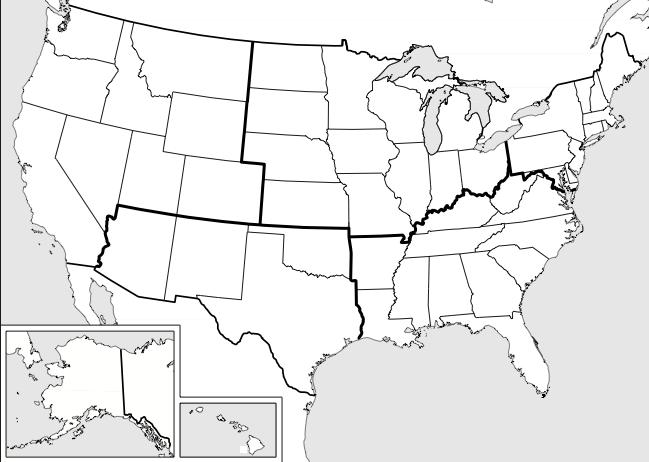
2 The West Region Land and Water of the West The West is the largest region in the United States. It is made of eleven states. The states are divided into two groups. The Mountain states include Montana, Wyoming, Colorado, Utah, Nevada, and Idaho. The Pacific states are California, Oregon, Washington, Hawaii, and Alaska. Alaska and Hawaii are separated from the other states by land and water. Several mountain ranges cover much of the West. The largest mountain range is the Rocky Mountains, which forms the eastern edge of the region. The Rockies begin far to the north, in Canada. From there, the Rockies stretch south all the way to Mexico, across Montana, Idaho, Wyoming, and Colorado. The Rocky Mountain The West is the largest region in the United States. Range is nearly 3,000 miles long, and hundreds of miles wide. Along the Pacific coast, more mountain ranges form a giant H on the map. The Coast Ranges make up the first long line of the H. The low mountains of the Coast Ranges seem to rise right out of the Pacific Ocean. They form cliffs in many places along the coast all the way up to Alaska. The highest mountain in the United States, Mount McKinley, is part of the Coast Range. Mount McKinley in Alaska is 20,320 feet high. The Sierra Nevada Mountains in the south and the Cascade Mountains in the north form the second long line of the H. These mountains are covered with forests. The Coast Ranges, the Sierra Nevadas, the Cascade Range, and the Rocky Mountains are all found in the West region. Some of the mountains in the West are volcanic mountains. Volcanoes are openings in the Earth's surface. Gas, steam, stones, ashes, and melted rock are forced through these openings. The melted rock is called lava. Volcanic eruptions happen, but not often. A famous eruption happened in 1980, when Mount Saint Helens erupted explosively. This eruption destroyed trees, melted ice and snow on the mountain, and caused landslides and floods. Animals were killed and some people lost their lives. created by Jill S. Russ mrsruss.com Page 1


3 The high, jagged peaks of the The Great Salt Lake is Sierra Nevada Mountains one of the largest lakes in surround the fertile soil of the the United States. The Great Central Valley. Salt Lake is about 75 miles long and 35 miles wide. The Great Salt Lake is very shallow. Most of the lake is only three feet deep. Unlike most lakes, the Great Salt Lake is full of very salty water. It is even saltier than the ocean. It is salty because several rivers flow into the Great Salt Lake, but no water flows out of the lake. When water evaporates, the salt is left behind. The Great Salt Lake is too salty for fish. The only animals that live in the lake are tiny Several valleys lie in between the Coast Ranges, the Sierra Nevada Mountains, and the Cascade Mountains. Two of the valleys, Central Valley and Willamette Valley, are covered with deep, rich soil. Many rivers travel through these two valleys. The Great Basin lies in the middle of the West region. A basin is a low, bowl-shaped landform that is lower than the land around it. The broad, flat valley of the Great Basin is mostly covered by the Great Basin Desert and the Mojave Desert. The Great Basin Desert is the largest desert in the United States. Death Valley, a part of the Mojave Desert, is the hottest, driest, and lowest place in the United States. Death Valley is 282 feet below sea level. The highest temperature ever recorded in Death Valley was 134 degrees. Tiny brine shrimp are the only animals that live in the Great Salt Lake. brine shrimp. Although they are small, brine shrimp are an important food source for the millions of birds that live around the lake. Dry and flat areas called salt flats surround the Great Salt Lake. The salt flats were left behind when Lake Bonneville, a big prehistoric lake, dried up thousands of years ago. These giant redwood trees are part of the temperate rainforest in the West region. Believe it or not, the West region also has a rain forest. The rainforest that runs along the Pacific Coast from California all the way to Alaska is the largest temperate rainforest in the world. Temperate rainforests are very wet, ancient forests that rarely freeze or get very hot. Temperate rainforests are also close to the ocean. Some of the large, old trees such as the giant redwoods, Sitka spruce and western hemlock reach over 300 feet tall and live over 500 years. created by Jill S. Russ mrsruss.com Page 2


4 Alaska and Hawaii, being apart from the other western states, are very different from the other states in this region. Alaska is the largest of the United States, but it has the fewest number of people of any state. The northern part of Alaska is tundra, a cold, flat, treeless land. The Hawaiian islands were formed from volcanoes, two of which are still active. Hawaii is made up of eight main islands. Its islands were made long ago by volcanoes that grew up out of the Pacific Ocean. Alaska is the largest state in the United States. Climate Just as the West has of different landforms, the West has a lot of different climates. You could travel from cold and rainy climates to extremely hot and dry climates all in this region. The western part of the region along the Pacific Coast receives a lot of rain. The coastal areas have mild, wet winters and cool, foggy or cloudy summers. As you travel east across the region through the Great Basin, the rainfall amounts decrease and the temperature gets warmer. In the Rocky Mountains, there is heavy snow in the winter. The snow remains on the ground for months at a time. Once the snow melts, the water goes into the Colorado, Rio Grande, and other rivers. Alaska has a unique climate. It is cold and wet for much of the year. Many places in Alaska receive as much as 100 inches of precipitation a year. Alaska is farther from the equator than any other state. As a result, it is the coldest state. Alaska has short summers and long winters. The winters are very cold with strong winds. Its winters are so cold that houseflies can't survive there. Lakes and rivers in this area are frozen for most of the year. Hawaii lies closer to the equator than any other U.S. state. Its climate is sunny and warm all year round. Hawaii enjoys a warm climate, but not too hot, due to cool ocean winds. There is a lot of rainfall all year. This helps palm trees and other tropical plants to grow year round. The island of Kauai has the wettest place on earth, receiving almost 40 feet of rain a year. The tropical islands of Hawaii have a warm, sunny climate that attracts many tourists. The Pacific Coast lies over many fault lines, which increases the dangers of earthquakes. The most famous is California's San Andreas Fault, which is more than 600 miles long. created by Jill S. Russ mrsruss.com Page 3


5 Products and Natural Resources The most important natural resource in the West is the Pacific Ocean. Fishing is an important industry up and down the coast. There are many important ports along the Pacific Ocean. A port is a place for receiving ships and transferring cargo. Here, goods are traded with Japan and Asia. The Columbia River is very important to the West region. Dams on the river help make a lot of electricity. Many businesses use this electric power. Farmers use water from the river to irrigate crops. Columbia River waters irrigate more than 8 million acres of land. Both farmers and businesspeople use the river for transportation. Many goods travel on the Columbia to ports along the Pacific Ocean. Many cargo ships travel to and from ports along the Pacific Coast. Soil is another important resource. In the Central Valley and the Willamette Valley, there are many fruit and vegetable farms. The Central Valley is called America's Fruit and Salad Bowl. More than 150 fruits and vegetables are raised here. Crops grown in this area include apricots, almonds, strawberries, cabbage, lettuce, tomatoes, grapes, asparagus, oranges, cotton, corn and much more. Potatoes, green beans, onions, and broccoli are also grown in the valley. Washington is known for its apples. Washington produces more apples than any other state. Central Valley supplies a lot of the food for the United States and for the rest of the world. The Trans-Alaska Pipeline carries oil across Alaska to the coast, where it is pumped onto ships that carry the oil to other parts of the United States. Another valuable resource in the West Region is oil. Oil was discovered in Alaska in the 1960s in the North Slope. The North Slope is near the Arctic Ocean. The oil was found in Prudhoe Bay. Once it was found, it needed to be transported to other areas. The Trans-Alaska Pipeline was built to carry oil from the North Slope. From the North Slope, it travels to Prince William Sound in Valdez, Alaska. The oil is pumped into supertankers. These supertankers carry the oil to other parts of the U.S. and the world. One stop is in San Francisco, California. San Francisco has oil refineries. The refineries prepare the oil so it can be used in homes and businesses. The Rocky Mountains are a source of many minerals. Deposits of copper, gold and silver have been found within the mountains. Gold was found in California in During the Gold Rush when people were moving west in search of riches, a small town in Colorado called Leadville was a popular mining spot for gold. The miners found some gold, but it was hard to separate the gold from the local sand. The miners found that the heavy brown sand they were digging in was actually full of silver and lead. Then, created by Jill S. Russ mrsruss.com Page 4

6 instead of a Gold Rush, there was a Silver Boom. More and more people moved to the area in search of silver. Leadville became one of the world's largest silver camps. Soon, the Silver Boom ended, but Leadville was lucky. Other valuable minerals were found in this area. One is molybdenum. Molybdenum is used in the production of high-strength steel. The steel produced in the West is used to manufacture other products. Aircraft are made in southern California. The state's warm climate makes it perfect for testing airplanes. Aircraft is also made in Seattle, Washington. You will also find ship-building industries on the Pacific Coast. Fishing boats, tankers, and battleships are made in Washington State and Hawaii. Many types of airplanes are built in the West region. During the last twenty years, technology industries have started in the West. Silicon, a valuable mineral that is used to make computer parts, is found in Silicon Valley, California. The silicon is mined and sent to companies that manufacture computer parts. There are many research centers in the West. These research centers are owned by our government. They test missiles, aircraft, and weapons. In the Great Basin, there is valuable open space. Missiles and military weapons are tested there. The West region is a center of the wood products industry. Wood products include lumber, plywood, cardboard, and paper. Much of the wood used in the United States comes from the West. Salt is one of the most important things that people get from the Great Salt Lake. In fact, over 4 million pounds of salt gets taken from it every year. Five companies get salt from the lake, including the Morton Salt Company, which makes the salt with the girl and the umbrella. They get the salt by evaporating water in big ponds. When the water evaporates, the salt is left behind. This can take a long time. Salt from the Great Salt Lake is sold in grocery stores everywhere. Idaho is home to vast potato farms, and the Idaho potato is sold by almost every supermarket in the United States. About three-fourths of Idaho's potato crop is now processed and sold as frozen french fries, instant mashed potatoes, or similar products. The rest are sold as baking potatoes. Hawaii is famous for its pineapples. You can also find sugarcane in Hawaii. The plant is grown on plantations. Once it is harvested, it is sent to sugar mills. This is where the table sugar we use is produced. Bananas, rice, coffee, and macadamia nuts are also grown in Hawaii. created by Jill S. Russ mrsruss.com Page 5


7 Landmarks The West region's natural features have been popular with travelers. Some of the most beautiful national parks are located in this region, including Denali National Park in Alaska, Yosemite National Park in California, Bryce Canyon in Utah, and Grand Teton National Park and Yellowstone National Park in Wyoming. You can visit the world's largest tree, a giant sequoia, in Sequoia National Park in California. The United States Congress established Yellowstone National Park in 1872 as the world s first National Park. Yellowstone National Park covers 3,472 square miles. That's bigger than the states of Delaware and Rhode Island With each eruption, Old Faithful spews more than 8,000 gallons of boiling water about 150 feet skyward. combined. There is an active volcano in the park. There are about 2,000 earthquakes there every year. The park also has more than 300 geysers. A geyser is a type of hot spring that shoots boiling hot water and steam into the air. Old Faithful is one of the most well known geysers. The name Old Faithful was chosen because they geyser is predictable. It erupts about every 91 minutes. Each eruption last from 1 ½ to 5 minutes. Today, up to 4 million people come to visit Yellowstone each year. Many cowboy movies and television commercials have been filmed in Monument Valley. Monument Valley is located in Utah. Many strangely shaped sandstone formations fill this vast, open desert valley. Monument Valley was created as material eroded from the Rocky Mountains, and was deposited and cemented into sandstone. The formations in the valley were left over after the forces of erosion worked on the sandstone. Many mining towns in the West started in out-of-theway places where gold and silver deposits were found. In a brief time they became boom towns. These towns grew quickly as thousands of prospectors and merchants moved to those places. However, when the gold or silver ran out, the towns were abandoned. The miners moved on to new strikes and claims. Other citizens left too. Without money from the miners, businesses closed. Soon, all that remained of the town were the deserted buildings and vacant lots. Many of these ghost towns are still standing today. People come to ghost towns to see what life was like during the Gold Rush. Ghosts towns are important tourist attractions in the West. There are over 1,300 ghost towns just in Nevada. created by Jill S. Russ mrsruss.com Page 6


8 Denver, Colorado is home to the United States Mint. A mint is a factory where coins such as dimes, nickels, quarters, and pennies-- are made. Back in the 1860s, miners brought their gold here. Their nuggets were melted and turned into valuable gold bars. The mint began producing gold and silver coins in Today, the mint makes about 50 million coins every day! Disneyland is in southern California. It is part of a giant entertainment industry. This industry began by making movies. America's first movies were made in the Northeast. The moviemakers needed sunny days to film outdoors. The Northeast is often cloudy and rainy. A few moviemakers found the sunshine they needed in southern California. Los Angeles, the second largest city in the nation, is now the home of the Hollywood movie industry. The movie industry soon attracted a man named Walt Disney. Disney Disneyland's Sleeping Beauty Castle was arrived in southern California in 1923 with one big designed in the style of European castles from goal. He wanted to make people happy. Disney's the Middle Ages. cartoons delighted kids of all ages. So did his movies, television shows, and the magic kingdom of Disneyland. Disneyland opened in This year, as many as 14 million people will visit the park. Tourists visit Alaska and Hawaii each year. People travel to Alaska to see its beautiful glaciers. There are cruise ships that sail through the waterways of Alaska. These cruise ships allow people to see the glaciers up close. Visitors to Hawaii go for its tropical weather and landscape. The warm weather year round makes its beaches the place to visit. People also visit the volcanoes of Hawaii. Culture Denver, Colorado is the center of professional sports in the West region. The city's major league teams include the Denver Broncos (football), the Colorado Rockies (baseball), the Denver Nuggets (basketball), and the Colorado Avalanche (ice hockey). Every January, Denver is the site of a national cattle show and rodeo. Iditarod teams typically have 16 or 18 dogs, which pull the sled about 10 miles per hour. A favorite sport in Alaska is dogsled racing. The most famous dogsled race is the Iditarod. The Iditarod begins in Anchorage. It ends 1,150 miles later in Nome. A few teams of dogs and their mushers, or drivers, have covered that distance in an amazing nine days. No wonder Alaskans call this event the Last Great Race on Earth. created by Jill S. Russ mrsruss.com Page 7
 also accompany the dance. Both men and women wear leis (flower or leaf wreaths) around their heads, ankles, wrists, and necks.")


9 The native people of Hawaii developed a dance form known as the hula. The hula is traditionally accompanied by a chant or song called a mele. Traditional instruments such as the ukulele and the ipu (gourd drum) also accompany the dance. Both men and women wear leis (flower or leaf wreaths) around their heads, ankles, wrists, and necks. Originally, the hula was performed to honor the ancient Hawaiian gods or a particularly powerful chief. It remains an important part of Hawaiian culture. The coastal waters of the Pacific Ocean provide abundant seafood, including crab, salmon, and octopus. One popular dish is cioppino, a fish stew made with a mixture of different kinds of fish and shellfish. Hangtown fry could possibly be the first California cuisine. It consists of fried breaded oysters, eggs, and fried bacon, cooked together like an omelet. In the gold-mining camps of the late 1800s, Hangtown Fry was a one-skillet meal for hungry miners who struck it rich and had plenty of gold to spend. Live oysters would be brought to the gold fields in barrels of seawater after being gathered in and around San Francisco Bay. Such a meal cost approximately $6.00, a fortune in those days. Saimin is a favorite food of people in the Hawaiian Islands. The native people of Alaska have an unusual version of ice cream. It's not creamy ice cream as we know it, but a concoction made from reindeer fat, seal oil, freshly fallen snow, fresh berries, and sometimes ground fish. Air is whipped in by hand so that it slowly cools into foam. Women traditionally made Eskimo ice cream, called akutaq, after the first catch of a polar bear or seal. Traditionally it was always made for funerals, potlatches, celebrations of a boy's first hunt, or almost any other celebration. Today, Eskimo ice cream is usually made with Crisco shortening instead of reindeer fat. The hula is often performed at parties called luaus. The favorite local food of the Hawaiian Islands is saimin, an inexpensive noodle and broth soup. It is eaten at any time of day. You can find this soup at snack bars, coffee shops, and even at McDonald's in Hawaii. Saimin is a kind of ramen noodle soup. Saimin is eaten very hot with chopsticks or spoons, and the broth is then drunk from the bowl. Eskimo ice cream is eaten as a dessert, a meal, a snack, or a spread. created by Jill S. Russ mrsruss.com Page 8


10 Thank you! Thank you for downloading this item. If you have questions, concerns, or general comments, please feel free to contact me at If you are pleased with your purchase, please leave feedback at TpT to let others know how this resource can help them. Thank you again for your purchase! ~Jill View a full listing of my products at Copyright 2011 by Jill Russ. All rights reserved by the author. Permission to copy for classroom use only. Electronic distribution limited to classroom use only.
Land and Water of the West
 The West Region The West Region Land and Water of the West The West is the largest region in the United States. It is made of thirteen states. The states are divided into two groups. The Mountain states
New England Middle Atlantic Region
 New England Middle Atlantic Region I. States of the New England Middle Atlantic Region: Maine - Delaware New Hampshire - New York Vermont - New Jersey Massachusetts - Pennsylvania Connecticut - Maryland
The Northeast Region
 The Northeast Region Land and Water of the Northeast The region between the coast of the Atlantic Ocean and the Great Lakes is called the Northeast region. The Northeast region includes nine states. The
followed animals from Asia.
 Native American Tribes Study Guide Test: JACOBS: Friday, October 1 st REYOR: Tuesday, October 5 th. Name: Date: Vocabulary Migration: moving from one region to another. Ancient Americans migrated to North
The California Gold Rush
 Suggested levels for Guided Reading, DRA, Lexile, and Reading Recovery are provided in the Pearson Scott Foresman Leveling Guide. The California Gold Rush by Peggy Bresnick Kendler Genre Expository nonfiction
Lesson 1: Migration to the Americas
 Lesson 1 Summary Lesson 1: Migration to the Americas Use with pages 54 57. Vocabulary Ice Age a long period of extreme cold glacier a thick sheet of ice migrate to move theory an explanation for something
Recipe for the Northwest
 Recipe for the Northwest States: Idaho, Montana, Oregon, Washington, and Wyoming Latitude: 41 N to 49 N Elevation: The lowest areas are at sea level along the Pacific Ocean and the Snake River in Idaho
THE COFFEE POT OF THE WORLD BRAZIL
 THE COFFEE POT OF THE WORLD BRAZIL Brazil lies in the north-eastern part of South America and occupies a little less than one-half the total area of the continent. In area, this is the fifth largest country
CANADA. An Introduction to the Art, Culture, Sights & Food. By: Masterpiece Momma
 CANADA An Introduction to the Art, Culture, Sights & Food By: Masterpiece Momma Where is Canada in the world? Canada is a country in North America. It has ten provinces and three territories. Canada is
! Climate! The climate in the Midwest is very unpredictable and can be very severe at times. There is no
 The Midwest Region Do you know where the Midwest is? The Midwest region is near the states like Nevada, Iowa, Kansas, Ohio and where I live Michigan and seven more. Michigan's Great Lakes are one of the
Which of these words make you think of Canada? Write the words that you associate with Canada into the maple leaf.
 1 WARMER Which of these words make you think of Canada? Write the words that you associate with Canada into the maple leaf. snow snowboarding mountains beaches cities bears trees whales English French
2.1 Why and how did humans first come to north America?
 2.1 Why and how did humans first come to north America? Objective you are going to analyze 10 native cultures of North and South America. The Many Native groups in America had a wide variety of beliefs
Regions of the United States
 Regions of the United States Class Outline Northeast South Midwest West The Northeast Northeast Maine, New Hampshire, Vermont, Massachusetts, Connecticut, Rhode Island, New York, New Jersey, Pennsylvania,
Fodor's National Parks Of The West (Fodor's Vacation Planner) READ ONLINE
 READ ONLINE") Fodor's National Parks Of The West (Fodor's Vacation Planner) READ ONLINE If you are searching for a book Fodor's National Parks of the West (Fodor's Vacation Planner) in pdf format, in that case you come
Fodor's National Parks Of The West (Fodor's Vacation Planner) READ ONLINE If you are searching for a book Fodor's National Parks of the West (Fodor's Vacation Planner) in pdf format, in that case you come
9/12/16. Lesson 2-1 Notes: Early People
 9/12/16 Lesson 2-1 Notes: Early People Lesson Objectives Identify possible explanations of how people came to live in the Americas. Explain how early peoples in the Americas lived, hunted, and farmed.
Chapter 4: How and Why Europeans Came to the New World
 Chapter 4: How and Why Europeans Came to the New World Section 4.3 - Ocean Crossing When sailors cross the ocean, they need a way to stay on course. They have no landmarks to guide them in the open sea.
Unit 2: American Indians
 Unit 2: American Indians CLASS WEBSITE: https://mryoungtms.weebly.com/american-indians.html QUIZLET GAMES: https://quizlet.com/join/msfyy94t5 American Indians 1 Early People Learning about Early People
Student Handout #4: Era 3 Societies around the World. The Olmec:
 Student Handout #4: Era 3 Societies around the World As you read about four different societies below, think about your claims related to empires from Student Handout #3. What are important features for
Washington State Wine 101
 Washington State Wine 101 Washington 2 nd Largest Producer in US Washington State produces: Premium wines of superior quality Range of varieties Distinctive character Unique balance of Old World and New
Lesson 3 - North American Peoples. What Makes a Culture Unique?
 Lesson 3 - North American Peoples What Makes a Culture Unique? Early Native American groups of North America adapted to their environments Advanced cultures developed in parts of North America long before
Cultures of North America
 Cultures of North America Focus Question: How did geography influence the development of cultures in North America? AD Sep 7 5:50 PM Mississippian Mound Builders 12 areas in Mississippi Mississippian Mound
The Fertile Crescent is a region of the Middle East that stretches in a large, crescent-shaped curve from the Persian Gulf to the Mediterranean Sea.
 The Fertile Crescent is a region of the Middle East that stretches in a large, crescent-shaped curve from the Persian Gulf to the Mediterranean Sea. The Fertile Crescent includes Mesopotamia, a wide, flat
El Cuadro Anaranjado (Orange)
") El Cuadro Anaranjado (Orange) There is a place high in the peaks of the Sierra Madre Occidental, near the town of Anganueo, where the trees are covered with brilliant orange butterflies every winter. There
El Cuadro Anaranjado (Orange) There is a place high in the peaks of the Sierra Madre Occidental, near the town of Anganueo, where the trees are covered with brilliant orange butterflies every winter. There
7th Grade US History Standard #7H117 Do Now Day #17
 Course: US History/Ms. Brown Homeroom: 7th Grade US History Standard #7H117 Do Now Day #17 Aims: SWBAT read and analyze a map locating representative Native American populations SWBAT compare how geography
The First Americans. You didn t discover it, we were already here.
 The First Americans You didn t discover it, we were already here. 9/3/2015 Template copyright 2005 www.brainybetty.com 2 Primary and Secondary Sources Primary Source: An original, first hand account created
United States History. Chapter 1
 United States History Chapter 1 Native Americans (Indians) North - Inuit and Alelut Northwest Coast- relied on natural resources such as salmon California- small bands fish flour from acorns- beans from
Research Project: American Indians in the 19th Century 4.G.iii, 4.G.v
 Name: USA Studies Weekly Date: Week 10, 2nd Quarter Research Project: American Indians in the 19th Century 4.G.iii, 4.G.v Read the article below to get some background information for the research project.
Northeast Region Test
 Name! Northeast Region Test # Write the name of the state on the correct line. 1. 2. 3. 4. 5. 6. 7. 8. 9. 10. 11. Connecticut Maryland Maine New York Pennsylvania Vermont Delaware Massachusetts New Jersey
UNIT #1 SETTLING THE WEST LESSON #4 Growth of Mining Industry (74-77)
") UNIT #1 SETTLING THE WEST LESSON #4 Growth of Mining Industry (74-77) Essential Questions 1. What caused the quick growth in population in the West in the late 1800s? 2. What are three methods of mining
UNIT #1 SETTLING THE WEST LESSON #4 Growth of Mining Industry (74-77) Essential Questions 1. What caused the quick growth in population in the West in the late 1800s? 2. What are three methods of mining
New England Colonies Economy
 New England Colonies Economy Subsistence farming/living. New England farmers often depended on their children for labor. Everyone in the family worked spinning yarn, milking cows, fencing fields, and sowing
Score / Name: P: CHAPTER 1 BELLWORK
 Score / Name: P: CHAPTER 1 BELLWORK Lesson 1 The First Americans: Migration to the Americas (Pages 1-4 in the Red Book) Reminder: Rephrase the question to form your answer. By the end of this lesson you
Kingdoms & Trading States of Medieval Africa
 Kingdoms & Trading States of Medieval Africa Early Societies in West Africa 500-1600 CE Table of Contents Background Africa s Four Climate Zones Africa s Four Vegetation Zones Africa s Vegetation Map Early
THREE WORLDS MEET CHAPTER 1 SECTION 1: PEOPLING THE AMERICAS SECTION 2: NORTH AMERICAN SOCIETIES AROUND Mitten CSHS AMAZ History Semester 1
 THREE WORLDS MEET CHAPTER 1 SECTION 1: PEOPLING THE AMERICAS SECTION 2: NORTH AMERICAN SOCIETIES AROUND 1492 Mitten CSHS AMAZ History Semester 1 Peopling the Americas Three Worlds Meet Main Idea - In ancient
List any questions that you have pertaining about the Economics Unit we just finished.
 Unit 2: Native American Cultures Do now Beringia Native American Cultures Exit slip The Arrival of Men (worksheet) I can explain the Beringia Land Theory. American Heritage: Native Americans 21:52 By:
Classroom Observer 10.
 Classroom Observer Name: Make 10 statements comparing objects, events, or people in the classroom using ratio language. For example: There are 3 pencils for every 2 students in the classroom. On the back,
Finca Bayano. Newsletter April 2014
 Finca Bayano Newsletter April 2014 The dry season is about to end Water reservoirs are going to be built Terrace cultivation is started Our most important tree: Cashew The dry season 2014 was a really
Assessment: China Develops a New Economy
 Name Date Mastering the Content Assessment: China Develops a New Economy Circle the letter next to the best answer. 1. What caused Chinese farmers to move from northern to southern China during the Tang
The First Americans. Lesson 1: The Search for Early Peoples. All images found in this PPT were found at Google.
 The First Americans Lesson 1: The Search for Early Peoples All images found in this PPT were found at Google. A. Over the Land 1. During Ages a. long, hard b. skin shelters with fires inside c. summers
World History I SOL WH1.2 Mr. Driskell
 World History I SOL WH1.2 Mr. Driskell A. Modern people are called homosapiens, meaning wise man. B. Homo-sapiens first existed in East Africa, several hundred thousand years ago. C. Home-sapiens spread
Explorers. of the NEW WORLD. Discover the Golden Age of Exploration. Carla Mooney Illustrated by Tom Casteel
 Explorers of the NEW WORLD Discover the Golden Age of Exploration Carla Mooney Illustrated by Tom Casteel Timeline ~ iv Introduction Exploring in the Age of Discovery ~ 1 Chapter 1 Searching for a Water
Everyday Life Southwest Desert. Indian Men
 Everyday Life Southwest Desert Invented ways to irrigate their crops, mostly by digging canals from nearby rivers farmers. Men hunted, but it wasn t important to the Desert Indians; there weren t any large
1. Introduction enabled
 1. Introduction Scientists have identified and studied five important groups of hominids. Like the hominids before them, early modern humans hunted and gathered their food. In this chapter, you'll read
early human history and Central & South America Jeopardy
 early human history and Central & South America Jeopardy What You Need To Know Every team will be chosen by Joe with the intention of mixing girls and boys and grade levels. Teams can choose a name if
 http://www.history.com/news/hungry-history/the-sweet-history-of-chocolate https://en.wikipedia.org/wiki/history_of_chocolate https://kidskonnect.com/fun/chocolate/ http://www.howstuffworks.com/history-of-chocolate1.htm
Prof. Ruthie García Vera Historia de Estados Unidos. Ancient Cultures of North America
 Prof. Ruthie García Vera Historia de Estados Unidos Ancient Cultures of North America Three groups dominate the oldest period of North American prehistory: The Hohokam The Anasazi The Mound Builders *the
Unit 3: European Explorers
 Unit 3: European Explorers http://mryoungtms.weebly.com/european-explorers.html https://quizlet.com/class/5155476/ 1 E x p l o r e r s Motivations, Obstacles, and Accomplishments of European Explorers
EQ: What was the impact of exploration and colonization on Europe?
 EQ: What was the impact of exploration and colonization on Europe? Reasons for Exploration God spread of Christianity Goods to trade and become wealthy (gold and spices) Glory explorers were seen as heroes
Religions of the Boyne City and the Charlevoix County area
 Religions of the Boyne City and the Charlevoix County area The Mound Builders The Mound Builders is a term used to describe First Nation's cultures that built earthen burial mounds and other earthworks
Geography of the Middle East, an ancient and modern crossroads
 Geography of the Middle East, an ancient and modern crossroads By WGBH Educational Foundation, adapted by Newsela staff on 01.09.18 Word Count 1,035 Level 1040L Image 1: The Nile River runs through the
Christopher Columbus Didn't Discover the New World; he Rediscovered it
 Christopher Columbus Didn't Discover the New World; he Rediscovered it By Encyclopaedia Britannica, adapted by Newsela staff on 06.19.17 Word Count 557 Level 560L Viking Leif Erikson discovers North America
The Stone Ages and Early Cultures 5,000,000 years ago 5,000 years ago
 The Stone Ages and Early Cultures 5,000,000 years ago 5,000 years ago Section 1 P. 28-34 Prehistory - the time before writing Archaeologists & anthropologists do the research Hominids - early ancestors
Wealth and resources. ! New beginning. ! Get out of debt. ! Escape political & religious persecution
 Wealth and resources New beginning Get out of debt Escape political & religious persecution Each colony was unique in its characteristics. They are grouped together based on location, reasons they were
Native Americans Culture
 Native Americans Native Americans have lived in what is now the United States for thousands of years. In that time, they developed many cultures. Culture is the way of life of a group of people. View the
The first Coloradoans
 The first Coloradoans Prehistoric Indians Paleo Indians Clovis Period Folsom Period Plano Period Pueblo Farmers Overview Prehistoric Indians Indians that lived on the land before written history existed
Pepper Bridge Winery AMAVI CELLARS
 Born of Fire and Ice Pepper Born of Fire and Ice Pepper Washington State s AVA s produce 18 premium wine varietals tons split about equally between 9 red and 9 white types. Overall Growth has averaged
Exploration ( )
") Exploration (1400-1607) - For many years, people in Europe knew of a distant land to the east called Asia, or the Far East. - They wanted to explore routes to the Far East - During this unit we will learn
Exploration (1400-1607) - For many years, people in Europe knew of a distant land to the east called Asia, or the Far East. - They wanted to explore routes to the Far East - During this unit we will learn
The 13 Colonies. Religious, Political and Economic Foundations
 The 13 Colonies Religious, Political and Economic Foundations Objectives TLW explain how religion played a role in the founding of the 13 colonies TLW compare religious freedom and tolerance in different
Land use in 1860 Land use in 1880
 After the Civil War, the area west of the Mississippi River was settled by miners, ranchers, and farmers Land use in 1860 Land use in 1880 Mining was the first industry to attract settlers to the West
Mesopotamia Mesopotamia = the land between two rivers Geography
 Mesopotamia Mesopotamia = the land between two rivers Geography * About 9,000 years ago, wandering tribes settled in the river valley between the Tigris and Euphrates rivers. * This area, also known as
Junipers of Colorado. Rocky Mountain Juniper
 of Colorado Three kinds of juniper are common small trees on the foothills, the low mountain slopes, and the mesa country of Colorado, the Rocky Mountain juniper of dry woodlands and forests, the Utah
Lesson 1: Traveling Asia s Silk Road
 Lesson 1 Summary Lesson 1: Traveling Asia s Silk Road Use with pages 102 104. Vocabulary emperor the ruler of an empire magnetic compass a tool sailors use to see what direction they are traveling The
Roanoke and Jamestown. Essential Question: How Does Geography Affect the Way People Live?
 Roanoke and Jamestown Essential Question: How Does Geography Affect the Way People Live? The Mystery of Roanoke Question: What problems did the Roanoke settlers encounter? The great powers of Europe were
Ancient Civilizations of North America. Prof. Ruthie García Vera Historia de Estados Unidos
 Ancient Civilizations of North America Prof. Ruthie García Vera Historia de Estados Unidos Three groups dominate the oldest period of North American prehistory: The Hohokam The Anasazi The Mound Builders
The Age of European Explorations
 The Age of European Explorations 1400-1800 By the 1400 s Europeans were in contact with Africans, Asians, and Americans. This is known as the GLOBAL AGE. Wherever Europeans went, they brought their culture
by Julian Stone illustrated by Joanne Renaud
 by Julian Stone illustrated by Joanne Renaud HOUGHTON MIFFLIN HARCOURT by Julian Stone illustrated by Joanne Renaud Copyright by Houghton Mifflin Harcourt Publishing Company All rights reserved. No part
Fertile Crescent & Mesopotamia. Miss Genovese
 Fertile Crescent & Mesopotamia Miss Genovese Geography Mesopotamia is the region between the Tigris and Euphrates Rivers (AKA The Land Between Two Rivers) Land was mostly flat with small plants Tigris
Native Americans & Spaniards. Two Worlds Collide. Name Date Class. The Americas Prior to Spanish Exploration
 Native Americans & Spaniards Two Worlds Collide Name Date Class The Americas Prior to Spanish Exploration Thousands of Native American groups thrived throughout North and South America before Spanish exploration.
Danger Cave. Much of what we don t about Utah s prehistoric people
 Danger Cave Much of what we don t about Utah s prehistoric people comes from Danger Cave. Danger Cave is in the West Desert near Wendover. Danger Cave Artifacts such as; beetle wings, textiles, leather
American Indians. The First Americans
 The Buffalo Hunter by Seth Eastman (1808-1875). Horses were introduced into North America by Spanish explorers in the 16th century, but American Indians soon became expert bareback riders of horses. American
Back to the English. HISTORY'S INFLUENTIAL PLANTS
 HISTORY'S INFLUENTIAL PLANTS Have you ever taken a close look at what kinds of plants are growing in your school garden? Have you ever tried to name some plants that you see on the street or on a mountain???
The Southeast Region. Land and Water
 The Southeast Region Although the Southeast is best known for its beautiful beaches, there s much more to the region than just sun and fun. Mountains. Valleys. Beaches. Swamps. The Southeast region has
Basic parts of a friendly letter: Heading, greeting, body, closing, and signature
 Name Grading Criteria Basic parts of a friendly letter: Heading, greeting, body, closing, and signature (10 points) Ideas: 1. Why should your family give you more resources to explore the area and civilization?
December 11, Study Guide
 Epic Epic Epic Study Guide "Hands down, this is the best study guide I've ever seen," - Abraham Lincoln Bonjour! I wish I were alive today so that I myself might be able to complete this study guide. Au
First Humans of Utah NOTES #1
 First Humans of Utah NOTES #1 History History is the study of the past. It deals with written records or accounts. PREHISTORIC: Term used referring to people who lived before white explorers and missionaries
Economy The Inca government also controlled the economy. Instead of paying taxes, Incas had to pay their government in labor (usually several weeks pe
 Government The Inca were ruled by one person. He was known as the Sapa Inca. The Sapa Inca was considered to be a descendant of the sun god. He owned all land and made all laws. He was responsible for
GARDENING WEEK 9 EXTENDING THE LIFE OF YOUR GARDEN: FOOD PRESERVATION AND SEED SAVING
 GARDENING WEEK 9 EXTENDING THE LIFE OF YOUR GARDEN: FOOD PRESERVATION AND SEED SAVING What we would like you to learn: 1. Learn about the history of food preservation. 2. Learn about different ways to
North American Native Americans
 North American Native Americans Introduction While the civilizations of the Maya, Aztec, and Inca were flourishing in Mesoamerica and South America, distinct civilizations were also emerging in North America.
Early People in the Central American Land Bridge James Folta
 Early People in the Central American Land Bridge Early People in the Central American Land Bridge James Folta People have been living in Central and South America for many, many years now. How did ancient
Ancient Mayans. KP Classroom
 Ancient Mayans The Mayans were an ancient American group of people that lived in areas of Central America and Mexico from 1500 BC until around 900 AD. Because the Mayans were untouched by other people
Background. Conifers of the Pacific Slope: An exploration into the world of ancient plants 12/6/17. blog.conifercountry.com/asca
 Background Educator (Kindergarten - College) Master s Degree in Biology (Conifer Ecology) from Humboldt State University. Ecological Research Includes: Whitebark pine mapping in Northern California Bigcone
People of the Old Stone Age
 1 People of the Old Stone Age Neanderthals and Cro-Magnons Mr. Graver Old World Cultures Name Period Notebook Number 2 Neanderthal People Learned Basic Skills Imagine, if you can, a muscular group of people
Christopher Columbus Didn't Discover the New World; he Rediscovered it
 Christopher Columbus Didn't Discover the New World; he Rediscovered it By Encyclopaedia Britannica, adapted by Newsela staff on 06.20.17 Word Count 808 Level 960L Viking Leif Eriksson discovers North America
Graphic Organizer. Early people depended on Ice Age animals for food, clothing and shelter.
 Graphic Organizer THE LAND BRIDGE THEORY Early people depended on Ice Age animals for food, clothing and shelter. After a climate change, early people followed Ice Age animals over a Land Bridge into North
Conifers of the Pacific Slope: An exploration into the world of ancient plants
 Conifers of the Pacific Slope: An exploration into the world of ancient plants What is the Pacific Slope? A phrase used by early explorers to describe the western slopes of the Continental Divide indicating
Mapping the West: The Journey of Lewis and Clark By Michael Stahl
 Mapping the West: The Journey of Lewis and Clark Mapping the West: The Journey of Lewis and Clark By Michael Stahl The United States of America is one of the largest countries on the planet. Much of America
ISN 4. #2. List reasons why people migrate.
 ISN 4 #2. List reasons why people migrate. 8 9 Reasons for Exploration You need a blank sheet of paper! With your partner, write as many reasons as you can think of that someone would explore/migrate to
Washington State Wine Primer. washingtonwine.org
 Washington State Wine Primer WHERE WASHINGTON SITS In The Global Scheme of Things The Big Picture The United States is the world s fourthlargest producer of wine, representing 8 percent of total global
Unit 3: Mesopotamia Test Respond to each question with the best answer based on what we ve learned in class.
 Unit 3: Mesopotamia Test Respond to each question with the best answer based on what we ve learned in class. 1. Why did ancient civilizations develop in Mesopotamia along the rivers of Tigris and Euphrates?
Who Grew My Soup? Geography and the Story of Food
 Who Grew My Soup? Geography and the Story of Food Purpose Students will identify the source of the food they eat and investigate the processes and people involved in getting food from the farm to their
Countries Of The World: China
 Countries Of The World: China By National Geographic Kids, adapted by Newsela staff on 02.15.18 Word Count 571 Level MAX Image 1: The Great Wall of China is a popular place for tourists to visit. It is
Europe Brazil Argentina London Liverpool Indonesia. Africa Asia England Ireland Scotland Wales
 Below are the names of some different places around the world can you put a tick by the places where rainforests are found and a cross by the places where no rainforests are found? Europe Brazil Argentina
World History and Geography to 1500 A.D. Unit VII Eastern Hemisphere Trade
 World History and Geography to 1500 A.D. Unit VII Eastern Hemisphere Trade During the Medieval Period (500 to 1500 A.D.), several major trading routes developed in the Eastern Hemisphere. These trading
Story of Wheat for Kids
 cover The Story of Wheat for Kids Grades 3-5 Wheat is Classy There are hundreds of varieties of wheat grown in the United States, but they are grouped into six classes based on hardness, color and time
Georgia s Prehistoric Cultures
 Georgia s Prehistoric Cultures Objective: I will be able to describe the growth of Native American cultures (Paleo, Archaic, Woodland, and Mississippian) prior to European contact. B.C.-A.D. or B.C.E.-C.E.?????
The Native American Experience
 The Native American Experience NATIVE PEOPLE AND GROUPS The First Americans Archaeologists believe that migrants from Asia crossed a land bridge between Siberia and Alaska sometime between 13,000 and 3,000
The Late Middle Ages AN AGE OF ACCELERATING CONNECTIONS ( )
") The Late Middle Ages AN AGE OF ACCELERATING CONNECTIONS (600 1450) In 1200 most western Europeans were serfs / peasants. Typically they were compelled to work on the manor (usually owned by nobility or
The Late Middle Ages AN AGE OF ACCELERATING CONNECTIONS (600 1450) In 1200 most western Europeans were serfs / peasants. Typically they were compelled to work on the manor (usually owned by nobility or
What Will You Learn In This Chapter?
 Chapter 2 - The Expansion of Trade Connecting Prior Knowledge: In the previous chapter, you explored some of the ways that society, religion, and a changing economy affected worldview. You saw how towns
Muhammad the prophet and founder of Islam. Mansa Musa a Muslim ruler of the Mali empire during its height
 Terms and People Muhammad the prophet and founder of Islam Mansa Musa a Muslim ruler of the Mali empire during its height Terms and People navigation the science of locating the position and plotting the
BC A
 Skara Brae Skara Brae, on the southern shore of Sandwick, Orkney, was a late Neolithic settlement that was inhabited between 3200 and 2200 BC. Eight prehistoric houses, connected by low covered passageways,
SW Prehistoric Cultures Geography
 Mesa Verde Chaco SW Prehistoric Cultures Geography http://www.youtube.com/watch?v=koqxd8fg5gw http://www.youtube.com/watch?v=dawlrzw7trg Other Southwest Prehistoric Cultures Mogollon: Spanish colonial